 |
| Bents Green Lodge |
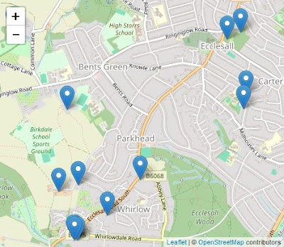
After having a walk around All Saints churchyard, to look at its Commonwealth War Graves Commission headstones and various other large monuments, my plan for the rest of the day was to walk up Ringinglow Road to Bents Green, then follow the public footpaths down to Whirlow and finish by making my way back to Ecclesall via Ecclesall Woods.
The route of my walk was based on a British Listed Buildings Photo Challenge, which had identified a scattering of buildings in places that I was unlikely to specifically visit or were set in private grounds, where there was no guarantee of obtaining a good view. Nonetheless, some were in parts of Sheffield that I had never been to before and this was a good enough reason to get out of the house for a few hours.
Leaving the churchyard, I started my walk up Ringinglow Road but, coming to a bus stop and knowing that there was nothing of interest to see here, I took advantage of an imminent No. 88 bus and continued up to Bents Green, where a coffee morning was being held at Bents Green Methodist Church.
 |
| Bents Green Methodist Church |
Although it is not listed, it was designed by the Sheffield architect W.J. Hale, who was responsible for the Wesley Hall, St. Luke’s church and the Congregational Church in Crookes and Sheffield Board Schools at Bole Hill, Walkley, Lydgate Lane and Hammerton Street.
During a previous walk from Ecclesall to Bents Green, I had a quick look at the exterior, which is built of very coarse grained Chatsworth Grit with brick dressings. I took a few general record photos of the interior but, with nothing of interest to this Language of Stone Blog, I had a cup of tea and a chat with a few locals before going to have a look at the houses on Trap Lane.
When preparing a report on my last visit to the area, I had looked for quarries on old Ordnance Survey (OS) maps and discovered that a few worked the Loxley Edge Rock around Greystones and, between the publication of the 1855 and 1894 editions, a quarry on the same formation had opened on Trap Lane and presumably supplied the stone for terraced houses that were built during the same period.
Of these, only Moor View Terrace and the house on the corner with Latham Square remain, but both have walling that is built with sandstone that is laid in courses that are about the same height as a brick, with only the latter having massive quoins.
The boundary walls are built with a similar thin bedded sandstone and, moving back down to Ringinglow Road, the garden wall to No. 258 is built with flaggy sandstone that is often rusty brown coloured. I didn’t look closely at the coping stones, but they are more massive and do not have the same staining and I think that it is likely that these are Chatsworth Grit.
Continuing along Ringinglow Road for a short distance, I then crossed over to have a look at the Hammer and Pincers public house which, along with Hill Top House and Bents Green Lodge, is one of the very few buildings marked on the 1855 OS map that can still be seen today.
I just took a couple of general photos of the front and rear elevation, which show that the squared but very irregularly coursed walling is composed of a mixture of rusty brown planar bedded sandstone and square blocks of a much more massive gritstone that lacks iron staining.
The outbuilding is built with similar stones and, as with the main building, has a stone slate roof and, looking closely, the quoins are undoubtedly Chatsworth Grit. The Rough Rock was the principal source of stone slates in Sheffield and the centre of production was at the Brown Edge Quarries, which are only 3.5 km to the west, as shown on the Building Stones Database for England map explorer.
The Trap Lane quarry had not yet been opened and the 1855 OS map shows just one old quarry at Greystones, which makes it quite likely that the iron stained walling stone could also be from the Brown Edge Quarries, which the same OS map describes in great detail.
Crossing back over Ringinglow Road, I was quite surprised to see that a few of the later interwar period houses have dry stone garden walls that have been built at a much earlier date. The flaggy sandstone has a high proportion of rusty brown stones that are very similar to those that I had seen in the vernacular architecture and boundary walls around Fulwood and Ranmoor, which I have concluded are built with Rough Rock.
A little further along Ringinglow Road is Bents Green Lodge, which is now used as a children’s home. I only took a couple of photos from the gateway, but these show sandstone ashlar to the elevation surrounding the entrance, which has well developed iron staining and Liesegang rings.
The house appears on the 1855 OS map and therefore doesn’t come from the Trap Lane quarry but, as with the planar bedded sandstone used for The Lodge, although I think that the dressings are probably Chatsworth Grit, it doesn’t look any of the sandstones that I am familiar with in south-west Sheffield.


No comments:
Post a Comment