I first heard about Hooton Pagnell back in 1994, when one of the other members of the South Yorkshire RIGS (Regionally Important Geological Sites) Group had arranged for the late Denys Smith, an expert on Permian geology, to lead a field trip during our ‘promotional fortnight’.
Having been involved in the organisation of other events at Boston Park and Roche Abbey at the time, I didn’t go on this field trip and I first visited this wonderful village in 1997, as the principal surveyor for the group, when Doncaster MBC joined in with this national county based initiative and Watchley Crag and a site, since known as the Village Pound, was included in a list of potential RIGS for me to visit.
This consists of two separate exposures in close proximity, the first being a bryozoan patch reef that is an irregular pillow-like mass composed of 'saccoliths', with associated thick bedded shelly, ooid-limestones, which forms the back drop to the war memorial garden.
It forms part of a retaining wall and a well maintained landscaped and planted area, with large limestone slabs used for rockery stones, which must be one of the most attractive geological exposures that I have seen in a built up area.
The reef is pitted with numerous tiny hollows representing external moulds of bryozoans with some surfaces showing net like patterns which suggest a well preserved skeletal structure of these colonial organisms. The irregular mass passes both laterally and downwards into thickly bedded breccia and shelly ooid-limestones, which appear depressed and distorted by the overlying reef.
Hooton Pagnell has won the Best Kept Village in South Yorkshire competition three times, with the benches presented by The Dalesman occupying the space in front of the reef. Although this is clear evidence that the residents take great pride in the village, there is no doubt that the outstanding geological features here have become increasingly obscured over the years.
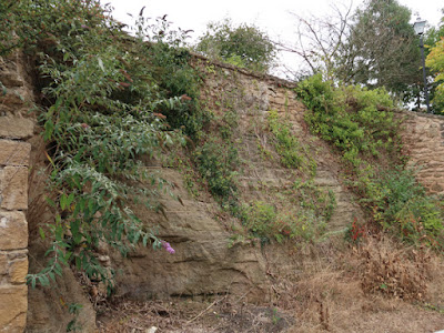
The second site in the Village Pound, which is also becoming overgrown, is about 60 metres to the south of the reef and forms a 3 metre section of limestone, comprising a series of thin grey laminated muddy beds, coarsening upwards into a buff sub-angular shelly pisolite.
These are generally less than 150 mm thick and are mostly separated by a sharp erosional surface and the fine beds comprise small shell fragments and have an open cellular texture, with cross laminations and undulating bedding planes being common.
When I visited this site in 2007, I noticed a large block of red/purple sandstone projecting from the level ground beneath the outcrop, which is used for parking, but I did not see it this time. It is very similar to the outcrop of reddened sandstone beneath the Cadeby Formation at Barnburgh Crags, which provides indirect evidence of the Carboniferous/Permian unconformity, although no sandstone is marked on the geological map in the immediate vicinity of Hooton Pagnell.
Although Doncaster MBC took the initiative by commissioning the British Geological Survey to undertake the Doncaster Geodiversity Assessment and producing a Local Geodiversity Action Plan a year later, none of the sites are maintained, despite being used for field trips by Year 1 students at the XP School in Doncaster and the Sheffield U3A Geology Group, amongst others.
In less than 2½ hours, I had managed to have a good look at All Saints church, photograph 22 listed buildings and see very many outcrops of limestone scattered throughout the village. With 20 minutes before the No. 203 bus to Thurnscoe arrived, I followed the footpath that heads down the low escarpment to see if there were any rock exposures but, seeing none, I just took a few photos of the landscape formed by the Coal Measures strata to the west.


No comments:
Post a Comment