 |
| The Monsal Dale Limestone Formation on the High Peak Trail |
Having crossed the Gulf Fault, Stuart and I continued our recce of the High Peak Trail for the next Sheffield U3A Geology Group field trip and soon encountered the Monsal Dale Limestone Formation, which is exposed in a railway cutting – over which is built a road bridge that served many quarries and mines in the vicinity, as shown on the 1884 Ordnance Survey map.
Although nettles sometimes prevented close inspection of the rock faces, there are plenty of opportunities to appreciate the general physical characteristics of the Monsal Dale Limestone – especially the patterns in the bedding and jointing.
A little further along the cutting at location No. 10, there are two rubbly beds, with the lower of the two underlain by a bed of weathered volcanic ash known as a clay wayboard. I had seen rocks like these a few times before when surveying the RIGS (Regionally Important Geological Sites) in the Peak District National Park and visiting Matlock Bath and Ashover with our group.
Productid brachiopods, overwhelmed by the ashfall, can apparently be found in this greenish-buff clay, which varies from 1 cm to 5 cm thick. We only had a quick look at some of the easily accessible beds, where the clay wayboard can be found, but didn’t see any fossils.
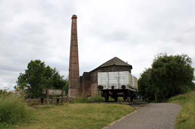
We then continued up the Middleton Incline until we reached the Middleton Top Engine House, which contains the world’s oldest beam engine of its type. The museum is only opened for a few weekends each year, so we just had a quick look at some of the information boards and then talked with a very helpful member of staff at the Middleton Top Countryside Centre.
She explained that a previously inaccessible old quarry was now the Redhill Quarry Nature Reserve and was open to the general public, which we soon discovered had several points of geological interest that would make this the ideal place to end our walk.
While retracing our steps back down Middleton Incline, we decided that it would be much easier on the day to start at the Middleton Top Countryside Centre and then walk downhill to Black Rocks car park – involving a shuttle arrangement between the car parks at each end of this route.
Arriving back at Steeple Grange Wharf, I was very interested to see what looks like a standard Commonwealth War Graves Commission headstone, but is actually one of three commissioned in 2018 by Martin Smith of the Steeple Grange Light Railway. Looking closer, there is the crest of the North London and Western Railway Company and the inscription records the fact that, after the Great War, more than 120,000 headstones – made with Hopton Wood limestone - were moved along the line destined for Imperial War Graves Cemeteries.
I can’t actually remember if I took my Estwing hammer with me, but I came back home with a couple of samples of limestone from the Redhill Quarry Nature Reserve. The larger specimen is a pale grey biosparite, where fragments of brachiopod shells and crinoids are cemented by well developed crystalline calcite, with the smaller specimen having fossil fragments in a fine yellow mud like matrix.


No comments:
Post a Comment