 |
| Black Rocks |
June 2022 proved to be a very productive month, exploring the geology and building stones and photographing the historic architecture of Otley Chevin, Wath-upon-Dearne, West Melton, Elsecar, Hunshelf and the Loxley Valley.
 |
| The GA East Midlands Guide No. 63 |
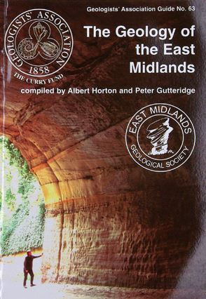
My last day out was to undertake my third recce for the Sheffield U3A Geology Group, this time with Stuart – a retired geography teacher who had studied geology at university, but who had only attended a couple of meetings since I had joined the group. The idea was to follow Excursion No. 4 in the Geologists' Association East Midlands Guide No. 63 (2003) – written by the late Trevor Ford, who was an expert on Peak District geology.
 |
| The route of the High Peak Trail |
This was devised as a linear route along the trackbed of the former Cromford and High Peak Railway, now the High Peak Trail and, arriving at the Black Rocks car park, we took advantage of roadside parking – avoiding the £4.80 all day parking charge.
 |
| The mineral waste tip at Black Rocks |
We then made our way up a moderately steep slope to the old lead mine waste heap beside Black Rocks, which is composed of fragments of limestone and black mudstone from the Bowland Shale Formation, which has attracted great interest in recent years, as a source of shale gas that is extracted by the very controversial process of fracking.
 |
| A specimen from the Bowland Shale Formation (21 mm diameter coin) |
The Black Rocks form a spectacular outcrop of the Ashover Grit, which the group had seen earlier in the year during the field trip to Ashover, but an exploration of the craggy outcrop was not included on our field trip itinerary.
 |
| A panoramic view of Dene Quarry from Black Rocks |
From Black Rocks there are a good views towards the still operational Dene Quarry to the east of Middleton, which exploits the Eyam Limestone Formation and, retracing our steps , we continued south along the High Peak Trail.

Continuing along the trail, we passed by the Steeple Grange Light Railway, a popular miniature railway run by volunteer enthusiasts that operates along a branch of the railway that once led to the Middleton limestone quarry.
 |
| The Steeple Grange Light Railway |
We shortly arrived at the National Stone Centre, a 16 ha site that incorporates various old quarries and is a SSSI (Site of Special Scientific interest). This long established site, which has had a planning application for its redevelopment approved, has examples of knoll reefs and several good displays of fossils in the Eyam Limestone Formation, including spectacular examples of crinoids.
 |
| A few views of the National Stone Centre |
This was to be the key site for the day and with a leaflet available from the National Stone Centre rock shop and well illustrated information panels placed at each locality, visitors can wander around the sites at leisure, without requiring expert guidance from a geologist.
 |
| An information panel |
I had last visited not long after it opened in 1990, to help a friend who wanted to write about it for the county magazine Derbyshire Life, but I couldn't remember too much about it. I was very interested to see the Millennium Wall, which comprises sections of dry stone walling that were built by all 19 branches of the Dry Stone Walling Association – using their local stone.
 |
| A section of the Millennium Wall |
Having made all necessary arrangements for our group to visit, we then continued up the trail past the remains of old winding gear, which was used to haul wagons up and down the Middleton Incline. A few places or views identified on the trail guide had become so overgrown or obscured by trees that we could not see them and we carried on up the increasingly steep incline.
 |
| The remains of winding gear |
Although seeing no evidence of this, we crossed over the Ranter Fault, which marks the eastern edge of a graben where the underlying geology reverts to the Bowland Shale Formation, which has been downthrown and preserved. Continuing over the bridge on the B6203 road, which approximately follows the line of the Gulf Fault at the western edge of the graben, there is a marked change in topography and the first appearance of the Monsal Dale Limestone Formation in the railway cutting.
 |
| A railway cutting and road bridge on the High Peak Trail |
No comments:
Post a Comment