Saturday 31 December 2022

Listed Buildings in Norton

 
The lodge to Oaks Park

After a period of 8 months travelling all over Sheffield on various buses, to see the remaining 47 Sheffield Board Schools, plus the Central Schools at Leopold Street, I finished this project at Whitby Road Council School - during my exploration of Darnall in the last week of October 2021. 
 
The distribution of the Shefield Board Schools

To make a good day out with a decent walk, I planned my trips to include listed buildings in the vicinity that didn’t yet have a photograph on the British Listed Buildings website, which would in turn give me a better understanding of the building stones of Sheffield and how they relate to the underlying Upper Carboniferous geology. 
 
For my next short venture, I decided to go and further investigate the listed buildings of Norton, which had developed into one of my favourite places in Sheffield, having visited the area around St. James’ church and the adjoining Graves Park several times in recent years – including a field trip with the Sheffield U3A Geology Group, to explore the Greenmoor Rock, which started at the Morrisons supermarket at Meadowhead. 
 
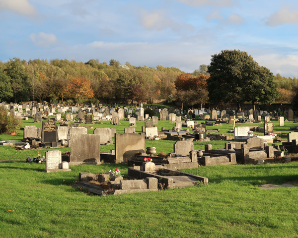
The Greenmoor Rock in south Sheffield

Various quarries once worked the Greenmoor Rock in the area and, although Grenoside Sandstone appears to have been used for St. James’ church and other substantial buildings, it is this stone that has been mainly used around Norton, Graves Park and also around Greenhill for the smaller houses and cottages. 
 
Greenmoor Rock in the boundary wall of Oaks Park

Alighting from the No. 1 bus from Sheffield on Norton Lane, the first building on my list was the west lodge to Oaks Park, where I immediately recognised the very regular thinly bedded Greenmoor Rock in the dry stone boundary wall, with its very distinctive dark brown iron staining on many joint faces. 
 
The west lodge at Oaks Park

The lodge itself has walling that is coarser a grained and more uniformly coloured, which may be from more massive beds in this formation and are used for general building, rather than the paving and headstones for which it was best known. The dressings, however are a yellowish, cross-bedded massive sandstone with iron staining and this is presumably the same stone used for the Georgian house, which I did not get to see. 
 
Listed buildings on School Lane and Cypress Avenue
 
Continuing down School Lane and then on to Cypress Avenue, the School House, the Post Office House and Chantrey Cottage are all obscured by tall boundary walls, dense hedges and trees and it was only Grooms Cottage (c1800) that I could quite clearly see. The latter looks like it is built with Greenmoor Rock walling and probably the stone roof tiles too, which have a much smoother surface than those made with the Rough Rock. 
 
Jordanhouse Hall Farmhouse

The mid C18 Jordanthorpe Hall Farmhouse on Cinderhill Lane could also only be seen at a distance and the physical characteristics of the stonework seem quite varied, with both the colouration of the sandstone and the height and regularity of the various courses not being typical of the Greenmoor Rock with which I was familiar. 
 
Jordanthorpe House

Crossing over the Bochum Parkway, I could not get access to the birthplace of the sculptor Sir Francis Chantrey, Chantrey House, due to it being in the grounds of the Mossbrook Infant School or Jordanthorpe House. I did, however, manage to photograph the latter from the unmade verge on the roundabout, from which there wasn’t a great view but enough to suggest that the yellowish sandstone used is Grenoside Sandstone. 
 
The lodge to the Norton nursery

Making my way back up Norton Lane towards St. James’ church, from the limited views I had of it, the lodge to Norton nursery (c1870) looks like a further example of grey/brown thinly bedded Greenmoor Rock, with a Welsh slate fish scale roof. 
 
The old school on Norton Lane

Next to the lodge, the old school (c1740) provides an example of how the Greenmoor Rock, laid with various thicknesses of the beds, has been used for the gable ends to the original house and for all of the walling to the southernmost extension, whereas the eastern front elevation is built in Grenoside Sandstone ashlar. 
 
Ashlar masonry on the front of the old school

After taking a few snaps of the brick built Norton Hall Farm (c1802), I quickly made my way  across Graves Park to the north entrance on Cobnar Road, where the lodge (c1870) is built in squared Greenmoor Rock of a moderate bed height, with massive sandstone that is probably from Derbyshire used for the dressings.
 
The north lodge to Graves Park
 

Thursday 29 December 2022

A Further Exploration of Darnall

 
Tinsley Park Cemetery

For my last excursion in October 2021, having had a good long walk to look at the sandstones used in the historic buildings of Thurcroft, Brampton-en-le-Morthen and Morthen, I returned to Darnall in Sheffield with my objective to visit the Whitby Road Council School and then take photos of the Cross of Sacrifice in Tinsley Park Cemetery for the British Listed Buildings website. 
 
The western part of Whitby Road Council School

Taking one of the very unreliable buses from Treeton and then connecting with one of the very frequent No. 52 bus services at Handsworth, operated both by First Mainline and Stagecoach – which seems quite ridiculous when the services on other routes in South Yorkshire are being cut back to the bone – I got my first view of the Whitby Road Council School through locked gates. 
 
Whitby Road Council School as seen from Jeffcock Road

Making my way to another set of locked gates on Jeffcock Road, within a couple of minutes I was able to establish that the Whitby Road Council School (1909) by Potter and Sandford has been built in the usual Crawshaw Sandstone from the Bole Hill quarries in Crookes/Walkley. 
 
Whitby Road Council School as seen from Fisher Lane

The architect Henry Ingle Potter had also been responsible for the Malin Bridge Council School (1905), where the most decorative feature is the name of the school inscribed in relief, but I saw no architectural features here that are worth mentioning. 
 
The school boundary wall on Fisher Lane

It was a slightly disappointing way to end a project that had taken me to places in Sheffield that I would never have thought of visiting before; however, as a geologist with a specialist interest in building stones, I was interested in the sandstone used in the boundary wall on Fisher Lane and also on the approach to Tinsley Park Cemetery along Barleywood Road. 
 
A detail of a boundary wall on Barleywood Road

The grey silty sandstone, with planar bedding and cross-lamination is quite typical of the Pennine Middle Coal Measures Formation (PMCMF) rocks that I had seen at the Advanced Manufacturing Park and around Handsworth. Here, several boundary walls are built with similar stone and this very distinct iron staining is a feature of the historic buildings of Handsworth, which I have always assumed are built with stone from the Handsworth Quarries. 
 
The distribution of PMCMF sandstones around Darnall

The gates, boundary wall, lodge and chapels at Tinsley Park Cemetery are all Grade II Listed but, with these already having photographs added to the British Listed Buildings website, I just took a few general record photographs and didn’t have a close look at the blackened sandstone that has been used to build them. 
 
The gates, lodge and twin chapels at Tinsley Park Cemetery

Walking straight up the road to the top of the cemetery, I just took a couple of photos of the Cross of Sacrifice - designed in 1918 by Sir Reginald Blomfield - in the form of a simple cross with a bronze sword attached, which Historic England describes as being made of Portland stone. 
 
The Cross of Sacrifice at Tinsley Park Cemetery
 
Except for those that were not lit up by the sun, all of the Commonwealth War Graves Commission (CWGC) headstones made of Portland stonethat I saw, as well as other memorials made in white Italian marble, were strongly coloured by the late afternoon light. 
 
Various CWGC headstones at Tinsley Park Cemetery
 
Although I didn’t take a close look at the texture of the stone used for the Cross of Sacrifice, which looks quite different to that seen in my photos of the headstones, I just thought that it was made of high quality Darley Dale sandstone, which has been used by the CWGC for very many headstones in and around Sheffield.
 
A detail of the Cross of Sacrifice
 
I hadn’t planned to go looking for the CWGC headstones and just had a quick look around on the way back to the entrance to the cemetery, to see if there were any regimental crests that I hadn’t seen before. Although subsequent research on the War Graves Photographic Project website indicates that I can find a few more here, the only one I saw on this occasion was the Canadian Royal Air Force on the headstone of Flight Sergeant R.P. Davies. 
 
The headstone of Flight Sergeant R.P. Davies

Just as I was about to leave the cemetery, I came across a small pile of miscellaneous rocks and soil, which I assumed had been excavated to make one of the graves. As seen in the boundary walls around Darnall, the stone is very fine grained and a muddy grey in colour - with one of the three samples that I collected being weathered to a distinctive ‘ginger nut’ colour.
 
Samples of sandstone from Tinsley Park Cemetery

Wednesday 28 December 2022

Sandstone in Morthen

 
The datestone at the old Morthen Chapel

Continuing with my walk, having photographed the historic buildings of Thurcroft and Brampton-en-le-Morthen, I headed off along Wood Lane and under the bridge on the southbound motorway to find the public footpath to the hamlet of Morthen – one of the three places in Rotherham, along with Laughton-en-le Morthen, to take the name morthen from the Old Norse for ‘moorland assembly.’ 
 
The route from Brampton-en-le-Morthen to Morthen
 
Walking parallel to the motorway for a short distance, at the point where the path turns sharply and drops down into the valley formed by Morthen Brook, I stopped to take a few photographs of Morthen in the distance – where a red/brown ploughed field and the converted barn known as Oak Cottage on the horizon behind it were clearly visible. 
 
A view towards Oak Cottage in Morthen
 
Following the path down to Morthen Brook, I passed under another section of the M1/M18 motorway junction and headed up to Morthen where, after briefly stopping to look at the scarp slope of the unnamed Pennine Upper Coal Measures Formation (PUCMF) sandstone that I had just descended, I immediately came across lumps of reddened sandstone in the field next to the path which, looking at the field boundaries here, I thought might be related to an old wall. 
 
A view towards the escarpment at Brampton-en-le-Morthen

Compared to the sample of sandstone collected at Second Lane in Wickersley, although similarly medium grained, it has a comparatively dull red colour that is provided by interstitial oxidised iron bearing minerals between the sand grains.
 
Samples of sandstone from Morthern (top) and Wickersley (bottom)
 
Looking at the geological map, I could see that I was on the edge of the Ackworth Rock, which I had not encountered before in Rotherham, but is described in the geological memoir as being thin and containing a lot of clay and shale. The piece I obtained from Brackenhill Quarries and other examples that I had seen, when undertaking research for a project at All Saints church in Pontefract, were grey/brown but had no red colouration. 
 
Continuing along the path into the hamlet, most of which is set on relatively level ground formed by PUCMF siltstones and mudstones, the first building that I encountered was a small outbuilding built out of sandstone that has various shades of yellow and red - a characteristic of some of the Rotherham Red sandstone in the southern part of the borough. 
 
An outbuilding built with red and yellow sandstone
 
The plum coloured blocks especially, as I had also seen at Wickersley and on Toad Lane in Brampton-en-le-Morthen seem to be more susceptible to cavernous decay and the cross-bedding is highlighted by differential weathering. Although I could not get close enough to observe the stones closely, the various buildings surrounding Lawns Farmhouse on York Lane appear to be built out of different sandstones, with some having red/yellow colour variation, while others or parts of them are mainly yellow. 
 
Various buildings at Lawns Farm
 
The old Morthen Chapel (1885) on the opposite side of the road provides another example of how variable the colours and textures of the sandstones used in this part of Rotherham can be, which can make it difficult to select a matching stone to be used for repairs. 
 
The old Morthen Chapel

No. 2 York Lane, Holme Farm with its associated buildings and No. 4 Morthen Hall Lane all show the same colour variations as described above, to varying degrees, and I assume that the mostly yellow varieties have been obtained locally from quarries that have long since been infilled or turned into a plantation.
  
Various buildings on York Lane and Morthen Hall Lane

Morthen Hall Lane continues to the east and rises up a gentle escarpment formed by an unnamed PUCMF sandstone which, appearing as the first sandstone formation below the Dalton Rock, is very probably the same rock that was exploited at Wood Quarry in Brampton-en-le-Morthen. 
 
Oak Cottage

Arriving at Oak Cottage, which is perched on the edge of the escarpment, I took a few quick photos of this and The Mews – the now converted stable block and coach house to the Grade II* Listed early C18 Morthen Hall - for the British Listed Buildings website. 
 
The Mews

Morthen Hall was built by John Carver, the rector of Whiston, and was the former home of the Athorpe and Middleton-Carver families. From a distance, the sandstone appears to be more uniform in colour than other buildings that I had seen, with a slight pink colouration to some of the generally yellowish stone. 
 
Morthen Hall

Completing my task for the day by photographing the ha-ha, gates, gatepiers and front boundary wall to Morthen Hall, I set off towards Wickersley and soon came across a large open field, where the ploughed soil is very red. Looking at the geological map, this is underlain by the Dalton Rock and the 1854 Ordnance Survey map shows that the plantation is the site of an old quarry. 
 
A field with reddened soil and a plantation on an old quarry

This is the nearest quarry to Morthen and could therefore have been the source for its stone, but the map also shows that Sheep Dike Lane at the edge of the field is marked as a bridle road and runs past the old Wood Quarry in Brampton-en-le-Morthen. I do not know when these quarries were established, but it raises the possibility that before the development of turnpike roads, packhorses could have been used to move the stone.
 
The route of Sheep Dike Lane
 

Saturday 24 December 2022

Sandstone in Brampton-en-le-Morthen

 
A detail of Manor Farmhouse

Arriving in Brampton-en-le-Morthen on the public footpath from Thurcroft, I made my way along Toad Lane and soon encountered a boundary wall to a later C20 bungalow, which has distinct mottled yellow to deep red colouration – a characteristic that seems to be common in the building stones from the Pennine Upper Coal Measures Formation (PUCMF) in this part of Rotherham. 
 
A boundary wall on Toad Lane

The masonry looks much older than the bungalow and is quite weathered, which suggests that it has been recycled from a demolished building but, without any kind of documentary evidence to support this, this is just speculation. 
 
A detail of the boundary wall on Toad Lane

A little further down the Toad Lane, the walling on the gable ends of the converted agricultural buildings is very different and my first thought was that this was another example of Rotherham Red sandstone, with its general plum colour and some yellow variations. 
 
Converted farm buildings on Toad Lane
 
I have seen so many examples of this reddened variety of the Mexborough Rock, including tits subtle colour variations, to make me feel confident to know it when I see it and, although the 1854 Ordnance Survey map marks Wood Quarry 500 metres to the north, the remains of the quarry faces that can be seen along the M18 motorway do not seem to have the same colour. 
 
the 1854 Ordnance Survey map of Brampton-en-le-Morthen

For simple agricultural buildings, given that the transport of stone adds significantly to its cost, it would probably be expected to use locally quarried stone for these; however, as the geological map for the area shows, the long established quarries at Whiston and a newer quarry at Ulley were only 4 km and 2 km away respectively and, furthermore, I have seen what I believe to be Rotherham Red sandstone used for outbuildings at Thurcroft Hall. 
 
Making my way north along Brampton Road, the first building on my list to photograph for the British Listed Buildings website was the Grade II Listed early-mid C18 Brampton Grange, where the coursed and squared sandstone walling, which shows pink /red variation beneath the greyish patina, is dressed with Permian dolomitic limestone. 
 
Brampton Grange

Looking at the quality of the materials and the detailing, this Queen Anne style house at the northern edge of the Conservation Area was presumably designed by an architect and, although I didn’t examine the stonework closely, it is very likely that the stone was brought in from one of the established quarries in the area. 
 
A house built in limestone on Brampton Road

Walking back down Brampton Road, passing various cottages that are built of light brown/yellowish sandstone with some pink/red variation, the next building of any great interest that I encountered is not listed – probably due to the extensive changes that have been undertaken to its front elevation. 
 
Details of various types of dolomitic limetone

Having expect to see historic buildings that used sandstone for its walling, at least, I was surprised to see that that the walling comprises yellowish dolomitic limestone – usually associated with the underlying Yellow Sands Formation – for the lower part of the walling, with cream limestone in the upper part and with massive grey limestone used for the quoins and for the alterations beneath the first floor windows. 
 
Various buildings on Brampton Road

Next to this are the Old Hall Cottages, which have been converted from Brampton Hall, with the Rising Deer public house, Thackeray Farmhouse, a converted granary, the partly rendered Holme Farmhouse and Farm View Cottages all being encountered within a short distance. 
 
A converted granary at Thackeray Farm

With the sun frequently appearing and then disappearing behind the clouds, the apparent colour of the sandstone walling that I could see was changing all the time but, in general, it looked quite yellow. Also, even though some orange iron staining could be seen, distinct reddening wasn’t very obvious in any of these buildings, which date from the late C16 to the early C18. 
 
Holme Farmhouse
 
The Dalton Rock, which outcrops between Brampton and Thurcroft, is referred to very briefly by the geological memoir as “yellow, medium-grained sandstone with micaceous and carbonaceous partings and with plant debris”, which I noted at Great Bank Quarry in Rotherham, but I have not seen any record of quarrying of this formation in the area. 
 
Town End Farmhouse

Arriving back at Toad Lane, the stonework Town End Farmhouse (c1800) differs again from that seen along Brampton Road, with pink tones in the sandstone walling and large relatively grey coloured quoins that again could be dolomitic limestone, but I didn’t look closely at these. 
 
The barns at Townend Farm and Manor Farm

The barns at Townend Farm and the adjacent Manor Farm were too far away to get a good appreciation of the stonework but, as with most of the buildings that I had seen in Morthen, I think that it is very likely that Wood Quarry supplied the stone for these. 
 
Manor Farmhouse and the attached Manor Cottages

The last building on my list to photograph was Manor Farmhouse and the attached Manor Cottages, from the C16 and C17, which are a built in a mixture of very large blocks of iron banded sandstone, with some red stone and a central section with large blocks of dolomitic limestone. 
 
Large blocks of dolomitic limestone at Manor Farm Cottages

In Rotherham, I had never encountered a settlement that is so dominated by farms and, in addition to knowing more about the sources of its building stone, I would like to learn more about its history. The only similar place that I had encountered was Palterton in Derbyshire, the previous month, whose origins can be traced back to Norman times. 
 
A boundary wall