Friday 27 May 2022

A Walk From Meersbrook to Lowfield

 
A detail of the main gable at Lowfield Board School

When taking photographs of the caretaker’s house at the former Norton Lees Council School, I noticed an interesting building at the top of Argyle Close, which wasn’t included on the British Listed Buildings website and so I went to investigate.
 
Views of the J.D. Cook and Beard Homes

I discovered that this was the J.D. Cook and Beard Homes, a terrace of almshouses built in 1934 for aged or infirm people, which was opened in 1935 by Mrs. Maria Beard - in memory of her brother J.D. Cook and her husband J.J. Beard.
 
A plaque at the J.D. Cook and Beard Homes

Continuing with my walk down to Meersbrook Park, while looking for the Grade II Listed drinking fountain - dated 1891 and erected by the Society of United Oddfellows in memory of William Westran – I must have appeared to have looked like I was lost and got chatting to a very attractive Asian woman, who had asked me if I needed directions.
 
The drinking fountain in Meersbrook Park

After taking a couple of photos, to mainly record the pink Peterhead granite columns, we went to get a cup of coffee and, although I passed the Meersbrook Bank Board School on the way, I decided to come back and take a closer look on another day.
 
Views of Meersbrook Bank Board School

Having had a good chat and made provisional arrangements to meet up again, I continued with my walk down the Chesterfield Road towards Heeley and stopped only to photograph two high level inscriptions on Meersbrook Buildings, one of which appeared to have been quite recently cleaned.
 
Inscriptions at Meersbrook Buildings
 
I carried on along the main road through this run down old industrial and commercial part of Sheffield for several hundred metres before arriving at Queens Road, where I stopped to take photos of a building that I had passed many times and had always thought must be an old bank.
 
The former Heeley branch of the Sheffield Savings Bank
 
When getting close enough, I could see that this was the Heeley branch of the former Sheffield Savings Bank, which was built in 1900 with fine ashlar, whose uniform buff colour suggests that it is one of the best quality sandstones from the Millstone Grit in West Yorkshire or Derbyshire.
 
A detail of the former Sheffield Savings Bank

I finished my walk by having a quick look at another Sheffield Board School on London Road, the Lowfield Board School, dated 1874, which was the 13th school that I had seen by the architect C.J. Innocent of the Sheffield based architectural practice Innocent and Brown.
 
The 1878 extension to the Sheffield Board School

Starting at the 1878 extension on Queens Road, although the overcast conditions did not show the stonework in the best light, the now familiar buff coloured Crawshaw Sandstone was immediately recognisable, with its distinctive planar bedding.
 
The bell turret

Although the school only has a single storey, it incorporates similar features to its two storey predecessors, such as the fish scale slate bell turret and shouldered windows. It also has an apse like projection on the London Road end of the north wing - similar to the one in Darnall.
 
The London Road elevation of the original school

One particularly attractive feature is the offset gable on the London Road elevation of the original block, containing the Sheffield School Board crest and many other architectural details that are considered to be trademarks of C.J. Innocent’s work - including the trefoil headed windows, set in a gable with a recessed arch and herringbone masonry. 
 
A detail of the gable on the London Road elevation

Tuesday 24 May 2022

Norton and Norton Lees Board Schools

 
The entrance for girls at Norton Lees Council School

After my walk through Graves Park, I followed the escarpment in Bolehill Wood without seeing any more rock outcrops and stopped briefly at Cherry Bank Road, to look at the view towards Blacka Moor on the edge of the Peak District National Park.
 
A view towards Blacka Moor

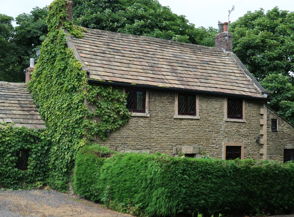
I then made my way up to Derbyshire Lane, via the steep Cavill Road - noting the use of the finely cross-laminated Greenmoor Rock in the vernacular architecture and boundary walls on the way - before arriving at the former Norton Board School on Mundela Place.
 
Greenmoor Rock used as a walling stone

The Norton School Board was formed in 1872, with the architect T. H. Wilson being employed as the architect to the Board until 1894. It was built in 1875, with an extension added at right angles to its west end in 1893 and, unlike the schools that were being built in Sheffield to the extravagant designs of C.J. Innocent, it is very plain and has a brick extension built in the 1930’s.
 
The former Norton Board School

With very little of architectural interest to see, I just took a few general record photographs of the building and was more interested in the cross-bedded sandstone that has been used for the walling, which is light grey/brown with a high proportion of orange iron staining.
 
Sandstone walling at the former Norton Board School
 
The Crawshaw Sandstone used for nearly all of the Sheffield Board Schools that I had seen to date has a very uniform light buff colour, with distinctive planar bedding and has proved very durable. The sandstone here, however, is much softer and is differentially weathered and isn’t like any of the named Coal Measures sandstones that I had encountered in Sheffield.
 
Views of St. Paul's church

I then headed off down Derbyshire Lane towards Norton Lees, an area dominated by interwar housing estates, where I stopped very briefly to look at the lodge and chapel at Norton Cemetery and then at St. Paul’s church on Norton Lees Lane, before arriving at the Grade II Listed former Norton Lees Council School.
 
The rear elevation of the former Norton Lees Board School

My first glimpse of the school, built in 1903 to a design by Joseph Norton, was of part of the rear elevation of the building, which the book Building Schools for Sheffield states that it was described as a “handsome business-looking pile standing on the side of a hill well out of reach of the smoke of the city" at its formal opening.
 
The Sheffield School Board inscription

A little further down Upper Albert Road, I got a view of a gable at the east end, where the Sheffield School Board inscription is cut into a massive pinkish sandstone, which is similar to the one that I had previously seen at the Pomona Street and Western Road schools.
 
The east end

Next to this is another gable with a broken segmental pediment, where the Sheffield School Board crest is barely visible through the dirt and beneath this is a band course is made of the same pinkish sandstone, which continues on the front elevation.
 
A general view on Argyle Street

Moving round to the front elevation on Argyle Road, it can be seen that the original school consists of two blocks and, although the stonework is dirty, the typical physical characteristics appearance of the Crawshaw Sandstone can still be determined.
 
Crawshaw Sandstone in the boundary wall

A high boundary wall, which displays the Crawshaw Sandstone to good effect, obscures the lower parts of the building but set within these are separate entrances for the girls and boys – a detail encountered in most of the schools that I had seen to date.
 
The entrance for boys

Continuing along Argyle Street to Argyle Close, glimpses of the school and extensive grounds could be caught through various gated entrances and the Grade II Listed caretaker’s house occupies a gap in the west boundary wall.
 
The caretaker's house

I finished by brief survey of this school at the single storey extension of 1913, also by Joseph Norton, which occupies the south-west corner of the site. I couldn’t get close enough to examine it, but the pattern of the stonework to the walling is very different to the original school and may well be a different stone.
 
The 1913 extension

Sunday 22 May 2022

A Further Investigation of Graves Park

 
An outcrop of Greenmoor Rock in Cobnar Wood

Following on from my brief exploration of St. Margaret’s church and the listed buildings in Swinton, I returned to Sheffield to continue my investigation of the Norton, Norton Lees and Meersbrook Sheffield Board Schools.
 
Starting at the south-west entrance to Graves Park at Meadowhead, however, I firstly wanted to investigate the escarpment of Greenmoor Rock on the east side of Cobnar Wood and then take a few photographs for the British Listed Buildings website near to the north entrance to the park.
 
The valley cut into the Greenmoor Rock in Cobnar Wood

I last visited this part of Sheffield in 2019, when leading a field trip with the Sheffield U3A Geology Group, but when attending one of the meetings of the Friends of Graves Park, I had been told that there were some good exposures of the Greenmoor Rock here.
 
The valley in Cobnar Wood
 
Following the path, which skirts the edge of the escarpment, there are fantastic views of the valley that has been carved through the Greenmoor Rock into the underlying mudstones and which is now occupied by Graves Park Beck.
 
Small outcrops of Greenmoor Rock
 
I passed by several hollows that were once the site of quarries, but I didn’t deviate from the path on this occasion and only discovered a handful of very small outcrops alongside it, which most visitors to Graves Park probably wouldn’t even notice.
 
An outcrop of highly laminated Greenmoor Rock

The Greenmoor Rock, or the Brincliffe Edge Rock in Sheffield, is best known for its dense, flaggy sandstones that were once prized for the very high quality of its paving, gravestones and road setts; however, the mudstones occurring beneath the sandstone were equally prized and were used to make bricks in several places along its outcrop in Sheffield.
 
Samples of Greenmoor Rock
 
Leaving the escarpment of Greenmoor Rock, I then continued up on to the area around the playing fields, where I stopped to take a look at the landscape formed by the overlying Grenoside Sandstone, before encountering the outbuildings at the Grade II Listed Bolehill Farmhouse.
 
A panoramic view of the Grenoside sandstone forming the skyline

Although the Greenmoor Rock doesn’t provide stone that is suitable for large quoins, it has been used for basic walling stone wherever it outcrops and the barn adjacent to the path provides a good example of its use for this purpose.

A barn at Bolehill Farmhouse

Moving on to the early C18 farmhouse itself, better quality and slightly more massive stone has been used for the walling and, although the individual stones have not been shaped, more regular courses have been achieved.

Bolehill Farmhouse

All the buildings at Bolehill Farmhouse also have their original stone tile roofs, for which the thinly bedded Greenmoor Rock is also very suitable and, just outside the park on Cobnar Road, the Poplars – dated 1670 – is built in similar materials, with thicker beds used for heads and cills.
 
The Poplars

A Walk From Swinton to Mexborough

 
An outlier of Mexborough Rock at Peas Hill Plantation

After my brief exploration of the listed buildings on Fitzwilliam Street in Swinton, I returned to Church Street via Milton Street and immediately encountered the remains of the old market cross, composed of the original Permian dolomitic limestone base and a new sandstone cross.
 
The market cross

It is thought to be from the time of King John in the early C13 and before it was relocated to its original position near to the site of the Chapel of St. Mary Magdalene, which is now occupied by the old St. Margaret’s church hall, it was placed outside the west door of the church.
 
The market cross

A little further down the road is St. John’s Methodist Church, which is built in a uniformly coloured light brown sandstone that does not appear to contain ironstone nodules typical of Mexborough Rock, with buff coloured medium grained gritstone dressings.
 
St. John's Methodist Church
 
Continuing down to the modern centre of Swinton, there is very little of architectural interest here, but when popping into the Community Library to see if there was any information about he local history, I was interested to see a hardback copy of the Building Stones of Rotherham – for which I had provided the photographs back in 1995.
 
The Building Stones of Rotherham

The brick built Carnegie Library, built in 1906, is surprisingly not listed and has several fine examples of stone carving on the uniformly buff coloured, medium grained gritstone dressings. These include a fine Baroque Revival style door surround that rises to three storeys and is topped by a pediment, which is decorated with swags.
 
Views of the Carnegie Library

Quickly walking down past the railway station and the small remaining stretch of the Dearne and Dove Canal, I came to the old Swinton Bridge School, commissioned by the Rotherham School Board and completed in 1878, which is now occupied by various businesses.
 
The former Swinton Bridge School

Like most of the few remaining Rotherham Board Schools, I have been unable to find out any information about its architect or history and I just took a few general record photographs of the principal architectural features.
 
Views of the former Swinton Bridge School

Although I didn’t examine the stonework closely, my photographs show that the massive sandstone dressings contain very many ironstone nodules, which suggest that it is from one of the quarries in the Mexborough Rock; however, the rock faced walling does not seem to have similar nodules and it may therefore have a different provenance.
 
Memorials at the former Swinton Bridge School

I was interested to see that one of the commercial units was occupied by a memorial mason, with many finished monuments on display. As a geologist, I couldn’t resist rummaging around in the skip, where I found a piece of gabbro to add to my rock collection.
 
A piece of gabbro
 
Further down the road, I was particularly interested to see the old premises of Tyas and Guest memorial masons, where the door surround to the very ordinary stone built terraced house is made in pink Peterhead granite. This would normally be a feature of more prestigious houses and was presumably added as an example of their work, which includes Thurnscoe war memorial.

The former premises of Tyas and Guest

Arriving in Mexborough, I took advantage of the LIDL supermarket to buy something for my tea and a nice bottle of Sicilan white wine and then made my way to Mexborough railway station, where I took some general photos for the British Listed Buildings website.
 
Mexborough railway station
 
Before crossing over to my platform by the foot bridge, I was very interested to see the extremely reddened sandstone in a section of walling at the west end of the station. Although I have not found the outcrop, the Geological Memoir for Barnsley describes a boundary between the yellow and red stained Mexborough Rock, which has a thin band rich in haematite with a metallic appearance.
 
Reddened Mexborough Rock at Mexborough railway station

While waiting for my train, I went to have a quick look at a small but very distinctive topographic feature standing above the floodplain of the River Don, named Peas Hill Plantation, which I had seen many times when travelling by train to Doncaster.
 
Pease Hill Plantation and the River Don floodplain

It is a small outlier of steeply dipping Mexborough Rock, which is detached from the main outcrop to the south-east by a fault. Unlike the Mexborough Rock to the north of the River Don, it has a SW-NE strike that relates to the formation of the Don Monocline, an important geological structure that affects the Coal Measures strata from Sheffield to Sprotbrough – a distance of 25 km.