Thursday 28 June 2018

A Geology Field Trip Around Eyam


Gigantoproductus brachiopod fossils in the Lower Shell Bed

I once lived in Bakewell and got to know the geology of the Peak District National Park quite well when I was commissioned to survey its RIGS (Regionally Important Geological Sites) and to identify places where tourism could be diverted away from ‘honeypots’ like Castleton.

A geological map of the area around Eyam

A month of intensive work only scratched the surface of its geology, but I nonetheless encountered a wide variety of sedimentary and igneous rocks and many spectacular landforms that I would recommend to prospective visitors to the Peak District.

Rose and Fossil Cottage

When I joined the Sheffield U3A Geology Group, I was very impressed by the wide variety of field trips that they undertook and, currently being without a car, it provided an opportunity to visit places that were otherwise inaccessible to me.

The Lydgate Graves

The October 2017 field trip to Eyam particularly interested me. Best known to tourists as the “plague village”, due to the part it played in containing an outbreak of the bubonic plague in 1665, there is also some interesting geology and geomorphology. 

Gathering around the information board at the Boundary Stone

The village is set on the Bowland Shale Formation, the lowermost strata of the Upper Carboniferous, and we started off here by looking at two of the very many places associated with the plague – Rose and Fossil Cottage and the Lydgate Graves. Making use of the Heritage Trails produced for the area around Stoney Middleton, we then followed a distinct ridge formed by the Eyam Limestone Formation to see the Boundary Stone

A view of Upper Carboniferous rocks from the Eyam Limestone ridge

From here, the younger Upper Carboniferous sandstones and siltstones rocks can be seen to form an escarpment to the north and, to the south, the flat reef limestone on which we were standing passes down into the Monsal Dale Limestone, which is seen in Middleton Dale

Lover's Leap in Middleton Dale

To the south side of Middleton Dale, the Monsal Dale Limestones have been extensively quarried and evidence of lead mining, lime kilns and evidence of other industries that have exploited the geological resources can be found along the gorge.

The Stoney Middleton Heritage Trail

The vertical cliff faces on the north side of Middleton Dale, especially at Castle Rock, show a cross section through the Eyam Limestones and the Monsal Dale Limestones, with variations in the facies, and differences between shallow and deeper water sediments can be clearly seen.

Castle Rock

Variations in colour and texture can be seen on a large scale and certain geological horizons such as the Lower Shell Bed in the Upper Monsal Dale Beds, where Gigantoproductus brachiopods can be found in great numbers, are quite spectacular. 

The Lower Shell Bed

In places, the path along Middleton Dale is quite precipitous – and not followed by everyone - but there are good examples of fluorite mineralisation, colonies of corals and fine views across to the quarries on its south side. 

A coral colony

Leaving Shining Cliff to walk back up to Eyam, the B6521 follows the course of a heavily wooded dry valley, and just before re-entering the village there is an exposure of thick beds of chert in the Eyam Limestone Formation - the last stopping point at the end of a very interesting day.

An examination of Eyam Limestone containing beds of chert

Thursday 14 June 2018

In Harrogate


A war memorial in Harrogate

When planning the weekend away to Knaresborough, it was always my intention to visit on the same weekend as The Flooring Show, a national trade exhibition held annually at the Harrogate Convention Centre. Although I had only a passing interest in this event, to see if there were any potential uses of my Glowing Edges Designs for rugs and carpets, I mainly wanted to have a good long wander around Harrogate

Bettys Cafe Tea Rooms

Very many years ago, I drove through this old spa town and noticed that it contained numerous large and ornate Victorian buildings and I was interested in having a closer look. Being dropped off at Harrogate railway station with my travel bag, I only had a fleeting look at some of the buildings on the way to and around the convention centre, but it was enough to give me an introduction to its building stones

The geology of the area around Harrogate

Most of the low lying old town centre is built on the Bowland Shale – potentially the source of shale gas by the controversial process of fracking - but the area surrounding Harrogate is formed from the Millstone Grit Group, which is usually a source of good quality building stone; however, in this part of Yorkshire and further north, the Yoredale Group forms a very distinct local variation in the character of these Carboniferous rocks, with limestone alternating with siliceous rocks. 

The Wesley Chapel in Harrogate

I didn’t get the opportunity to examine any of the buildings closely using my hand lens and other geologist's tools that I had with me - to determine the physical characteristics of the stones - but buff/brown sandstone is ubiquitous in the historic buildings of Harrogate. 

The Victoria Shopping Centre

Opposite the railway station, the Victoria Shopping Centre, built in 1992 by architects Cullearn & Phillips in a Palladian style, caught my eye – not least for the statues at parapet level and the colour of the stone, which is distinctly orange/red in places and not typical of those normally quarried from the Millstone Grit. 

The Jubilee Memorial

The ornate sandstone Jubilee Memorial of 1887, with a Portland limestone statue of Queen Victoria, is very impressive and makes use of Scottish grey and pink granite in its columns – materials that were widely used in the late 19th century, but are now generally unobtainable and difficult to match

A relief sculpture on Harrogate War Memorial

Another use of Portland stone can be seen in the Harrogate War Memorial, but around Low Harrogate, where the original spa town grew around the various springs that are found here, sandstone dominates the historic architecture. 


A detail of the pediment to the Royal Hall

Although I had no opportunity to closely examine them, the large monumental buildings such as the Royal Baths and the Royal Hall appear to be built of stone with a uniform colour but commercial parades and the less ornate buildings have greater orange/brown colour variation.

Cheltenham Parade in Harrogate

I have never had a reason to professionally investigate the geology and building stones of North Yorkshire, and haven't visited any quarries there, but I suspect that the grand buildings have used sandstone from West Yorkshire – given its reputation for producing durable stone - and those of lesser importance have used the cheaper stone from nearby.

The Royal Baths in Harrogate

Like Buxton in the Peak District, although it would take a long day out to get there and back by public transport, I think that I could easily spend a few hours exploring its historic architecture - as well as its green spaces - and I look forward to visiting Harrogate again.


Tuesday 12 June 2018

The Nidd Gorge


The geology around Knaresborough

Compared to 2016, when I got on the bus and train to travel as far as I could from Treeton – to survey a wide variety of mediaeval churches and associated historic buildings – 2017 was a comparatively quiet year.

Knaresborough railway station

I had explored parts of the Sheffield Round Walk and the villages of Norton and Grenoside, as well as having a close look at the Mam Tor landslip, but I spent most of the time much nearer to home – helping out with the maintenance of St. Helen’s church and trying to get another Glowing Edges Designs project off the ground.

A view of the railway viaduct in the Nidd Gorge

It had taken 15 years for an idea for a display at Clifton Park Museum to turn into the production of a set of unique Crepe de Chine silk scarves and I was in need of a break – which was provided by the offer from an old friend to spend the weekend in Knaresborough.

A view along the Nidd Gorge from the A59 road bridge

Arriving on the train across the viaduct from Leeds, I didn’t really notice the Nidd Gorge which, along with Knaresborough Castle and Mother Shipton’s Cave, is one of Knaresborough’s principal tourist attractions; however, with the plans to spend an afternoon in Harrogate cancelled, I was shown around this very attractive place. 

A cliff on Waterside

Walking down Waterside to the river from the road bridge on the A59, I didn’t stop to investigate further as I would have done if I were not in company and, even when passing under the railway viaduct, I didn’t take much notice of the surrounding gorge – until I encountered the vertical cliff face upon which the castle is set.

Magnesian Limestone above the Addlethorpe Grit

Knowing the Magnesian Limestone very well - based on geological surveys in South and West Yorkshire, I immediately recognised the pale limestone of the Cadeby Formation high up in the cliffs. Beneath this, I assumed that the red/orange cross bedded sandstone was a thick deposit of the Yellow Sands Formation - which I had seen before in Hooton Pagnell and Pontefract.

Sandstone in the Nidd Gorge

I have since discovered that this is the Addlethorpe Grit from the Millstone Grit Series and that this distinct change in the rock is due to the CarboniferousPermian unconformity here. 

The Addlethorpe Grit

Examining the photographs that I took at the time, the distinct reddening of this sandstone provides a good example of the weathering of uplifted Carboniferous rocks in the hot and arid Permian climate – and the rocks that form the lowest part of the cliff here seem to be different again, with a massive nature that is characteristic of the Millstone Grit. 

The Chapel of Our Lady of the Crag

Walking further south-east along the Nidd Gorge, a plaque that told us that we were near to the Chapel of Our Lady on the Crag – which deserves further investigation - and we carried on looking at the geology, architecture and sculpture until we decided that we had walked far enough for the afternoon and that is was time to get back to Knaresborough to have a well earned drink. 

An example of vernacular architecture along Waterside

In the hour and half spent wandering along the east side of the Nidd Gorge, some interesting and varied geology had been encountered and, using a guide produced by the British Geological Survey, this would make a particularly good field trip for the Sheffield U3A Geology Group - especially if combined with a visit to Knaresborough Castle and a wander around the very attractive market town.

A cliff formed on the west side of the Nidd Gorge

Tuesday 5 June 2018

The Mam Tor Landslip


A general view of the old Mam Tor road

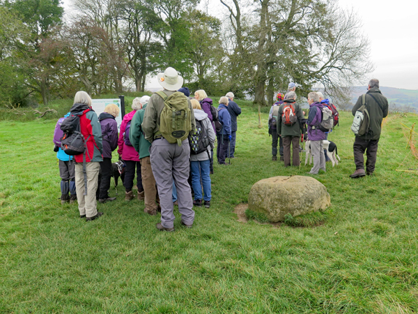
During August 2017, the trip to Hope Cement Works with the Sheffield U3A Geology Group provided me with an opportunity to visit a place that I was otherwise unlikely to see; however, the afternoon session was dedicated to a brief exploration of the landslips at the base of Mam Tor – a site that I first visited as an undergraduate geologist and have seen many times since when visiting Castleton for both work and pleasure. 

Mam Tor with the entrance to the old Odin Mine in the foreground

The vertical faced scar exposes a cyclical succession of turbidite sandstones and shale of the Mam Tor Beds, which are very susceptible to landslips and has resulted in Mam Tor also being known as the shivering mountain. 

The Mam Tor landslip

Elsewhere in the Dark Peak – such as the nearby Back Tor and Bretton Clough – there are other spectacular examples of landslips but, at Mam Tor, it is the history of the failed attempts to keep the A625 road open that is of most interest here. 

A view across the landslip towards Castleton

Mam Tor road was first constructed across the landslip zone in 1819 using spoil from the nearby Odin Mine, to replace an ancient packhorse route that ran through Winnats Pass. This rotational landslide, which began approximately 4000 years ago, is particularly active after periods of prolonged wet weather and major road works were undertaken several times during the 20th century until 1979, when it was finally closed. 

A general view of the Mam Tor road

When I first visited Mam Tor, I remember that the recently closed A625 road wasn’t in very good condition but, nearly 40 years later, I was extremely surprised to see how much it had deteriorated - large sections of the old road have been fractured and others have broken up completely have been slowly sliding down the slope. 

A view of Hope Cement Works with Castleton in the foreground

As with the visit to Hope Cement Works earlier in the day, memories of studying Industrial and Environmental Geology as an undergraduate came flooding back. My 2: II Bsc. Hons. degree in Geology, with subsidiary Chemistry and Zoology, is nothing to boast about; however, on this course, I was top of my class and it proved to be influential on future work that I would do. 

Fractures on the old Mam Tor road

Although by no means an expert on the construction of roads, I think that students of engineering geology and civil engineering would find the remains of the Mam Tor road particularly fascinating. Sections up to 2 metres thick, exposing the various road courses, record the numerous efforts to keep this very important road route open over the years. 

A section through the old Mam Tor road

The geology, mineralogy, geomorphology, archaeology, industrial history and beauty of Castleton and the surrounding area ensure that it ranks very highly in the places to visit in the Peak District National Park - for geologists and the general public alike. 

A general view of the old Mam Tor road

Sunday 3 June 2018

Hope Cement Works


The limestone quarry at Hope Cement Works

Before studying for a degree in geology, I took a year out after leaving school to work as a builder’s labourer in London and I became very familiar with various types of sand, gravel, aggregate, cement and clay products. 

An Industrial & Environmental Geology textbook

Having considered studying as a building surveyor in London, I decided to go to Nottingham University and, during my final year, I opted to study Industrial and Environmental Geology, which largely concentrated on the various bulk materials that I had got to know even better – when returning to London during the holidays. 

A textbook introduction to cement making

I never thought of working in this field but, when a trip to Hope Cement Works was placed on the itinerary of the Sheffield U3A Geology Group, I didn’t want to miss it. As a tourist to Castleton, when living in High Green to the north of Sheffield many years ago, and having worked briefly as a geologist for the Peak District National Park Authority – surveying its Regionally Important Geological Sites (RIGS) – I had passed it very many times and I was very curious. 

A Google Earth view of Hope Cement Works

Unlike the area around Buxton, where the quarrying of limestone has left scars to such an extent that it has been excluded from the National Park, Hope Cement Works has been here since 1929, long before the region was designated as a National Park. 

Hope Cement Works forms a distinctive landmark

Its stack forms a landmark that can be seen from miles around, but much of the industrial complex - which includes quarries for the limestone and shale and its own railway line - has had its visual impact reduced by careful landscaping and tree planting. 

A sculpture with the theme of "Safety"

The extent of the works was partly demonstrated with a trip to the limestone quarry in a minibus, during which we passed various very large pieces of plant and machinery and, from the quarry edge, we were provided with an explanation of the quarrying process. 

The geology around Hope Cement Works
The quarry cuts through the Monsal Dale Limestone Formation and the upper part of the underlying Bee Low Limestone Formation, and the variation of the chert content in these means that the chemistry needs to be continually monitored and the silica content adjusted to 5 % before the stone is moved on to the works. 

A reference to Hope Cement Works in the BGS Memoir

At the works, further information on Hope Cement Works was provided in a short presentation and the tour finished with a visit to the control room, where every aspect of the cement making process is managed using a vast bank of computer screens, which made a big impression on me.

The control room at Hope Cement Works