Sunday 29 April 2018

Chancet Wood to Ladies Spring Wood


Looking down the escarpment of Greenmoor Rock in Chancet Wood

When undertaking the Porter Valley leg of the Sheffield Round Walk, problems with the bus service resulted in me having to walk twice as far as I had intended. Consequently, I didn’t have enough time to fully explore the places of interest for geologists and industrial archaeologists, which were listed in various maps and guides that I had downloaded.

A Google Map view of the southern outskirts of the City of Sheffield

Having briefly explored Norton, its church and other parts of Graves Park that I hadn’t seen before, I returned to this part of Sheffield afterwards to continue my exploration of the Sheffield Round Walk – this time from Chancet Wood to Ladies Spring Wood.

Greenmoor Rock on the Sheffield Round Walk

Looking at the Geology of Britain viewer and Google Map, I was interested to see that the paths along this section essentially follow the outcrop of the Greenmoor Rock and I was also looking forward to seeing the flora in the established woodlands that grow along the lower scopes of the escarpment - in particular the provenance of the bluebells that grow here.

Bluebells

At Chancet Wood, the path follows the contours, with a steep slope falling down to the upper end of Abbey Lane in Woodseats, and continues round to the head of a steep sided valley, where a small outcrop of Greenmoor Rock is cut through by Abbey Brook, before it continues down to Beauchief Abbey, after which it then joins the River Sheaf.

An exposure of Greenmoor Rock in Abbey Brook

This is the only part of this walk where I saw any rock exposures but, if joined with other walks like Ecclesall Woods – or one that I have in mind for Graves Park – it would be easy to include this as part of a field trip for the U3A Sheffield Geology Group or similar others.

Following the Greenmoor Rock through Park Bank Wood

After crossing the valley and Bocking Lane, the walk continues at Park Bank Wood where the path continues to follow the contours of the Greenmoor Rock and overlooks the public golf course, which is set next to Abbey Brook valley.

Beauchief Abbey

A short detour here brings you to Beauchief Abbey, which I haven’t yet seen inside but has remains that have proved to be of great value to students of archaeology from Sheffield University over the years.

Ladies Springs Wood

Walking back up the hill on the road to Beauchief Hall, I rejoined the Sheffield Round Walk at Ladies Spring Wood, where various natural springs are encountered when following the Greenmoor Rock down to the River Sheaf.

A weir on the River Sheaf

At Twentywell Lane, where I left the Greenmoor Rock and the River Sheaf to catch the train back to Sheffield from the nearby Dore railway station, the river, a main road and the railway to London are all squeezed into this part of the Sheaf Valley – and many points of interest for geologists, geographers, civil engineers, industrial archaeologists and local historians can be found here.

Wild garlic

Tuesday 24 April 2018

St. James the Great - The Porch


Barbaric heads from a corbel-table

The church of St. James the Great in Norton is kept locked except for services and occasional coffee mornings, like most of the mediaeval churches that I have visited, and I didn’t have the opportunity to explore its interior; however, the outer doorway to its porch is open and there are several interesting details to see here.

The doorway to the porch

The Historic England List Entry Summary describes the porch as having a “plain C13 style outer doorway with restored responds” and refers to six reset headstones, as well as the Norman mask corbels, which are alternatively described as “barbaric heads from a corbel-table” in the principal resource that the writer uses - Pevsner, N, Radcliffe, E, The Buildings of England: Yorkshire: The West Riding, (1967), 479.

Sculpted corbel brackets

I didn’t stop long enough to examine the various stones very closely but yellow/orange coloured Grenoside Sandstone is the principal building stone – seen in the dressings especially – with the green/grey Greenmoor Rock used mainly for the grave slabs.

A view of some reset grave slabs

The very heavily restored chevron decorated Norman doorway is also quite yellow and, looking up, the very fine Victorian rib vaulted ceiling is very striking with its uniform colour. The latter reminds me of Holy Trinity church in Wentworth, where I once thought that it would be a very difficult stone “to match” - if it was ever in need of repair.

The south doorway of the church of St. James the Great

This interesting church merits another visit soon, to take a good look at its interior and to re-examine a few puzzling details that I had noted when quickly looking around its exterior.
  
A reset grave slab


The Church of St. James the Great


A view of the church from the southeast entrance

Entering the churchyard of St. James the Great in Norton from the southeast - on the last day of March - various blooming trees and large shrubs were obscuring the east end of the church, and my first view of this very interesting church was its squat tower and the crenellated parapet to the C15 clerestory that is attached to it.

The south elevation

Moving closer to the Blythe Chapel, dated 1524, a change in the building stone - from local Carboniferous Grenoside Sandstone to Permian dolomitic limestone - can be quite clearly seen here. Built with fine ashlar in a late Perpendicular style, with very simple windows, the masonry details still appear sharp and it contrasts strongly with the coursed rubble sandstone in the south aisle.

The chancel

Like the late addition to the tower at St. Helen’s church in Treeton, it is a strange architectural anomaly – especially given the distance and the difficulty of terrain between Norton and the nearest source of dolomitic limestone, which is at least 15 km away as the crow flies.

Variation in the colour of masonry in the tower

Looking at the masonry of the south elevation as a whole, the colours, shapes and sizes of the various blocks used in the south aisle and the lower part of the tower are all very similar. Nearly halfway up the tower, there is a sharp change in the overall colour of the masonry, with it now containing a greater proportion of distinctly yellow/orange stone.

Detail of the upper section of the south elevation of the tower

Except for the west window, which is considered to be a later C15 addition, it doesn't appear that there have been any changes in block size, course height etc that normally indicate a phase of later extension or rebuilding - and it is quite possible that the colour change reflects some variation in the source of the Grenoside Sandstone used here.

The Perpendicular style west window of the tower

Historic England and Pevsner refer to the tower as being of essentially Early English Gothic or C13, as well as making comment on the unusual window tracery in the aisles, but there is very little mention of their dates – with Historic England only referring to a C13 style of the outer doorway and Pevsner producing a very sweeping statement to say that the rest of the exterior is Perpendicular in style.

A general view of the east end

Walking anticlockwise around the church, the east elevation to the C19 clergy vestry provides another example of the colour variation in the Grenoside Sandstone and it is clearly different to that used in the Perpendicular style end of the chancel, which it adjoins.

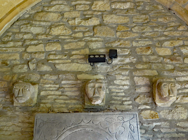
Weathered coats of arms on the dolomitic limestone chancel

I didn’t study the external fabric at any length, but I noticed a few other interesting features, including a blocked up doorway, eroded coats of arms to the chancel, ornate rainwater heads that provide a record of the restoration in 1710 - and a few gargoyles.

A rainwater head and a gargoyle

Monday 23 April 2018

A Trip to Norton


In Norton

When undertaking my surveys of mediaeval churches in and around South Yorkshire during 2016, there were a few that I didn’t manage to visit, including St. James the Great in Norton; however, having planned to start the next leg of the Sheffield Round Walk at nearby Meadowhead, this gave me the incentive to go and take a good look at a village that dates back to at least Saxon times.

A Google Map view of the area around Norton

As with previous days out, I inevitably discovered a few things that relate to my professional interests in geology and building conservation and my first stop off point – taking the bus from Sheffield along and up the Chesterfield Road - was at a large old quarry that I had passed a few times before when travelling on this route.

The quarry at Woodseats now occupied by Homebase and Dunelm Mill

The A61 follows the outcrop of Greenmoor Rock – once highly valued for paving, kerbs and gravestones - which forms a distinct escarpment that rises up to Norton where, together with the succeeding Grenoside Sandstone, it forms a high point on the southern outskirts of the city.

Greenmoor Rock at Morrisons Car Park in Meadowhead

At Woodseats and further up the hill towards Meadowhead, however, it is the underlying mudstones and siltstones that have been exploited to make bricks. The old quarries here are now occupied by national retail outlets, which makes access to the remaining rock faces quite difficult – and rock netting partially obscures them - but there are sufficient exposures to provide a good insight into the geology of the region.

A geological map of the southern outskirts of Sheffield

Making my way across Graves Park, an unnamed brook - which has been dammed to provide various ponds in the former Norton Hall estate – has cut down through the Greenmoor Rock to form a steep sided valley and, although I didn’t see them, I have been informed that there are several good outcrops in its lower parts.

An exposure of sandstone in Graves Park

Arriving in Norton, the vernacular architecture, which is essentially built from the local stone, contrasts strongly with the red brick and render interwar housing estates – with grey Welsh slate roofs - that have engulfed the old village. I didn’t have the time to thoroughly explore the village but various sandstones have been used here.

Greenmoor Rock used as basic walling stone

Greenmoor Rock is frequently seen as a general walling stone but it is Grenoside Sandstone which has been preferentially used for both walling and dressings in the various Listed Buildings that can be found here.

The Old Rectory

I didn’t get near enough to Norton Hall or its stable block, with its similarities to Wentworth Woodhouse, to assess the sandstone that has been used for the fine ashlar on its principal elevation but – at a distance – the colouration suggested that this could be Grenoside Sandstone.

Norton Hall Stable Block

Just before I finally got to the church of St. James the Great, I also came across a few interesting monnuments that deserve further investigation, including those to Annie Hall and Sir Francis Chantrey –  former residents of Norton who have been commemorated with granite monuments.

The Chantrey Memorial

Both of these, and also the nearby public war memorial, provide examples of white granite that appear from a distance to be typical of Cornwall or Devon and which - when examined closely - clearly display large crystals of white feldspar and easily recognisable quartz and mica.

The War Memorial in Norton

Monuments like this have been used all over the world as an educational resource, to introduce students of all ages to the wonders of the Earth Sciences - and the use of various optical instruments that professional geologists and mineralogists use for their work.

An elaborate granite monument dedicated to Anne Hall

Although I hadn’t planned my visit to Norton with any ideas for educational walks or talks in my mind, I had by now seen a wide variety of stone related points of interest on my journey to make this quite possible – which included a brief encounter with the remains of an old cross of a type that I had last seen in Worksop and Maltby.

The remains of a mediaeval cross in Norton

Wednesday 18 April 2018

The Porter Valley


A view of Sheffield 

I had been aware of various published trails relating to the Porter Valley for some time and although I had seen parts of it – when walking through Endcliffe Park after a trip to Planet Pot with my Spanish students and following a personal visit to the Shepherd Wheel – I had never looked at its geology in any detail.

For my planned second leg of the Sheffield Round Walk, from Ringinglow to Hunters Bar, I had downloaded various pdf files from the Sheffield Area Geology Trust website but, as I briefly reported in Tripadvisor at the time – and in recent posts that briefly describe Whinfell Quarry Garden and the upper Limb Valley – problems with the buses put paid to my plans.

The Saturday bus service to Ringinglow from Sheffield

By the time that I arrived at Ringinglow, near to the head of the Porter Brook, I had already walked several kilometres on an unseasonably warm day in late March and - with my knees not being as good as they used to be – I was very glad that the rest of my walk was now downhill.

The path down to Porter Clough from Ringinglow

After flowing a few hundred metres from its head across a plateau formed by the Rough Rock, the Porter Brook then cuts down into the weak siltstone and mudstone of the underlying Rossendale Formation to form the spectacular Porter Clough – a steep sided ravine that is marked by a distinct V-shape on the geological map.

The footpath down Porter Clough

As seen in the upper reaches of the Limb Valley, several springs emanate from the valley sides and the path in parts was like a muddy stream but, after a few hundred metres of this terrain, there is a change in character – where the Porter Brook encounters the Redmire Flags – and the stream course is confined to a narrow gorge, with a small waterfall exposing this sandstone.

A waterfall

A little bit further downstream where the Porter Brook merges with Mayfield Brook, there is an example of ochreous staining of the stream beds, as seen in Ecclesall Woods, but any desire to search for goniatites in muddy stream banks - which I might have once been encouraged to do as an undergraduate geologist - had long since disappeared and so I stuck to the well beaten track.

Ochreous staining to the stream bed

Downstream from the point where these brooks converge, there is evidence of Sheffield’s industrial history along the banks of the Porter Brook all the way down to Hunters Bar, in the form of dams, weirs, goits and related structures, although Forge Dam and Shepherd Wheel are the only places that have developed into tourist attractions – with a working wheel in the latter.

The weir at Forge Dam

Having finally reached Forge Dam, I had done enough walking for one day and, if I had seen a bus stop nearby, I would have caught the next bus back to town, especially since there was a very long queue at the cafe and I was now in need of something to eat and drink. Instead, after sitting down for 5 minutes, I gritted my teeth and continued my walk down towards Sheffield.

A tributary stream exposes the Rough Rock
 
It is the industrial archaeology rather than the geology that is most noticeable in the lower section of the Porter Valley and this deserves more attention than I have given it here; however, even without leaving the footpath, exposures of rock in hanging tributary streams, further examples of ochreous staining and the general morphology of the Porter Brook - which possesses the characteristics of a small river here - provide points of educational interest to students of geography at all levels.

The bridge at Hangingwater Road

Judging by the extent of easily accessible and sufficiently extensive rock exposures that I had seen during this leg of the Sheffield Round Walk, albeit truncated by the lack of time, I probably wouldn't lead the Sheffield U3A Geology Group or similar others on a field trip here - based on its strictly geological content.

A monument to Queen Victoria

That said, from start to finish, the walk from Ringinglow to Endcliffe Park provides a great introduction to the natural, industrial and cultural history of Sheffield and I think that everyone would have an enjoyable time here - not least because it finishes with one of the most spectacular Beech trees that you could ever see.

A spectacular Beech tree at the east entrance to Endcliffe Park