Monday 31 December 2018

From Ashford-in-the-Water to Bakewell


A view to the north across Holme Bridge

In the hour and a half that I spent exploring the village of Ashford-in-the-Water and Holy Trinity church, I encountered many building and decorative stones that I knew would be of interest to the Sheffield U3A Geology Group, and thought that the industrial archaeology in the area deserved further investigation. 

An eastward view of the River Wye from the A6020

When I entered the village by the A6020, I had been surprised to see that the River Wye was divided into two branches and – when looking at a map of the stretch of the river between here and Bakewell – it looks like it has been diverted in several places, as I had recently seen all along the Loxley Valley in Sheffield. 

A view of the Bowland Shale Formation along the River Wye

Arriving back at the A6, to catch my bus back to Bakewell, I discovered that I had misinterpreted the bus timetable that I collected from Bakewell Visitor Centre earlier in the day, and that I would have to wait 30 minutes for the next bus. A passer-by noticed my dilemma and, after a short conversation in which the distance to Bakewell was briefly discussed, I decided to head off on foot – following the River Wye as far as I could. 

A weir on the Ashford Hall Estate

To the east of Ashford-in-the-Water, the river passes into a lake, with a small weir, which is overlooked by what appear to be non-native trees that I assume to be part of the old Ashford Hall Estate belonging to Lord George Cavendish and which was landscaped by Joseph Pickford

A dry valley cutting into the Monsal Dale Limestone Formation

After passing across a dry valley that once formed a tributary to the River Wye, and which cuts through the Eyam Limestone Formation into the underlying Monsal Dale Limestone Formation, the path leaves the course of the river and joins the A6 just to the west of Lumford Mill, one of three cotton mills built by Richard Arkwright

A view of Lumford Mill from the A6

Continuing towards Bakewell, the roadside cutting on the south side of the A6 was largely obscured with thick vegetation, with only glimpses of the bedrock behind it, but there is a short stretch where bedded Monsal Dale Limestone – with a moderately steep apparent dip – forms a vertical rock face that immediately fronts the road. 

An exposure of the Monsal Dale Limestone Formation on the A6

Unfortunately there is no path along this stretch of the road allows further exploration of this exposure of rock, which is in very close proximity to an outcrop of the Conksbury Bridge Lava Member – as marked on the British Geological Survey map – and it would be interesting to see if this volcanic rock is visible when the vegetation has died back over the winter period. 

A general view of Holme Bridge

On the outskirts of Bakewell, the A6 and the River Wye converge at Holme Bridge, built for pack horses, dated 1664 but, unlike the one previously seen in Ashford-in-the-Water, it is made of large, well squared blocks of gritstone - with cutwaters

A tourist information board at Holme Bridge

Entering Bakewell, a variety of listed buildings line both sides of Buxton Road, including an old mill, a Victorian church, Georgian townhouses and modest cottages and, although some have Carboniferous Limestone walling, most of the buildings are constructed of Millstone Grit

A view of Buxton Road with various buildings constructed in Millstone Grit

Generally, Millstone Grit is considered to be a durable building stone suitable for use in building elements exposed to extremes of wet and cold - often encountered in the Peak District - but in the mixed use building opposite the Catholic Church of the English Martyrs, the lower section of stonework has suffered from advanced weathering and decay, with the complete section of a house being completely renewed. 

Restoration of Millstone Grit that has been damaged by road salt

Arriving back in Bakewell just after 5 pm, in just two and a half hours I had encountered very many points of interest relating to geology, geomorphology, archaeology, industrial history, architecture, art and sculpture that I think would form the basis of a good field trip.

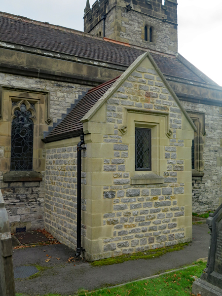
The Catholic Church of the English Martyrs

By now, after a very full day during which I had not stopped, I had decided that I was in no hurry to get back to Sheffield and, taking advantage of the Red Lion - a C17 coaching inn that is conveniently sited opposite the bus stop - I reviewed my day over a pint of Bakewell Best Bitter.

The Red Lion in Bakewell

Friday 21 December 2018

The Ashford Black Marble Industry


A detail of the inlaid table at Holy Trinity church in Ashford-in-the-Water

Walking round Ashford-in-the-Water, which could be considered to be a typical picture-postcard village, it is difficult to imagine that it once had a thriving industry which produced various products from Ashford Black Marble, a bituminous Carboniferous limestone that was firstly quarried and then extracted from two mines located just beyond the west end of the village. 

Reproduced from Derbyshire Black Marble by J.M. Tomlinson

This limestone, found in the Monsal Dale Limestone Formation, was first used in the middle of the 16th century with the first identifiable use being for fireplaces at Hardwick Hall c.1590 and it was later used for Chatsworth House when it was rebuilt in the latter part of the C17. 

The geology around Ashford-in-theWater

In 1748, Henry Watson of Bakewell created the Ashford Marble Works on the River Wye very near to the mines and the water power transformed an industry that previously relied on hand tools. In addition to its architectural use in the interiors of fine houses and churches, Ashford Black Marble was also used as the base material for inlaying with other Carboniferous limestones that were used for decorative effect, such as Rosewood and Duke's Red marbles, as well as malachite and other imported semi-precious stones. 

Inlay work at Buxton Museum & Art Gallery

The inlaying craft formed the basis of a substantial cottage industry in Ashford-in-the-Water and another marble works operated in the village during the 19th century but the mining and marble processing came to an end in around 1905, with the vast majority of the old buildings that formed the Ashford Marble Works being demolished to make way for the A6 bypass in the 1930’s. 

The memorial to Henry Watson

Nowadays, there is virtually nothing left in the village that relates to these former industries and one has to visit museums in Buxton and Derby to see a wide variety of inlaid ornaments - and places like St. Peter’s church in Edensor, Chatsworth House and Bolsover Castle - to see the Ashford Black Marble in an architectural context; however, in Holy Trinity church there are examples of both monumental and inlaid work.

The inlaid table by Abel Tomlinson

On the south wall of its interior, there is a large memorial to Henry Watson made of a slab of Ashford Black Marble and there is a fantastic example of inlaid work made by Abel Tomlinson. Although not actually containing any Ashford Black Marble, this magnificent table contains a wide variety of local decorative stones - which were used for inlaying - and it was awarded a prize medal at the London International Exhibition of 1862

A detail of the inlaid table by Abel Tomlinson

This post is only a very brief account of the industry that once dominated this wonderful village and is just designed to highlight its importance to potential visitors. A comprehensive account of the Derbyshire Black Marble industry was written by John Michael Tomlinson and produced as a special publication by the Peak District Mines Historical Society, which is still available for purchase today.

Derbyshire Black Marble by John Michael Tomlinson

Holy Trinity Church in Ashford


A general view of Holy Trinity church from the north-west

During my trip to Ashford-in-the Water, although I only had time to quickly walk around the village, I encountered many Iisted buildings, various walls and other structures that exhibit the building materials typically found in the White PeakCarboniferous limestone walling and Millstone Grit dressings, with flaggy varieties of the latter being used for roofing. 

Limestone and gritstone used in the tower

Approaching Holy Trinity church from the north-west, having previously walked down Vicarage Lane, the tower obviously looked like it was mediaeval – from the C13 according to Pevsner – and when close enough to see the details of the individual blocks of stones, I noted that the walling stone essentially comprises thinly bedded pale grey/light brown limestone, with some chert, and that the C14 parapet is built with gritstone. 

An extension built in limestone and gritstone

This church was largely rebuilt 1868-70 and, quickly walking around its exterior, I didn’t find anything of particular architectural interest apart from a recent offshoot extension to the north aisle, which made me curious to know where the limestone and gritstone came from –  as a stone matching expert - and the remains of a preaching cross, which reminded me of the one that I had seen the month previously at St. Peter’s church in Edensor

A view of Holy Trinity church from the south-west

The south elevation is obscured by two large yew trees – considered to be more than 500 years old - and having walked along Church Street to get a view of the church from the south-west, I discovered the Cornish granite memorial to the Great War

A memorial plaque dedicated to WW2

Next to this is a memorial to the Marquess of Hartington – the heir apparent to the Duchy of Devonshire – and others who perished in WWII, which appears to be made of Hopton Wood stone. Here, there is also a castellated chimney that was removed from the vestry roof and is now used as a 2000 millennium time capsule. 

A castellated chimney now used as a time capsule

Entering the porch, a Norman tympanum above the door depicts the tree of life with a hog and a lion set either side of it and, once inside the church, I discovered a single north arcade with very simple capitals, dated to the C14, and a font in the Perpendicular Gothic style but – with the walls being completely plastered – there wasn’t much masonry to catch my eye.

The tympanum above the south door

Monday 17 December 2018

Ashford-in-the-Water


The River Wye at Ashford-in-the-Water

September 2018 proved to be a very productive month for my investigation of places that I think will be of interest to Geotourists and, during my trips to the Peak District National Park – the Longshaw Estate/Padley Gorge and Edensor/Chatsworth – I saw many examples of Millstone Grit in its natural setting and as a building stone.

Pale Eyam Limestone with Millstone Grit dressings on Greaves Lane

For my next trip to the Peak District, I had intended to visit the Bakewell Rock Exchange in the middle of October, combining this with a visit to Holy Trinity church in Ashford-in-the-Water; however, when the X54 bus failed to turn up in time to get me to a new ceramics class that I had just started in Sheffield, I decided to catch a later bus and make a special trip to this village, which is set on the Eyam Limestone Formation.
Whilst undertaking a survey of the RIGS, when living in Bakewell, I encountered very many examples of Carboniferous Limestone - from black deep water sediments composed of lime mud to pale grey knoll reefs that are full of brachiopods, corals and crinoids - but I never took much notice of their use as a building material.
Carboniferous limestone is very hard and difficult to work by hand and, traditionally, it has been used for basic walling in vernacular architecture in the White Peak, with Millstone Grit reserved for the dressings, and generally it is only those varieties that were polished as decorative stones – including Ashford Black, Hopton Wood and Sheldon – that have been used outside this area.

Travelling from Treeton to Ashford-in-the-Water is no easy matter and - with three separate bus journeys required - a short delay to the X54 resulted in two missed connections, which added an hour and a half to my journey. Finally getting to Ashford at 2:30 pm, only to find that road works were preventing access to the centre of the village, I was starting to think that this day out wasn’t such a good idea after all – especially since I had to catch another 3 buses to get home.
Not to be deterred, I set off at a quick pace to explore the old village and, as I had expected, there was the usual pattern of limestone used for walling and gritstone for dressings. Looking at various blocks of limestone from a distance, I began to see subtle variations in colour and texture that I had not distinguished before.

The barn at Highfields Farm

When encountering Highfields Farm on Vicarage Lane, I immediately thought that it would make an excellent stop off point on a geological field trip, with an expanse of walling that contained blocks of stone with a different character and a very unusual barn.

A detail of thinly bedded limestone with chert at Highfields Farm

The Eyam Limestone is of two main types, a reef facies and a bedded facies, and it is the latter that is seen here - both thinly bedded brownish coloured limestone that contains very distinctive bands and nodules of black chert and a massive fine grey limestone of mid to dark grey colour. 

Eyam Limestone with subconchoidal fracture at Highfields Farm

When looking closely at the darker limestones, it is clear that they are only suitable for general walling stone as, when dressed with a hammer, this stone breaks with a very irregular subconchoidal fracture.

The Elms on Vicarage Lane

Walking back down Vicarage Lane into the village, with my eye now adjusted to these variations, I noted that this pattern is repeated in all of the limestone walls that I subsequently saw and there was no sign of fossiliferous varieties that are generally associated with the reefs.

Great Batch on Church Street

Although not suited for use as dressings in buildings, the Carboniferous limestone seen here is quite a versatile building material and has been worked into semi-circular coping stones for various boundary walls and has been used in the Sheepwash Bridge, without the need for structural support with Millstone Grit dressings.

The Sheepwash Bridge

Monday 3 December 2018

Geology & Archaeology in Loxley


A view downstream at Malin Bridge

In the last 4 years, I have encountered a lot of interesting historic architecture during my travels around South Yorkshire and the surrounding counties and, when going out with the Sheffield U3A Geology Group, some interesting rocks and landscapes too. 

A Google Map view of the Loxley Valley

Also, having explored various parts of the courses of the principal rivers, and their tributaries, which flow into Sheffield – the Don, Sheaf, Porter Brook and the Rivelin - I have now acquired a much better appreciation of the industrial history of Sheffield.

A packhorse bridge

For this reason, having thoroughly enjoyed my visit to the Stoneface Creative Woodland Weekend event at Storrs Wood, I looked forward to my walk along the River Loxley to Malin Bridge. Starting at Rowell Bridge, where there was once a forge mill, I found a path to the north side of the river where I soon encountered what looked like a packhorse bridge.

A geological map of the area around the Loxley Valley

Crossing over it, I came across what appeared to be an old quarry face, where there are extensive exposures of thinly bedded flaggy sandstone from the Rossendale Formation, which I assume would have been used for stone roofing tiles.

An example of  the interaction between geology and botany

Unlike other mines and quarries in Loxley, there is no mention of it on the Victorian maps I have seen. What interested me particularly was the large tree in the rock face, whose roots have deeply penetrated the bedding planes and joints. 

The Olive Wheel Weir

With the path soon dying out shortly after I had encountered the Olive Wheel Weir on the river, I had to retrace my steps to Storrs Lane, where I continued along the path to the north of the river until I came across the dam at Olive Wheel Mill

A view of the Olive Wheel Mill and its dam

Here several stone buildings from the old mill complex still remain and some of them have been redeveloped as housing, although others still appear to be disused and in need of some repair.

 A view of some of the buildings at the Olive Wheel Mill

At this point, there is a gorge where the river has cut through the bedrock and a section of the Rossendale Formation - several metres high - is exposed along the south bank of the river. 

A riverside exposure of sandstone from the Rossendale Formation

With the option of crossing the river here, I stopped on the north bank and eventually came to a small hamlet at Low Matlock Wheel which, like several other places along the course of the River Loxley was devastated in the Great Sheffield Flood, but none of the buildings relating to the working rolling mill or the old water wheel could easily be seen from the public thoroughfare.

A distant view of the buildings at Low Matlock Wheel

Low Matlock Lane continues to run parallel to the course of the river here, but at a distance of 50 metres or more and, except for a few fragments of foundations etc. from the Broadhead Wheel and Tilt than can be seen in the woodland at Wisewood, I didn't see any other evidence of the industry that once thrived here.

Ochreous staining in the riverbank

In the south bank, opposite the dam to Scythe Wheel, an ochreous spring flows into the river, which are very similar to those that I had seen in Ecclesall Woods and the Porter Valley. These are the result of the oxidation of the mineral pyrite by groundwater that flows through the various shafts and tunnels of the shallow coal mines, which were once active around here.

Remnants of the old forge at Loxley Park

The buildings at Scythe Wheel have long since disappeared – although the position of various dams and goits can be seen on Google Map – but in the grounds of Loxley Park, a private residential care home, various parts of plant and machinery from the forge have been preserved, although I don't know what their function was. 

A view upstream at Malin Bridge

Continuing my walk along the river, the sediments in the river bed were still seen to be distinctly coloured red and at Malin Bridge, where the River Rivelin joins the River Loxley, large rocks in the water are heavily iron stained but at the weir in Hillsborough the colour seems to disappear.

The River Loxley at Hillsborough

My walk ended here but the River Loxley continues down to Owlerton and, before it joins the River Don, there used to be several more dams, goits and mills along this stretch of the river. 

An easy going trail along the River Loxley

I don’t profess to be an enthusiast of industrial archaeology but, as I have written before when describing visits to Abbeydale Industrial Hamlet and the Shepherd Wheel, the industrial heritage of Sheffield, as a whole, doesn’t receive the attention that it really deserves. 

An information board on Storrs Lane

As a geologist and field trip leader, who has been encouraging similar minded professionals from Europe to visit South Yorkshire and the surrounding counties in recent years, I was very surprised to discover that – except for a well designed board when I began my walk at Storrs Lane - I don’t recall seeing any other information that would us to really appreciate this part of Sheffield.

An attempt to make the River Loxley accessible to the less-agile