Saturday 28 November 2020

Treeton Wood - Part 2


Wild garlic in Treeton Wood

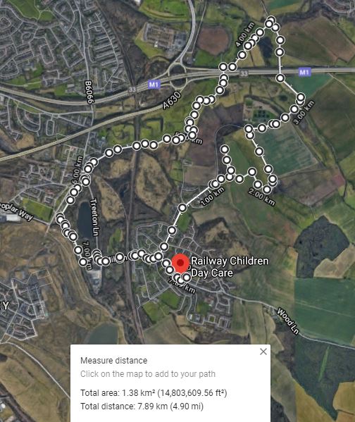
Continuing with my exploration of Treeton Wood during the Covid-19 Lockdown, I followed the path along its eastern edge before taking a quick diversion along an unmarked path that passes over the adjacent ploughed field, to take a few photographs of the landscape from here.

A view towards Ulley

Looking towards Ulley, the red fields on the Mexborough Rock in the distance contrast strongly with the soil on which I was standing, where innumerable small pieces of fine grained, light brown sandstone are found on the surface.

Rock fragments in the soil

Making my way down the steep slope here, I came across a small stream, which springs just beyond Treeton Wood and marks the boundary between Treeton Wood and the agricultural land that runs up to the back of Falconer Wood and Hail Mary Hill Wood to the south.

Blocks of sandstone in the stream bed

With steeply sloping ground above me to the right, I followed it downstream and, for part of its upper course, it cuts a steep v-shaped profile and its bed is occasionally littered with small pieces of laminated sandstone/siltstone; however, I didn’t see anything other than mudstone that had weathered to yellowish clay in its stream banks.

Weathered mudstone in the stream bank

Further downstream, in places there is no well defined channel and areas of relatively flat, periodically flooded land are found, where wild garlic grows in abundance, and after gathering some of this to use for cooking later, I carried on down to the north-west corner of Treeton Wood.

Erosion by a temporary stream channel

Leaving the wood, I then took a few photographs of the landscape around me before following the path to Hail Hill Mary Wood, which I am told often gets very muddy. The stream is culverted here but it soon reappears at the edge of this wood, before flowing down to Treeton Dyke.

The geology around treeton Wood

Today, this stream forms a very minor watercourse but, looking at an Ordnance Survey map and a geological map, it occupies a distinct geographical feature that cuts through the escarpment of Treeton Rock and which is marked as being full of alluvium – evidence of the erosion and deposition that has taken place here for very many years.

A view of Treeton Wood and Hail Mary Hill Wood

Stopping only to take note of the steeply rising ground that runs up to the summit of Hail Mary Hill, I followed the track that passes the new housing estate back to Treeton, where I looked back over some of the land that I had explored during my circular walk.

A walk around Treeton Wood
 

Treeton Wood - Part 1


Bluebells in Treeton Wood

As I had expected during my first few walks around Treeton, during the COVID-19 Lockdown, I didn’t find a single rock outcrop but, having walked up and down a few hills and surveyed the landscape around me, I now had a better understanding of the geomorphology and how this relates to the underlying geology.
 
For my next walk, I decided to go and further explore Treeton Wood which, like Treeton Dyke and the River Rother, is within easy walking distance from the centre of Treeton but I had only visited it once or twice a few years ago.
 
A view from Wood Lane

Starting from St. Helen’s church and continuing along Wood Lane towards Aughton, past the new housing estate at the edge of the village, the land rises up to Treeton Grange. From this stretch of road, a vale of ploughed agricultural land can be seen in the distance – separating Treeton Wood and Hail Mary Hill Wood.
 
A simplified geological map of the area around Treeton

Looking at the Geology of Britain Viewer map, the Pennine Middle Coal Measures Formation strata here are marked in green (sandstone) and grey (mudstone), with recent alluvial deposits laid down by the River Rother and its tributaries shown in very pale yellow.
 
A view of Hail Mary Hill from Wood Lane

In general, these strata are tilted a few degrees in a north-easterly direction and the weather resistant sandstones form the higher ground, often with distinct escarpments, and the softer rocks form the vales in between.
 
Treeton Wood

Continuing along Wood Lane, past Treeton Grange, I took the second entrance into Treeton Wood and, although this is not obvious when viewing it on Google Map, I soon encountered an escarpment, where some of the slopes are moderately steep.
 
An escarpment in Treeton Wood
 
The path that I took follows the escarpment through the middle of the wood and I didn’t see any rock outcrops, except at one place where a hollow exposes a small section of fine grained sandstone bedrock and the soil horizons above it.
 
Arock exposure in a hollow in Treeton Wood

Various archaeological finds have been made in Treeton Wood, including embankments said to be Romano-British, but I didn't knowingly encounter any of them and, after stopping to photograph some of the bluebells that cover the wood at this time of the year, I briefly explored the open land to the east of the wood.

A view from Treeton Wood towards Ulley

Wednesday 25 November 2020

A Walk Around Edwards Meteor Way

 
Efflorescence at St. Helen's church

As briefly described in my introduction to the geology around the village of Treeton, with walks around Treeton Dyke, the River Rother and 70 Acre Hill, much of the surrounding area has been despoiled by the coal mining industry and I still hadn’t seen any exposures of the underlying strata of the Pennine Middle Coal Measures Formation.
 
A view of the Treeton Colliery tip

I always try and find something that appeals to my interests in “geology” when I go out on my day trips or - as during the COVID-19 Lockdown in April 2020 - taking essential exercise and my next short walk was to further explore the ridge of Mexborough Rock that I can see from my house.
 
The lower slopes of the ridge here are covered in landscaped waste from Treeton Colliery, which once occupied the land now covered by the Beaumont Park housing estate and, in memory of the pilot of a Gloster Meteor jet that crashed here in 1954, it has been named Edwards Meteor Way.
 
A view towards Treeton

The area is very popular with dog walkers and, on the only occasion that I had been there to take some photos of Treeton and views towards Handsworth in the west, a local told me that the waste from Treeton Colliery tipped here constitutes red shale.
 
A view towards St. Helen's church

Quickly walking to the top, from the entrance at Windle Court, I didn’t see any signs of red shale anywhere and I only stopped to take a good look at the reddened soil that can be seen on the agricultural land beyond.
 
A view towards Burnt Wood

Wherever the red variety of Mexborough Rock outcrops, its position in the landscape is generally marked by the colour of the soil that lies upon it and, below Burnt Wood, it is very strong. This general colouration of this rock formation and the Spa Fault to the east of is further discussed in the Geological Survey of Britain memoir for the Sheffield region and in a paper by John Hunter in the Mercian Geologist.
 
A view of the reddened soil on Spa Hill

I spent less than 15 minutes here and, on this occasion, the light wasn’t very good for photography and so I carried down another path to the Beaumont Estate and, walking along Front Street back to my house, I popped into St. Helen’s churchyard, which I had not visited since the beginning of the lockdown.
 
St. Helen's church

To my great surprise, the stonework to the porch was covered in efflorescent salts, which I had never seen before in the 4 years that I had been attending the Coffee Mornings here, when I help with the day to day maintenance of the fabric and the churchyard.
 
The porch at St. Helen's church

In the late afternoon, with the sun bringing out the colour of the Rotherham Red sandstone and its contrast with the jambs of the doorway, which are built in Ancaster limestone, an interesting example of a  weathering process was taking place before my eyes.
 
A detail of the north jamb
 
The repeated recrystallisation of salts in the micropores of the stone, due to cycles of wetting and drying, causes it to deteriorate and it won’t be that long before the details on the headstops are completely unrecognisable.
 
A weathered headstop

Several years ago, I noticed that cavernous decay affected the masonry inside the porch, and having been in effect a ‘surveyor of the fabric’ in recent years, I have noticed that many blocks of stone that exhibit this type of weathering have deteriorated considerably – especially some of the C15 masonry where tool marks have been scoured out.
 
A pheasant on Wood Lane

Finally arriving back on Wood Lane, although I hadn’t seen any exposures of rock or any buzzards, which can often be seen flying around Spa Hill, I was very surprised to see a pheasant wandering along the other side of the road. I have no idea where it might have come from, but it made me smile at the end of the day.
 
A short walk around Treeton

Monday 23 November 2020

70 Acre Hill and High Hazels Park


An artificial pond on 70 Acre Hill

Following the COVID-19 lockdown instructions to go out only for essential exercise and shopping, my third trip to explore the geology around Treeton involved a short bus journey to Poplar Way, from where I headed north under the Sheffield Parkway to the 70 Acre Hill local wildlife site.

Gorse on 70 Acre Hill

As with Treeton Dyke and the land around Spa Farm and the River Rother, I had walked around this area many years ago and didn’t encounter any rock outcrops, but I remember the impressive views from the top of 70 Acre Hill, which is actually a landscaped tip of colliery waste.

Like at Treeton and nearby Catcliffe, various coal mines once operated in the area and the now disused Sheffield City Airport was built on the site of a large opencast mine, which was closed and infilled before I moved to Rotherham.
 
Views towards Rotherham
 
The path from the Sheffield Parkway to 70 Acre Hill passes around Tinsley Park Golf Course and at the time of my visit, the ubiquitous gorse bushes were in full bloom; however, I stopped only to look at the views towards Rotherham, where the Mexborough Rock forms the high ground.
 
A recreational area on 70 Acre Hill

Wandering randomly around various pathways, I encountered a few artificial ponds and a small recreation area, where there is a concrete sculpture, and then headed downhill to High Hazels Park, which I had never visited before.
 
An artificial pond

At its centre is the mid C19 High Hazels House, in the Italianate style, whicht is now the home of Tinsley Park Golf Club. It is notable mainly for the use of Permian dolomitic limestone which, although a very common building stone in Rotherham and Doncaster where the Cadeby Formation outcrops, I had not seen before in Sheffield - except for the chancel at St. James' church in Norton.
 
High Hazels House

On one corner of the house, a bright red patch on the limestone can be clearly seen from a distance and, looking closer, this reddening is the result of a fire that must once have been lit right next to the wall.
 
Fire damage at High Hazels House

I have seen this oxidation of the iron bearing minerals in several old buildings and ruins built out of dolomitic limestone, where there has been a fire, but the intensity of the heat here has been such that it has shattered the stonework.
 
A view across Tinsley Park Golf Course
 
Various modern sculptures are dotted around the park, as I have seen before in several parks in Sheffield, and I took a few photographs of these before heading across the empty golf course on the way back towards Poplar Way and Morrisons supermarket at Catcliffe.
 
A view of Treeon from Poplar Way

I didn’t see any rock exposures but, having walked for 6.75 km, it was good exercise and I now have a better appreciation of the varied topography formed by the Pennine Middle Coal Measures Formation strata in this part of South Yorkshire, as well the coal mining history.

A walk around 70 Acre Hill
 

Saturday 21 November 2020

From Spa Farm to the River Rother


Wetlands at Long Lane

Continuing my exploration of the geology and historic buildings around Treeton during the COVID-19 lockdown, after taking a few photographs of the Mexborough Rock that forms the high ground beyond Ulley Brook, I had a quick look at Spa Farm.
 
A view of the Mexborough Rock beyond Ulley Brook
 
A chalybeate spring here was once exploited for therapeutic purposes in the 1660’s and a couple of farm buildings are listed, but I only stopped long enough to note the mottled red/yellow colouration of some of the Rotherham Red sandstone before making my way down to Long Lane.

Various buildings at Spa Farm

The escarpment of the Mexborough Rock and the line of the Spa Fault can be clearly seen from here and, continuing along Long Lane under the M1 motorway towards Whiston - passing by a lot of rubbish on the way - I went to investigate an area of permanent wetlands that I had seen many times when driving by.

A view to Spa Farm from Long Lane

Looking at a geological map, the area between Treeton, Catcliffe and Whiston is marked by an extensive spread of alluvial sediments that have been deposited by the River Rother and its tributaries - Ulley Brook and Whiston Brook – and the whole area was turned into a great lake during the floods of 2007.
 
The natural landscape here has been changed so much by efforts to manage the flow of water, with various embankments and drainage ditches being clearly marked on Ordnance Survey maps that date back to the mid C19.

Arriving at a break in the hedgerow on Long Lane, I followed the footpath to the wetlands and quickly walked around its edge, from where I could see various species of water loving plants that would be of interest to botanists and ecologists.
 
The wetlands at Long Lane

Returning to Long Lane, I had a look at the Rotherham Red sandstone bridge that crosses Whiston Brook, which has a surprisingly small arch through which the water flows, and then followed the brook for a short distance before heading along the path towards the River Rother.
 
Views of Whiston Brook
 
Unknown to me at the time, the path runs past a moated scheduled ancient monument known as Blue Man’s Bower, which I had been aware of  ever since living in Treeton but had never known its precise location. Stopping only to photograph the escarpment of the Mexborough Rock in the distance, which I had encountered earlier on my walk, I soon arrived at the river.
 
A ridge of Mexborough Rock in the distance

Starting my walk back to Treeton, the path next to the River Rother runs under the M1 and continues intermittently along embankments and, with the riverbanks here being completely bare and only seeing a couple of swans, I hurried on towards Catcliffe.
 
Views of the River Rother
 
Looking back towards Bole Hill Plantation, which covers the spur of Mexborough Rock that was once quarried for Rotherham Red sandstone, the soil on the lower slopes above the floodplain is characteristically red.
 
Bole Hill Plantation

Beyond Catcliffe railway bridge, which now only takes freight traffic, the path carries on along past a landscaped tip of waste from Treeton Colliery and ends at the disused railway viaduct, where the renowned Staffordshire blue engineering bricks have been used in its construction.
 
Railway engineering along the River Rother

Towards the end of my walk, I took a path that I had never used before, which runs on an embankment alongside the River Rother behind Catcliffe Flash, an area affected by coal mining subsidence that is now a nature reserve popular with birdwatchers.
 
A view across Catcliffe Flash

Stopping to photograph a feature in the riverbank at the edge of the Waverley Estate, which at a distance I thought might be an outcrop of the Pennine Middle Coal Measures Formation, I walked along another embankment to Treeton Lane, from which I had a good view of the new building that has been erected on the former site of Mill House.
 
Miscellaneous views
 
I finished my walk by carrying on up Mill Lane over the railway bridge to Station Road, which then winds up the escarpment of Treeton Rock to the junction with Front Street, where I turned right and continued along Wood Lane until I finally got home.
 
An exploration of the Spa Fault and the River Rother