With the UK Government COVID-19 lockdown taking effect in March 2020, which limited me to go out only to buy food, take no more than an hour’s outdoor exercise and use public transport only as an absolute necessity, my further exploration of the geology, mediaeval churches and historic buildings of South Yorkshire and the surrounding counties came to an abrupt halt.
 |
| Covid-19 Alert Tier 3 |
Knowing that much of the area within walking distance from Treeton has been despoiled at one time or another by the coal mining industry, I did wonder how I would keep myself physically and mentally active – and find subject matter for my Language of Stone Blog.
The oldest part of Treeton, around St. Helen’s church, stands on a distinctive escarpment of Treeton Rock – now just recorded by the BGS as an unnamed part of the Pennine Middle Coal Measures Formation - which runs SSE to Hail Mary Hill Wood and Falconer Wood and overlooks the River Rother to the west, whose course has been diverted to enable the extraction of coal.
Standing on the boundary wall at the west end of St. Helen’s churchyard, there is now a clear view towards St. Mary’s church in Handsworth, whose steeple can be just about be made out on the skyline but, when I first moved to Treeton in 1997, this view was obscured by a vast mound of waste from the Orgreave Opencast Coal Mine – which itself occupied the former site of the Orgreave Coking Works.
 |
| The view to St. Mary's church in Handsworth |
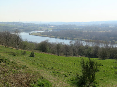
Prompted by a request to take some photographs of flowering blackthorn, by an elderly friend who had been ordered to shelter at home for the foreseeable future, my first walk entailed a walk around Treeton Dyke, which occupies a former meandering course of the River Rother that is now used for water sports and angling and recreation.
Following the track down from Wood Lane, which is adjacent to the strongly contested Jones Homes development site and is further blighted by fly tipping, a path continues into Hail Mary Hill Wood and follows the course of a small stream, which occupies a distinct alluvium filled v-shaped feature that is clearly marked on the geological map.
Carrying on down this path down to Treeton Dyke, the Treeton Rock forms a distinct spur to the south but there are no rock outcrops to be seen and the most distinctive feature here is an area of marshland where osiers and other wetland species flourish.
Continuing along the path that runs down towards the hamlet of Fence, which was built to accommodate the workers at the nearby colliery, I then headed back towards Treeton, passing land to the west of Treeton Dyke, which consists of waste products from Forgemasters.
The only point of geological interest here are large blocks of ripple marked sandstone, which deter trail bikes, and from here I made my way back to Treeton along a path that skirts the site of an old quarry, which once supplied yellow/brown iron banded sandstone for the village. Before heading home, I stopped to take a couple of the Waverley Estate, which brings back memories of the song Little Boxes.
 |
| Houses on the Waverley Estate |


No comments:
Post a Comment