Saturday, 30 November 2024

Memorials in St. Mary's Church Tickhill

 
The Fitzwilliam tomb

When entering the interior of St. Mary’s church in Tickhill, I was immediately attracted to the large Foljambe tomb chest at the west end of the north aisle, which has an effigy of Louisa Blanche Foljambe (d.1871) and her baby son - carved in alabaster by William Calder Marshall and brought from Haselbech in Northamptonshire in 1908. 
 
A detail of the Foljambe tomb
 
Louisa and her husband Cecil George Savile Foljambe could trace their ancestry back to John of Gaunt, who was granted Tickhill Castle by Edward II in 1372. The chest has its sides intricately decorated with cusped ogee arches, marble colonnettes with ornate capitals and heraldic shields, which makes me think that it could be made of Caen stone. 
 
The Foljambe tomb
 
This Jurassic limestone from Normandy in France was first brought to England by William the Conqueror and used in the Tower of London and Canterbury Cathedral, but it was also popular with later Victorian architects and sculptors to make decorative screens, fonts and pulpits. 
 
A detail of the Foljambe tomb
 
Tucked away next to the wall in the north-west corner of the church is the tomb chest of William Estfeld, who died in 1386 and whose coats of arms is seen in the wall above the chancel arch. As with the Foljambe tomb, I didn’t look closely at the stone but it appears to be made with dolomitic limestone from the Permian Cadeby Formation and is very plain, except for the quatrefoil decoration on the front. 
 
The tomb chest of William Estfeld
 
Walking down the north aisle, I was interested to see a modern grey Welsh slate plaque, with his letter cutting highlighted with paint, which commemorates Jack Cannings and his son Walter who held the posts of verger and sexton. 
 
The memorial to Jack and Walter Cannings
 
Continuing down to St. Helen’s chapel, which has also been known as the Laughton chapel due to its associations with the Laughton family of Eastfield, on the south wall there is a fine Baroque style marble wall memorial to John Laughton (d.1709). 
 
The memorial to John Laughton (d.1709)

On the floor of the chapel, partly covered by chairs, are various grave slabs made of Permian dolomitic limestone and a Carboniferous limestone ledger stone commemorating John Stringer (d.1799) and his wife Sarah (d.1805), who was the daughter of another John Laughton of Eastfield. 
 
Grave slabs in St. Helen's chapel
 
Many of the dolomitic limestone grave slabs date back to the C17, with the oldest that I saw being from 1681, but I only took a few photographs that record the styles of calligraphy, letter cutting and spelling that doesn’t conform to modern standardised English. 
 
A detail of a C!7 grave slab
 
Moving from St. Helen’s chapel into the chancel, I took a few photos of the alabaster Fitzwilliam tomb chest, upon which lie the effigies of Sir Thomas Fitzwilliam and his first wife Lady Lucy Neville – dated by the information panel to c.1535.
 
The information panel for the Fitzwilliam tomb

It is believed to have been moved from the Tickhill Friary in 1538 during the Dissolution and, according to an inscription on the tomb that I didn’t see, it also commemorates his father Sir Richard Fitzwilliam and his wife Lady Elizabeth Clarell. 
 
A view of the Fitwilliam tomb from St. Helen's chapel
 
Including references to the tomb of King Henry VII by Pietro Torrigiani, Pevsner describes it as ‘square panels with shields in close laurel wreaths. Shell-tops above the square panels. Colonnettes or balusters with acanthus-leaves growing up them’, but the church website provides a much more detailed account of its history.
 
The effigy of Lady Lucy Neville
 
Looking a little more closely, I noted that the effigies have been quite badly damaged, with the hands of both Lucy and Sir Thomas being missing, with the latter also having part of his leg removed – very probably as part of the vandalism that took place during the English Civil War. 
 
Damage to the effigy of Sir Thomas Fitzwilliam

The tomb was originally sited in the south-east corner of the church but, in the mid-1800s, was moved to the north-west corner behind high railings. It was incomplete and had suffered badly from damp and, as part of a programme of restoration work begun in 2012, was dismantled, conserved and resited in its present position, during which human remains were found in the tomb core.
 
A detail of the east end panel of the Fitzwilliam tomb

Leaving the chancel to look at the east end of the north aisle and the nave before leaving the church, the flooring incorporates further dolomitic limestone grave slabs that are inscribed with crosses, which I assume to be mediaeval, but I have not seen any information about these.

Mediaeval grave slabs
 

Friday, 29 November 2024

St. Mary’s Church Tickhill – The Interior

 
A view of the tower
 
In my 1967 edition of The Buildings of England - Yorkshire West Riding, Pevsner begins his quite lengthy account of St. Mary’s church in Tickhill with the words: “The proudest parish church in the West Riding, except for those of the big towns.” When quickly photographing its exterior after visiting Tickhill Castle in September 2021, I was very impressed by the height of the aisles and nave, which are part of the extensive rebuilding of the early C13 church during the late C14. 
 
A view of the tower from the north aisle
 
Entering the church by the north porch, the tall C13 arches from the tower to the nave and the aisles show that this was already a large church and the illustration by Sydney Kitson, reproduced by the Corpus of Romanesque Sculpture in Britain and Ireland (CRSBI), shows that the previous early C12 church was also quite substantial. 
 
A view east from the north aisle
 
Looking down the north aisle and through the north arcade to the nave and beyond, I was immediately struck by the quality of the lighting inside the church, which is due to the height of the windows in the aisles and clerestory, which has two windows per bay, and also to the window at the east end of the nave. 
 
A view east along the nave
 
Pevsner further comments on the interior: “Wide arcades of four bays with tall piers of an unusual section. Four semi-octagonal shafts in the main directions, four small hollows in the diagonals. Each arch carries an ogee gable the top of which reaches into the clerestory zone”.
 
The south arcade and clerestory
 
Walking down to the east end of the nave and turning to look at the tower arch, an old roofline is clearly visible above it and its apex is offset from the position of the crown of the arch, which is presumably the result of the realignment of the tower and nave.
 
The old roofline above the tower arch
 
Continuing into the chancel, its north wall contains a lancet window, which is evidence of the Early English Gothic style that had developed by the early C13. According to the church website, this was originally part of the external wall that was enclosed after the building of St. Helen’s chapel, which was added in the 1340s and replaced a vestry that was accessed by the priest’s door. 
 
The north wall of the chancel
 
Walking up and down the nave to take a better look at the arcades, I stopped to further look at the various heraldic devices above the chancel arch, including an angel holding the shield with the coat of arms, which the church guide describes as belonging to the Estfeld family and also the Fitzwilliam crest with a supporting hand. 
 
Heraldic devices above the chancel arch
 
On the arcades, further heraldic devices can be seen on shields that are carved on the base of the spandrels between the arches, which the church guide describe as Fitzwilliam, Merchant’s Monogram and Our Lord, without going into further detail. 
 
Details of spandrels with heraldic devices
 
The capitals to the late C14 chancel arch and arcades all have octagonal sections, with simple mouldings below and above a central band that is decorated with what Pevsner describes as bossy foliage – leaves, berries and flowers stylised with nail-head to my eye. 
 
Various carved capitals
 
The bands on the responds to the tower arch, which was remodelled as part of the heightening of the tower, are larger and contain similar floriated decoration and I also noticed that there are also grotesques on both sides of the tower arch.
 
A grotesque
 
Being conscious that I still had 14 more buildings to photograph for my Photo Challenge during my exploration of Tickhill, before catching the then hourly No. 22 bus back to Doncaster, I didn’t have the time to look closely at any of these interesting details. 
 
A grotesque
 
I finished my very brief exploration of the interior of St. Mary’s church by taking a couple of quick snaps of the font, which Pevsner considered to be Perpendicular Gothic (with a footnote suggesting an alternative C19 date), but Historic England makes no reference to it. 
 
The font

When first entering St. Mary’s church, I looked for one of the simple black and white folded A4 pages that have been used throughout South Yorkshire, as part of the Heritage Inspired initiative, but I couldn’t find one. 
 
Visitor information at St. Mary's church

On my way out, I had a good look through the various leaflets etc. that are made available to visitors and was interested to see that there was a comprehensive church guide in an A4 ring binder file. Although the lighting inside the church enabled me to easily take photographs of more than 20 pages that are of interest to me, it would be nice to see a version of this online.
 
An extract from  the church guide


Thursday, 28 November 2024

An Exploration of Tickhill - Part 3

 
A detail of the decoration to the west face of the castle gatehouse

Having encountered Paper Mill Dike and Mill Stream during my exploration of Tickhill, which gave me an insight into the water management of a naturally waterlogged area that presumably began when Roger de Busli established his motte and bailey castle and Mill Dam at Tickhill, I got a brief glimpse of a section of the remaining curtain wall. 
 
A section of the curtain wall at Tickhill Castle
 
The limestone ashlar facing stones have developed a grey patina, which is quite typical of the massive dolomitic limestone of the Cadeby Formation. This contrasts with the thinly bedded limestone from the Brotherton Formation, which has been used for the core. 
 
The entrance to the gatehouse
 
Continuing along the footpath to the west of the castle, I stopped very briefly to photograph a decorative detail on the outer face of the gatehouse, which is best described by the Corpus of Romanesque Sculpture in Britain and Ireland.
 
The moat at Tickhill Castle
 
Tickhill Castle is still partly surrounded by a water filled moat, which I presume has a similar date to Mill Dam. The topographic map of Tickhill shows that the castle is built on relatively high ground at the southern end of an outcrop of the Lenton Sandstone Formation, around which the Paper Mill Dike would have been naturally diverted, before water engineering was undertaken. 
 
The topography around Tickhill Castle
 
The next building on my list to photograph for my British Listed Buildings Photo Challenge was the Grade II Listed No. 3 Dam Road, an early C18 house with a C17 wing and stables that is built with coursed rubble walls, some of which are rendered, and with red pantile roofs. 
 
No.3 Dam Road

Following the path to Paper Mill Dike, I took a few more photos of No. 3 Dam Road and Rolan Bridge, which according to Historic England dates back to at least the C18 and is constructed with a Magnesian Limestone clapper arch and two C19 brown brick segmental arches. 
 
Rolan Bridge

Looking east along Paper Mill Dike from Rolan Bridge, I immediately noticed the Grade II Listed early C19 building that Historic England describe as “Ancillary building to south-west of Number 3, bordering Paper Mill Dike” and which they think could be connected with industrial processes or perhaps used as a boat house. 
 
The building to the south-west of No. 3 Dam Road
 
Most of the buildings that I had seen to date were built of stone, with some being rendered, but the nearby Edlington Formation and the Roxby Formation have traditionally being used to make bricks and the 1854 Ordnance Survey map shows a brick and tile yard on the northern outskirts of Tickhill, just to the north of Common Lane. 
 
Westgate House
 
Returning to Dam Road, I stopped briefly at the Grade II Listed Westgate House, which dates back to the C18 and is yet another example of a rendered house in Tickhill – a building method that seems to be common in the villages set on the Brotherton Formation that I had so far visited – Warmsworth, Sprotbrough, Wadworth and Loversall included. 
 
The boundary wall and gatepiers to Westgate House
 
The boundary walls are built of mainly thinly bedded limestone that was probably quarried locally from the Brotherton Formation, but the massive gatepiers are made with limestone from the Cadeby Formation. Arriving back at Westgate, I took a few photos of the brick wall and railings to No. 14, before heading off along Church Lane to look at the interior of St. Mary’s church. 

St. Mary's church

Monday, 25 November 2024

An Exploration of Tickhill - Part 2

 
The spillway to Mill Dam passing beneath Lindrick

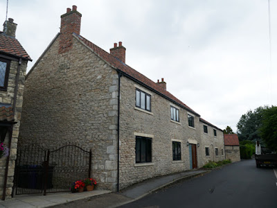
Continuing my exploration of Tickhill, the next building on my list to photograph for the British Listed Buildings Photo Challenge was Lindrick House and after taking a few photos of the rendered early C19 Brook House, I headed east along Lindrick and immediately stopped to photograph the refurbished Lindrick Farm House and attached farm building. 
 
A refurbished farm house and attached building on Lindrick
 
Looking at the current Google Street View of Lindrick, which was photographed in 2011, the west end was rendered and had no openings and the farm house to the east had its stonework marred by very thickly applied Portland cement ribbon pointing and the ground floor door and windows had a different configuration. 
 
Another view of the refurbished farm house on Lindrick
 
There is a strong contrast in colour between the massive quoins, which are pale cream and have probably brought in from the Cadeby Formation, and the yellowish limestone that is more thinly bedded and is probably locally quarried from the Brotherton Formation. 
 
A refurbished agricultural building on Lindrick
 
I didn’t stop to look closely at the stonework and carried on along Lindrick until I encountered another range of farm buildings, which appear on the 1854 Ordnance Survey (OS) map and have also been partially refurbished since the 2011 Google Street View was published. 
 
Lindrick House
 
The Grade II* Listed early C18 Lindrick House is another building which has rendered rubble walling with ashlar quoins and dressings, with the gate piers and garden wall providing further examples of contrasting limestone from the Cadeby Formation and Brotherton Formation.
 
Lindrick Cottage
 
After taking a quick look at Lindrick Cottage, at the eastern end of the farm complex mentioned above, I carried on along Lindrick and, when looking over the boundary wall, I was very surprised to see a moderately sized manmade channel, which I soon learned was the spillway from Mill Dam.
 
Looking east along the spillway
 
Just a few minutes earlier I had crossed Paper Mill Dike, which confluences with Denaby Wife Dike 2 km to the west on the Edlington Formation, before continuing along its natural course east towards Tickhill and then feeding Mill Dam, which is sited next to Tickhill Castle and its moat.
 
Looking west along the spillway
 
From Mill Dam, the spillway continues westward alongside Lindrick and then turns at a right angle to the south and disappears under the road, before emerging on Water Lane and, as the renamed Mill Stream, continues along another engineered route for more than 1 km before eventually joining up with the River Torne. 
 
A view south along Mill Stream
 
Along the course of the River Torne, which rises at Sandbeck Park and empties into the River Trent at Keadby, much of the land was waterlogged until 1628, when Cornelius Vermuyden was appointed to drain Hatfield Chase. Looking at the British Geological Survey map, the deposits of alluvium to the south of the castle show the extent of ancient flooding and a map of the dikes and drains shows that the area has been the subject of extensive water engineering.
 
The distribution of alluvium around Tickhill

I retraced my steps back to Lindrick and followed the spillway to the sluice at Mill Dam, which was originally built in the C11 to power the Crown Mill and also served the Grade II Listed Tickhill Mlil - sited at its southern end and marked on the 1854 OS map as a corn mill. 
 
The sluice at Mill Dam
 
Tickhill Mill, which is now in residential use, dates back to the C13 and is the last of the town's four water mills to survive, but only C18 and C19 elements of the building still remain. These are built using locally quarried coursed rubble limestone for the walls, massive limestone from the Cadeby Formation for the quoins and dressings and red pantiles for the roofs. 
 
Tickhill Mill
 
The next building on my list to photograph was the early or mid C18 Grade II Listed Mill Farm House, which is built with similar materials to those seen at Tickhill Mill and contributes to this very attractive part of the Tickhill Conservation Area, without possessing any features of real architectural merit. 
 
Mill Farm House
 
The same can probably be said about the C18 or early C19 Castle Farm Cottage which, along with the unlisted house named Roadside Barn, belongs to the group of buildings that is marked as Castle Farm on the 1854 OS map. 
 
Castle Farm Cottage
 
The last building to photograph in this part of Tickhill was the large two storied C18 or early C19 Barn in Castle Farmyard, accessed from a public footpath that I have since learned leads to more dikes and drains that eventually link back to Paper Mill Dike - which then joins up with the River Torne to the east of Tickhill.
 
The Barn in Castle Farmyard