When undertaking the reconnaissance of Monsal Dale for the Sheffield U3A Geology Group field trip in April 2019, Hob’s House – with its landslips and spectacular coral bands – was considered to be the most interesting site that we would see during the day.
With the objective of the Group’s trips to also provide a good walk of 4 to 5 miles, we had to try and find other points of interest that might include some industrial archaeology, which is also a feature of Monsal Dale, like many others in the Peak District.
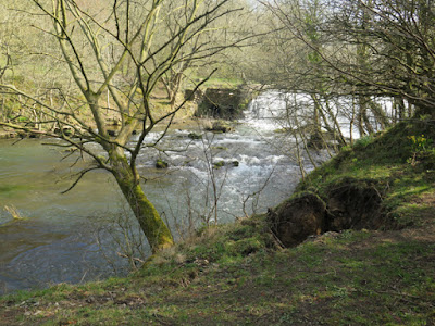
Just downstream from the large weir on the River Wye, a tree on the river bank has partially fallen, with its roots having pulled away the subsoil to an exposure of tufa with concretionary structures, along with fine carbon rich layers.
With this unexpected discovery, which would occupy the group for a reasonable amount of time, the small floodplain just downstream on the opposite bank was considered to be a good place for a lunch stop, before investigating the river bank.
 |
| An exposure of alluvium in the river bank |
With this unexpected discovery, which would occupy the group for a reasonable amount of time, the small floodplain just downstream on the opposite bank was considered to be a good place for a lunch stop, before investigating the river bank.
The river bank here has been reinforced with gabions in places, to prevent excessive erosion, and a section of the bank also exposes partially cemented coarse sand deposits that are overlain with alluvium that contains a high proportion of silt, with angular fragments of limestone.
Continuing further downstream, there is virtually no exposure of limestone, although riffles in the river bed are very common, and several springs emerge from the lower slopes, which are associated with tufa that forms terrace like features.
Approaching Lees Bottom near to the A6 road, the Lees Bottom Lava Member underlies the lower slopes and, although there is no outcrop of the basalt to be seen, its presence is indicated by a large expanse of boggy ground and several streams that flow over the impermeable rock.
The return journey to Monsal Head was undertaken via the farm at Brushfield Hough and an old lead rake known as the Putfield Hill vein where, in places, waste tips contain various specimens of calcite and barytes. There are no outcrops of limestone to be seen on this leg of the walk, but the dry stone walls contain concentrations of brachiopods and there are good views of Fin Cop, upon which there is an Iron Age hillfort.
On the descent back into Monsal Dale, the slopes upstream of the viaduct are not covered in dense woods and the development of the scree slopes here can be quite clearly seen, together with exposures of Monsal Dale Limestone that are dipping to the south-east.
In the well worn and eroded path, limestone bedrock and loose irregular blocks are exposed in the path and there there are several well rounded boulders of basalt, which are some distance from the nearest outcrop of volcanic rock and must therefore have been deposited here during the Quaternary Period – either by an ice sheet or by fluvioglacial processes.
Our reconnaissance of Monsal Dale finished by crossing Headstone Viaduct to briefly look at the entrance of the Headstone Tunnel, where there is an extensive outcrop of Monsal Dale Limestone, and then carrying on up the steep path up to Monsal Head.
Often with moderately demanding slopes and, taking the gradients into account, the walk was over 8 km, and have to admit feeling very tired at the end of the day. In an ideal world, I would have taken advantage of the Monsal Head Hotel – relaxing in the late afternoon sunshine with a pint of real ale – but unfortunately my companion for the day had to get back home.
 |
| An exploration of Monsal Dale |


