Tuesday, 29 December 2020

Handsworth Community Park


An inscribed monolith at Finchwell Road

Continuing my walk from Normanton Hill to Treeton, during the COVID-19 Pandemic, my next stop after St. Joseph’s church was Handsworth Community Park, a green space that I had identified on Google Map when looking for new places to visit.
 
The entrance to Handsworth Community Park

Arriving at the St. Joseph’s Road entrance, I was interested to see the large, irregular monolithic blocks of Coal Measures sandstone, which have been roughly shaped and tooled – reminding me of similar landscaping that I seen at Manor Fields Park and along City Road in Sheffield.
 
A detail of the sandstone monoliths

I didn’t stop to closely examine the sandstone, but the dense accumulation of iron oxides and hydroxides on the bedding and jointing planes is a feature of very many sandstones found in the Pennines and adjoining areas.
 
The playground at Handsworth Community Park

Although there once very many quarries in the Sheffield area, producing stone for local needs, they have long since closed and it is quite possible that the stone used here was brought from West Yorkshire, which is still a major supplier of Carboniferous sandstone.
 
Sandstone monoliths

Sheffield is one of the greenest cities in Europe and has very many public parks and green spaces, some of which are Registered Parks and Gardens, this is only a local community space, with football pitches and other sports facilities and a children’s play area.
 
The well equipped play area, however, has many other examples of similar monolithic blocks that still retain drill marks, where very large blocks were split into smaller ones using plug and feathers. Like those at the entrance, some of these are tooled to various degrees and, in a couple of places, these have been shaped into swords.
 
A carved sword

To the east, at a distance of 2.5 km, the tower of St. Helen’s church in Treeton can be made out and the ridge of “Rotherham Red” sandstone, which forms the skyline, stretches from Canklow Woods in Rotherham to beyond Ulley.
 
A panorama

When I first moved to Treeton back in 1997, and for several years after, these views were obscured by a vast mound of waste from Orgreave Opencast Coal Mine, which occupied the low ground and whose extent is marked by the hatched markings on the geological map.
 
Land affected by the coal mining industry

After taking a few photos of the views that I could now see, I left the park and carried on down to the railway line and after crossing the bridge finished my walk by having a quick wander through the Waverley Estate – a vast, soulless housing development that is now in its place.
 
A monolith at Finchwell Road

Monday, 28 December 2020

St. Joseph's Church in Handsworth


A statue of St. George and the Dragon

On my walk along Richmond Road from Normanton Hill to the old centre of Handsworth, I had seen a few different Coal Measures sandstones in mainly Victorian terraced houses and various boundary walls.
 
The most common of these has a very distinctive ‘ginger nut’ hue to the stonework, which masks the generally grey colour of the body of the stone and, with this being used in so many historic buildings in Handsworth, I have always assumed that its source must have been the Handsworth Quarries to the north of the old village.
 
St. Joseph's church

The Victorian terraced houses along St. Joseph’s Road are built of the same variety of sandstone and I was therefore quite surprised to see that the churchyard wall of St. Joseph’s Catholic church and the old school next to it are built in Rotherham Red sandstone.

A gatepost and section of boundary wall

Over the years, I have seen innumerable historic buildings and boundary walls that have been built out of this locally distinctive variety of Mexborough Rock. It can range in colour from deep red, various shades of mauve to red/yellow mottled varieties, which are not easy to describe even with a Munsell colour chart.
 
The west front of St. Joseph's church

Entering the churchyard, I immediately noticed that the west end of the church itself is built in another mottled red/yellow sandstone, with a pitched face finish, and that the dressings are constructed in what looks like a similar sandstone.
 
The west door
 
The western bay and south porch were added from 1956 to 1957 by Hadfield, Cawkwell & Davidson to the original church built in 1881 by the Sheffield architects M.E Hadfield & Son – who built St. Marie’s cathedral and other catholic churches in the region. I didn’t closely examine this with a hand lens, but my first impression was that this could be one of the mottled Triassic sandstones that would have easy enough to transport to Sheffield in the 1950’s.
 
The south elevation of St. Joseph's church

Their client Henry Fitzalan-Howard, the 15th Duke of Norfolk was a great benefactor of the Roman Catholic Church in Sheffield and when the church, the adjoining presbytery and the school were commissioned, the sandstone used was extracted from his Bole Hill quarries in Treeton – according to the Taking Stock website.
 
The west elevation of the presbytery

The Rotherham Red sandstone used for the boundary wall and the general walling in the presbytery are obviously very different to the quoins and dressings used in the latter and for the ashlar in the south wall of the nave to the church.

Masonry used in the extension (L) and original nave (R)

The best pale mauve coloured Rotherham Red sandstone has quite a uniform colour, but they still contain reddened ironstone pellets, mainly altered to haematite, which are quite characteristic of this rock and detract from its quality as a building stone.
 
A detail of the dragon

Although the church and presbytery are Grade II Listed, they are generally quite austere but there is a fine carving of St. George and the Dragon in Permian dolomitic limestone, set in an ornate niche on a corner of the projecting bay to the presbytery.
 

On this occasion, I didn’t investigate the north and east elevations of the church and presbytery but other points of interest here are the Grade II Listed water pump, with a large stone trough and a very modern sculpture of the Virgin Mary that looked extremely uniform in colour and very new.
 
A statue of the Virgin Mary

Friday, 18 December 2020

From Normanton Hill to Handsworth


Coal Measures sandstone at Sea Breeze Terrace

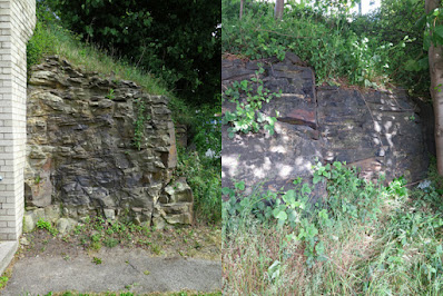
The Carboniferous limestone retaining wall at the top of Normanton Hill provided a good start to my COVID-19 walk from Richmond back to Treeton and, although now largely overgrown, there is a small exposure of Pennine Lower Coal Measures Formation sandstone on the opposite side of Richmond Road.
 
An overgrown rock exposure on Richmond Road

Except for the spectacular scenery in the Peak District National Park and various limestone gorges in the east, there are very few extensive rocky landscapes in South Yorkshire. The bedrock geology is generally only well exposed in stone quarries, brick pits and in various road and railway cuttings and, as such, accessible outcrops such as this possess considerable scientific and educational value.

An exposure of sandstone on Richmond Road

Local authorities have statutory obligations in respect of geological conservation but, in practice, funding is not even available to maintain RIGS or similar sites - except if funded by a developer as at Green Moor – and unrecorded exposures like this will just disappear.
 
An exposure of sandstone on Richmond Road

Noting the wedge bedding, spheroidal weathering and its high iron content, which is very evident on the exposed joint planes, I then carried on down Richmond Road to the modern church of St. Catherine of Siena – designed by Sir Basil Spence.
 
The church of St. Catherine of Siena

This is set on one of the mudstones that separate the sandstones marked on the geological map between Normanton Hill and Handsworth and, looking back, the 9 degree angle of the dip slope marked on the map is clearly discernable here.
 
The geology crossed by Richmond Road

Continuing along Richmond Road, the scarp and vale topography of the Pennine Middle Coal Measures Formation strata is again quite obvious, but the surrounding landscape is obscured by the predominantly inter-war housing estates that have been built alongside this road.
 
Gate piers on Richmond Road

I am a great advocate of urban geology and, keeping my eyes on the various stone walls and old houses that I could see along the way, the highlight of my walk to date must be the pair of gate piers at the entrance to a small block of modern flats.
 
Honeycomb weathering

Marking the entrance to the former Gray's Farm, they have been dated by English Heritage to c.1700 and are described as being “Ashlar, Round piers with vermiculated rustication, with ball finials on long necks”.

An iron nodule

Apart from the intricate stone carving, which is normally reserved for buildings of high status, the sandstone itself contains very many weathered iron nodules – from pebble to small cobble size – that are characteristic of the Coal Measures strata of this age in South Yorkshire and there is a good example of honeycomb weathering too.
 
The 1894 Ordnance Survey map of Handsworth

Looking at old maps, a few old quarries are marked in the area, with the largest being to the north of the old village of Handsworth but, without any supporting documentation, I can only make a guess at the provenance of these various sandstones.
 
The Wesleyan Reform Chapel on Richmond Road

Although, as a geologist, I am writing this Language of Stone Blog to appeal to anyone who shares my interests in stone in its may forms, much of my professional work has been concerned with the surveying and restoration of historic buildings – and I particularly liked the brick built Wesleyan Reform Chapel.
 
Sea Breeze Terrace

Passing the delightfully named Sea Breeze Terrace, which is built in a sandstone where the finely laminated beds are clearly seen and has in places what I would call a “ginger nut” hue, I walked up and down a few more slopes before arriving at the bottom of the escarpment upon which St. Mary’s church in Handsworth is situated.

Houses on Richmond Road

I didn’t stop to look closely at any of the mainly terraced houses around here, all of which are built in a similarly coloured sandstone, and quickly made my way up the escarpment and passed by the water trough and the war memorial, which I had already photographed a few times, before continuing towards St. Joseph’s Catholic church.
 

A view up the escarpment to Handsworth

Tuesday, 15 December 2020

Carboniferous Limestone in Sheffield


Crystals of fluorite

In the 9th week of the COVID-19 Pandemic in 2020, there was no change in the various restrictions that had been imposed in the UK but, having discovered that I was usually the only person on the bus to the nearest supermarket at Catcliffe, I decided to travel a little bit further on the No.73 bus towards Sheffield.
 
Although passing through an urban area, the scarp and vale topography formed by the underlying Pennine Middle Coal Measures Formation strata along this route is very noticeable. Furthermore, the broad anticlinal structure of the Pennines, which is emphasised to the south-east of Sheffield by the Derbyshire Dome, results in a rise in elevation from 50 metres at Treeton to 150 metres at the top of Normanton Hill, where I alighted from the bus.
 
The car showroom at the junction of Richmond Road and Normanton Hill probably wouldn’t attract the attention of the vast majority of passers-by; however, I had always been curious about the retaining wall on its south side, comprised of roughly laid large blocks of stone, and I went to have a much closer look.
 
The junction of Richmond Road and Normanton Hill

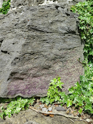
I had always assumed that these were blocks of local Carboniferous sandstone, but they are actually blocks of Carboniferous limestone, whose nearest source is more than 20 km away in the White Peak of Derbyshire.

Carboniferous limestone with lenses of chert

When living in Bakewell many years ago, when contracted to survey a wide variety of Regionally Important Geological Sites (RIGS) in the Peak District National Park, to establish their suitability for geotourism at all levels, I encountered very many spectacular landforms and a wide variety of fossils and minerals.
 
Purple fluorite

Spending less than 10 minutes at Normanton Hill, without having to clamber up a rock face as I had done during a Sheffield U3A Geology Group trip to Eyam, I discovered crinoids, brachiopods, clear and purple varieties of the mineral fluorite and chert.
 
Crinoids

The study of the science of geology has long since been demoted in very many schools, universities and museums, but I think that this site provides a good example of urban geology for educational purposes and I could easily start a field trip here.

Brachiopods and chert

Friday, 11 December 2020

An Exploration of Catcliffe


The Sheffield District Railway cutting at Catcliffe

Now entering the eight week of the COVID-19 pandemic, with travel restrictions still in place and queues at the nearest supermarket often resulting in making me miss my hourly bus home, my next local walk to further investigate the geology and historic buildings around Treeton started at Catcliffe Glass Cone.
 
Catcliffe Glass Cone

Apart from the various mediaeval churches in Rotherham, which I have detailed in my previous posts, this is one of the very few Grade I Listed buildings in Rotherham. Although essentially built with bricks, it deserves mention – as does the unlisted St Mary's church, built in 1910, which is just a stone’s throw away.
 
St. Mary's church
 
Although the church is not a listed building, the sandstone used to build the church was supplied from Orgreave colliery and the style of the tooled masonry for the walling is very unusual – described to me variously as polygonal cut random, mosaic style or random pick-face - and I have only seen something similar at St. Mark’s church in Grenoside and Whiston Methodist Church, both of which are in South Yorkshire.
 
A detail of walling stone at St. Mary's church

In addition to the odd style of masonry, the choice of Triassic red St. Bees sandstone for the dressings is also quite unusual in this region, where the local Carboniferous Millstone Grit and Coal Measures sandstones have been used for the vast majority of traditional buildings – with only Portland limestone from Dorset normally used for some of the more prestigious public buildings, as is the case in many cities and towns in northern England.
 
The west door of St. Mary's church

Over the years, weathering has formed a patina on the Coal Measures sandstone walling and the stone dressings have become blackened in places; however, the red sandstone surrounds to the west door are still very clean and unweathered, which suggests that it has been inserted recently.
 
A detail of masonry to the west door

Perhaps it is because the church is not listed, or no effort was made to properly match the existing red sandstone, but I was very surprised to see that the new red sandstone used is Permian Locharbriggs sandstone - with its distinctive dark clay bands – and not St. Bees sandstone, which is still readily available.
 
A detail of Locharbriggs sandstone

Having developed specialist stone identification and matching skills, while working in the building restoration industry, I notice such details and, given that the architect for St. Mary’s church is also responsible for St. Helen’s church in Treeton, I would hope that much greater care is taken when specifying a suitable replacement the Rotherham Red sandstone here, which is becoming increasingly scarce.
 
A reference book in my library

Such attention to detail separates the restoration specialist from the general builder but, in my experience of historic buildings, this distinction is not always made in practice; however, on this occasion, the main purpose of my walk was to try and find a path to the Sheffield District Railway cutting, where an extensive section of the Pennine Middle Coal Measures Formation is exposed.
 
Set on the southern end of the now closed Tinsley Marshalling Yard, which was built in 1965, I had seen this exposure many times when driving by or sat on the top deck of a bus but, as with many railway cuttings, public access is not possible and so I tried to find a suitable vantage point.
 
A view south from Wood Lane
 
After making my way through and around various housing estates in Catcliffe, which are set on Treeton Rock, I arrived at Wood Lane, which is the only road apart from the inaccessible Sheffield Parkway that crosses this railway cutting. From here, high walls on the road bridge prevented from me from getting a good look and I could only take a few general photographs.
 
A view north from Wood Lane

Since the marshalling yard here was closed, the rock exposures have become substantially overgrown but competent sandstone can still be seen in the upper half of the section, with the mudstones of the lower half of the section being heavily weathered and covered with scree.
 
A detail of sandstone above mudstone

Making my way along Europa Link to the Mercure Sheffield Parkway hotel, the undeveloped waste land to the north of the Sheffield Parkway was full of lumps of grey siltstone, but I could still not find access to the cutting and again could only take a few photos from behind a fence.


A walk around Catcliffe