Saturday, 6 October 2018

A Trip to Castle Hill - Part 2


A detail of a plough carved on a milestone

At the start of the Sheffield U3A Geology Group trip to Castle Hill, our leader for the day explained that we would encounter hardly any rock outcrops and, by lunchtime, I have to say that this field trip was turning into one of the most disappointing outings that I had been on with the group – as far as learning about the geology was concerned. 

The Castle Hill Geology Trail - Part 1

The large fold out Castle Hill Geology Trail was proving very difficult to use on a windy day – something that I had also highlighted when visiting Rochester Castle - which was a great pity considering its excellent content, and I think that a tried and trusted A5 booklet format would improve the ‘Geotourism experience’. 

The Castle Hill Geology Trail - Part 2

That said, putting down my camera for a good part of the day, I just enjoyed the rest of the walk by taking in the views of the moors and of Castle Hill from different angles and talking with various members of the group that I previously didn’t know – as well as picking the best blackberries that I have ever tasted. 

A milestone

Arriving in the hamlet of Farnley Hey, most of the group looked at varied stonework seen in the vernacular architecture here, particularly the extensive use of stone roof tiles – which are no longer produced – and, unusually for me, I didn’t take a single photo; however, when passing a striking milestone that had been erected since the trail had been written, I was quick to record the details of a plough and a bird - guessed to be a robin - which are carved on its sides. 

A finely carved detail on a milestone

Finally, at Molly Carr Wood, we had our first encounter with hard rock exposures, where the Lumb Dike cuts down through the flaggy sandstones of the 80 Yard Rock into the underlying shale – to leave a steep sided valley.

An outcrop of the 80 Yard Rock hidden in the undergrowth

At the point where the path descends into the valley, the 80 Yard Rock is largely hidden by the undergrowth but, in the stream bed – exposed due to the lack of rain in the summer – numerous small slabs of grey shale were clearly seen and a small outcrop could be seen at the waterside. 

The dried up bed of Lumb Dike in Molly Carr Wood

Returning to Castle Hill, the walk up a very steep slope reminded us all that we were very fortunate to have had a break from the intense heat that had prevailed for several weeks. By the time that we reached the car park, most of the group decided to get off home; however, a few of us decided to make the very most of the day and walked to the top of the Victoria Tower - from which there are some spectacular views.

The Victoria Tower

Friday, 5 October 2018

A Trip to Castle Hill - Part 1


A view of Castle Hill from the south-west

Following my day out to the Yorkshire Sculpture Park, my next trip with the Sheffield U3A Geology Group involved an exploration of Castle Hill – a distinctive landform to the south of Huddersfield, which has been occupied many times since an Iron Age fort was built here and it is now protected as a Scheduled Ancient Monument.

The geology around Castle Hill

I first saw this very impressive place from afar, 3 years ago, when exploring the nearby Beaumont Park but, currently being limited to public transport in my travels, I didn’t think that I would be able to visit it. Castle Hill is formed by a succession of alternating sandstones and softer siltstones and shales within the Greenmoor Rock - familiar from previous visits to Green Moor and Brincliffe Edge - which dip to the north-east and looking at it from a distance, various benches can be determined in its slopes.
 
A discussion at the base of the Victoria Tower

In the absence of our official leader for the day, Chris Darmon, who had led us around Alderley Edge the previous month, 20 of us gathered at the base of the Victoria Tower to escape the strong wind before starting on what was effectively a self-guided walk – following the Green Walk that is detailed in a comprehensive Geology Trail produced by the West Yorkshire Geology Trust
 
The Green walk - reproduced from the Castle Hill Geology Trail

Heading south-east down from Castle Hill, the first stop was to examine a section of dry stone walling that was built originally from the local flaggy Greenmoor Rock, but which has been subsequently extended or rebuilt using larger blocks of yellowish coloured sandstone. This has the appearance of Grenoside Sandstone, the next highest rock in the geological succession, which I had seen before in Grenoside village and at Norton in Sheffield. 

Examining the dry stone wall on Lumb Lane

In addition to containing at least three varieties of sandstone, this section of walling on Lumb Lane also contains both red and grey granite, in the form of setts that were once used for road surfacing and which have now been recycled, and possibly basalt – although an examination of this with a hand lens proved inconclusive due to the highly weathered surface, which revealed no obvious feldspar or pyroxene crystals. 

A recycled grey granite sett among various sandstones

The walk then continued past weavers’ cottages, where the pattern of upper floor windows provided evidence of their former use, and then continued across the 80 Yard Rock where faults are marked on the geological map, but which didn’t prove easy to positively identify amongst the landforms seen here. 

The Millstone Grit moors with the Meltham syncline to the right

Continuing down through the geological succession, where 5 coal seams are found, old workings at the surface are marked by the presence of a pond and a gorse covered waste heap; however, the group struggled to find them and we decided to stop for lunch at a point where we had views of the Meltham syncline on the skyline and from which the Crosland Hill sandstones quarries – used to supply many projects in Sheffield – could also be seen.

A distant view of the Crosland Hill Quarry

Tuesday, 2 October 2018

The Yorkshire Sculpture Park


A view of the south elevation of Bretton Hall

Compared to 2016, when I was out exploring new places at least once a week, 2018 was somewhat subdued, despite the extended period of hot summer weather, and I had to rely on my outings with the Sheffield U3A Geology Group to see somewhere new – the Churnet Valley and Alderley Edge being particularly interesting. 


There are, however, several longstanding favourite places of mine that I like to show to friends who visit me in South Yorkshire, including the city of Lincoln, Conisbrough Castle, the village of Wentworth and the Yorkshire Sculpture Park. I have been visiting the latter for more than 20 years and, taking advantage of a glorious day, I spent 4 hours there – finding places that I would certainly use for a formal field trip. 

Shapes in the Clouds III by Peter Randall-Page in Rosso Luana Marble

Although I don’t have any experience as a sculptor, as a photographer I have taken an interest in this art form ever since I was commissioned on an ad hoc basis, back in 1993, to record examples of post–war architectural sculpture by the Royal Commission on the Historic Monuments of England (RCHME) – now part of Historic England - which led to a project for the National Inventory of War Memorials


Having already developed interests in photographing finely carved stonework etc. when preparing publicity material for Triton Building Restoration, my eye for capturing fine details was noticed by the NMR when I exhibited a photo album of black and white prints at a national trade exhibition, and I have been developing this skill ever since. 

A view of the landscape at the Yorkshire Sculpture Park

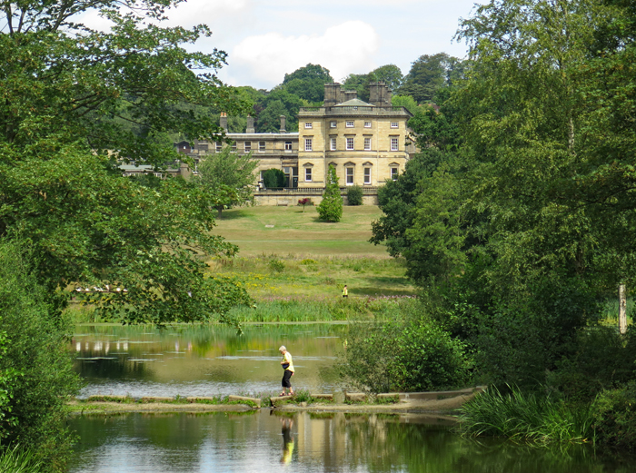
Over the years, I have seen many very fine sculptures at the Yorkshire Sculpture Park made from a wide variety of different stones but, more often than not, the sculptures on display are made of other materials: however, set in the grounds of the old Bretton Hall, it is just a pleasure to take in the landscape – where the tilted Carboniferous Coal Measures strata have been eroded away by the River Dearne to emphasise the dip and strike landforms that are typical of the region. 

The Camellia House

Bretton Hall itself has always been out of bounds, formerly as Bretton Hall College and now that it is being redeveloped as a hotel, but the chapel and the Camellia House, as well as substantial artworks by Andy Goldsworthy, provide plenty of opportunities to look closely at the various sandstones used as a building stone here. 

Lady Eglinton's Well

Walking around the grounds, Lady Eglinton’s Well obscures an old quarry face, where unusual examples of spheroidal weathering can be seen, which reflects the variation in iron content – including the development of ironstone nodules. Although I have never explored it in detail, a quarry face is found just behind it and the sedimentary structures here can be studied at leisure. 

Spheroidal weathering and iron nodules in an old quarry face

Every time I visit the Yorkshire Sculpture Park, I always find something new. On my last trip, I explored the Upper Lake, where the Shell Grotto forms an interesting example of stone construction - but I still have yet to see the Obelisk and the Greek Temple.

The Shell Grotto

Sunday, 23 September 2018

A Trip to Alderley Edge - Part 2


The Sheffield U3A Geology Group on Stormy Point at Alderley Edge

During the Sheffield U3A Geology Group trip to Alderley Edge, the whole morning was spent examining Church Quarry in detail but, after lunch, the group set off to explore several other sites that relate to its history of mining. 

A scar left by mining along the Engine Vein

The first stop off point was to see the mine workings along the Engine Vein, which date back to the Bronze Age. The site is fenced off and it is not possible to look closely at the Helsby Sandstone, which contains most of the minerals here that consist of widespread occurrences of barytes and more localised copper-dominated polymetallic ore deposits; however, it is possible to see green coloured staining from the mineral malachite, which once appeared at the surface. 

A discussion about the geology that can be seen at Stormy Point


We then moved on to Stormy Point, an open space in the woodland where a large area of bare rock is exposed and which provides a good opportunity to examine the geology in some detail. 

A view towards the Peak District National Park from Stormy Point

The mineralisation is considered to be the result of the percolation of low temperature saline fluids through the porous Helsby Sandstone, with the faults in the region acting as conduits and also being associated with the concentration of minerals as veins.

An excavated mineral vein at Stormy Point

One of these mineral veins has been clearly excavated here and, although these have been worked out by generations of miners over the years, blue azurite and malachite can still be found in the rock fragments and barytes occurs as veins and clots in the bedrock here. 

Veins and clots of barytes at Stormy Point

Although the bedrock at Stormy Point essentially comprises conglomerate, in places these are underlain by beds of marl with green/red colouration, which are differentially weathered to leave the conglomerate standing proud. 

Triassic conglomerate and marl with a £1 coin used for scale

After a brief investigation of other  worked out mineral veins that are associated with faulting, we had a brief look at the large Old Alderley Quarry. Although the quarry faces were not readily accessible, from a distance a thick bed of marl is clearly distinguished from the sandstone above and below it – being differentially weathered to leave a deep linear scar in the quarry face. 

A view of the Old Alderley Quarry

The trip finished with an exploration of the area to the west of the B5027 road, to see one of the old minerals processing areas - where the land is still poisoned by the chemicals used in the extraction of the metals – and various capped old shafts and adits that are the only
 remains of the mining industry, which finished here in 1919.  

An old adit

As I had previously discovered with previous trips by myself to the Porter Valley and Ecclesall Woods, the industrial archaeology didn’t interest me that much – although I think that I would appreciate it much more if taking part in one of the organised visits down one of the old mines, arranged by the Derbyshire Caving Club; however, as a professional geologist, I won’t complain because I am a little bit wiser and my collection of rocks has increased significantly.

Various rocks collected from Alderley Edge

Thursday, 20 September 2018

A Trip to Alderley Edge - Part 1


Examining the quarry face in Church Quarry

In a year that has yet again been very barren for my professional work and spent near to home, I kept myself occupied for much of the time by focussing on the organisation of the Heritage Open Days for St. Helen’s church in Treeton. 

The Wizard Tearoom at Alderley Edge

I still made time for the occasional trip out to take advantage of the wonderful summer weather, however, with trips to Pontefract Castle and Saltaire by myself and on trips with the Sheffield U3A Geology Group. When the latter announced that the itinerary for 2018 included a trip to Alderley Edge, I put it in my diary straight away. 

The geology of Alderley Edge

Alderley Edge forms an uplifted area comprising Triassic conglomerates and sandstones, with subsidiary marl, which is surrounded by lower lying land that is covered in Quaternary till. I had seen examples of similar l during my previous U3A trip to the Churnet Valley, but the area around here has had a long history of mining, with both copper and cobalt being principally exploited since ancient times. 

An introduction to the geology by Chris Darmon

Our leader on the day was Chris Darmon, a very experienced geologist and field trip leader, and after we had all arrived at the Wizard Tearoom, we set off to Church Quarry, where we stayed all morning to closely examine the Helsby Sandstone Formation, which contains various separate members. 

A general view of Church Quarry

This medium sized quarry was worked in the 19th century for building stone and exhibits dipping strata, with the lowest metre or so of the principal quarry face consisting of a uniform medium grained sandstone separated from the conglomerate above it by a distinct unconformity

Conglomerate above sandstone at the unconformity

The conglomerate in particular provided the group with the opportunity to observe cross bedding, scour structures, variations in grain size and other features, which indicate that the sediment had been formed in a river channel, whose extent and direction could be worked out approximately from field evidence. 

A section through the main quarry face

As with other Triassic sandstones that I had seen in the Churnet Valley, Alton Towers, Nottingham and around Doncaster, the distinctly rounded pebbles found in the conglomerate are mainly quartz. It is thought that these are Devonian in age and have been reworked from rocks of this age that were found in the area that is now Budleigh Salterton in Devon and brought by a north flowing river into the area now occupied by the Cheshire basin, as a flash flood. 

Examining the unconformity

In one corner of the quarry, a short man made tunnel provides evidence of the mining activities in the area. The appearance of cobalt mineralisation of the sandstone here was investigated for its economic potential, but further investigation soon discovered that it was worthless and the tunneling ceased.

A view along the aborted tunnel

Wednesday, 12 September 2018

Heritage Open Days - A Review


An examination of 'honest repairs' to the chancel

When deciding to open up St. Helen’s church in Treeton for the Heritage Open Days this year, the Friends of St. Helen’s Church Trust made a conscious decision to choose the weekend that coincided with the Rotherham ShowAfter all, it had severely declined in recent years in our opinion and, considering that Sunday has always been the most popular day, our marketing strategy was to try and encourage everyone to visit us on Saturday.

The welcome to St. Helen's church on the Heritage Open Days

The Thursday opening was planned as an extension of the regular Coffee Morning and the posters and other publicity material – including posts on Social Media – was primarily intended to encourage more residents of Treeton to visit the church, although we were hoping that we would attract visitors from our listing on the HOD website

Setting up the bunting and balloons to the entrance steps

When setting up the banners, bunting and posters in the morning, having noticed the enthusiasm of the other volunteers who were helping out, I said that “even if we don’t attract a single new visitor, we should just be content to have another day of fun amongst ourselves”, which we did; however, our visitor counter reached 46 and, although we were a bit disorganised in this respect – and included volunteers - everyone agreed that it had been a very successful day. 

Help given to visitors by a member of Treeton Local History Group

In addition to the expected visitors from Treeton and nearby, we had several visitors from Sheffield and further afield and the display stand and the slide show of old photographs produced by the Treeton Local History Group was much appreciated. 

A visitor from Scunthorpe taking photos for her website

For the Saturday, one of my concerns had been that the Rotherham Advertiser and the Rotherham MBC communications team didn’t provide the help in publicising the event that we had asked for. I needn’t have been worried because, despite the weather that changed from light drizzle at the time of opening to a downpour at the finish, a steady stream of people came through the doors all day. 

A general view of visitors in the nave

The Thursday had been a ‘trial run’ in many respects, catering mainly for the local community, but we all had to step up a gear on the Saturday and I didn’t stop for a moment all day. The many tours of the exterior of the church proved to be very popular, and the ‘two tone’ tower and other architectural features - described by Sir Nikolaus Pevsner as “very confusing” - were discussed. 

A display by Trevor Spencer from the Sheffield Indexers

Inside St. Helen’s church, the presence of the Sheffield Indexers was an added bonus and the homemade cakes and other refreshments proved to be very popular, with £106 received for the Friends of St. Helen’s Church Trust – as well as other donations being made towards the Treeton Local History Group and to the badly needed maintenance of this Grade I Listed church. The visitor count for the day was 52 but, with no one specifically delegated to this duty, and with the counter being passed around, this was considered to be an underestimate. 

Cakes and scones

All in all, it was considered to be by far the most successful Open Day that the Friends of St. Helen’s Church Trust had organised, and all those that took part said that they thoroughly enjoyed the day. If I had to express an element of disappointment, it would be that we had all hoped for a dry and sunny day, so that the village stocks could have been opened up to provide some great family entertainment and photo opportunities; however, the rain didn’t stop the sense of fun for a few people that left school very many years ago.

Having fun in the village stocks (Photos provided by Diane Thurman)