Sunday, 12 August 2018

Pontefract Castle Magazine


In the magazine at Pontefract Castle

When I visited Pontefract Castle on the late May Bank Holiday weekend this year, my primary intention was to revisit the castle magazine to take a set of photos that would replace those from my last trip to Pontefract in 2016, which I had inexplicably deleted from my computer. 

The stairs down to the magazine at Pontefract Castle

At that time, the electrics underground had failed but the temporary contractor’s lighting, together with the tour leader’s torch, had provided enough light to take a few decent photographs – albeit stretching my Canon Powershot G16 camera to its limit. 

A lense of iron rich siltstone in the Newstead Rock

With only 9 people turning up midweek in October, we were able to explore every cavern and – staying behind for a few moments to use flash photography as I did at Chislehurst Caves – I was able to highlight the lenses of fine grained iron rich silt that occur in the Newstead Rock, which are not obvious in the weathered exposures of rock beneath the north curtain wall. 

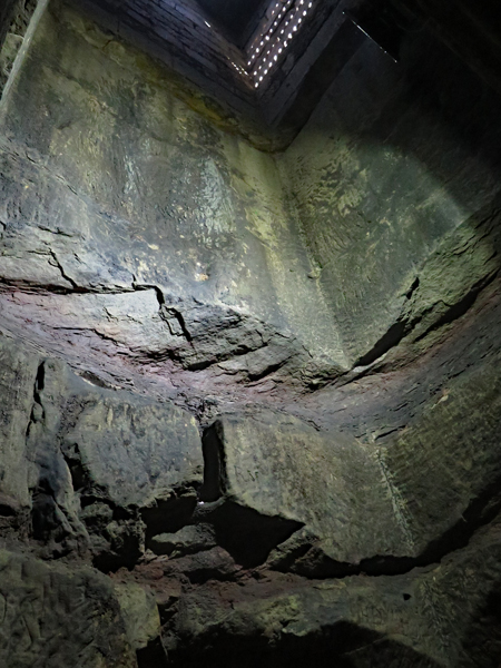
A general view of the magazine at Pontefract Castle

The “Dungeon Tour” proved very popular on this day, with the maximum of 20 people going underground, and opportunities to further examine the geology were therefore very limited, especially since the fixed permanent lighting was not as bright as I had hoped for. 

A photo with and without the camera flash

For the general visitor, the principal interest of this excavated cavern, originally the cellar to the 11th century Great Hall, is its history, which includes use for storing gunpowder, liquorice and – in the English Civil War – as a prison. 

Steps carved in situ from the Newstead Rock

Pontefract Castle endured three sieges and it was one of the last one under Royalist control to fall and, although nothing like as elaborate as that seen at the Beauchamp Tower at the Tower of London, the inscriptions provide a record of these turbulent times.

An inscription by John Grant in 1648

Friday, 10 August 2018

Pontefract Revisited


Kirkebi Anglo Saxon church

When I first visited Pontefract, back in 1999, it was to undertake a survey of the stonework at All Saints church and, although I visited the historic town centre, to note the principal building stones used, it was another 15 years before I revisited to take a good look at Pontefract Castle, the old sandstone quarry on its north flank and a part of the town where moulding sand was once extensively mined from the Yellow Sands Formation.

All Saints church in Pontefract

A couple of years later, having joined the Sheffield U3A Geology Group, I decided to visit Pontefract Castle again to specifically go on one of the short tours of its magazine - excavated into the Newstead Rock that underpins the castle – and to assess its suitability as part of a potential future field trip to Pontefract with the group.

Vuggy dolomitic limestone at Pontefract Monkhill railway station

Although the geology encountered in the magazine proved to be very interesting and I discovered some good outcrops of vuggy Magnesian limestone at Pontefract Monkhill railway station, which added to the points of interest that I had previously identified, my trip coincided with the demise of the contractor who had been undertaking an extensive programme of restoration to the castle.

Consolidation works to the rock face beneath the north curtain wall

The resultant delays to the works and disruption to this very popular tourist attraction set back my ideas to lead the group around Pontefract; however, my suggestion that the old quarry faces below the north curtain wall could be conserved for its geological value – as at Sandal Castle – was well received and, with special group visits to the magazine possible, I still think this would make a great field trip.

Newstead Rock in the quarry face beneath the north curtain wall

Sometimes you just have to go with the flow and, after I had proposed this at the January 2018 indoor meeting of the geology group, only to discover that the year's field trip itinerary had been already set, I subsequently discovered that my last set of photographs had gone missing.

Stone restoration at Pontefract Castle

Not to be deterred, I decided to visit Pontefract Castle again on the late May Bank Holiday this year, to coincide with their Siege Weekend. Although much of the castle was still a building site, I saw very many interesting examples of stone restoration – in the castle grounds itself and along the walls of Castle Garth – that confirmed my thoughts for its suitability as a field trip location.

Stone restoration along Castle Garth

Monday, 6 August 2018

The Churnet Valley - Part 2


Barytes crystals in the Hollington Formation sandstone

In the first part of the exploration of the Churnet Valley with the Sheffield U3A Geology Group, we encountered various exposures of the Hawksmoor Formation/Chester Formation, with its distinctive beds of conglomerate but, walking up Rakes Dale to Alton, this is succeeded by the younger Helsby Sandstone Formation/Hollington Formation

Vernacular architecture in the village of Alton

In the village of Alton, although many of the old buildings are built out of red brick, several houses provide good examples of Hollington sandstone, which varies from buff to red in colour and is commonly mottled. Although used largely for historic buildings in the West Midlands, and for restoration, its reputation made it worthy of inclusion in the Triton Stone Library

An exposure of Hollington sandstone on Toot Hill

Continuing to Toot Hill, the Hollington sandstone dry stone walling is seen to contain small crystals of the mineral barytes, which has weathered proud of the surrounding sandstone, and a good example of the same stone is found at the precipitous edge, which overlooks the Churnet Valley below and from which the ruins of the Alton Towers stately home can be seen. 

Alton Towers

Walking back down towards the Churnet Valley, various outcrops of the conglomeratic Hawksmoor Formation were encountered, including some that contained a distinctive pattern of honeycomb weathering that I have not seen in Carboniferous sandstone.

An outcrop of conglomeratic sandstone with honeycomb weathering

The close proximity of these outcrops to the tracks that we were following provided a good opportunity for the members of the group to closely study the pebbles and the distinctive cross bedding and other sedimentary structures in the rock, which provide clues to the formation and origin of these rocks.

An explanation of cross bedding © The Churnet Valley Geotrail

Although the Sheffield U3A Geology Group tries to introduce its members to a varied geology as possible on its field trips, the nearby Carboniferous rocks of the Pennines region – especially the limestone and gritstone of the Peak District National Park – tend to be visited time and time again and it was refreshing change for everyone to see a very different type of landscape. 

An old brick pit

The last stop on the field trip, before we returned to Oakamoor, was a brief visit to an old brick pit, which is marked by a shallow depression in the landscape that is now filled with water. The Triassic sandstones of England often contain beds of impermeable marl – a calcium carbonate rich mudstone laid down as lacustrine deposits – that was sometimes thick enough to be exploited 
for local usage or commercially.

An inscription by Thomas Patten and Company

Friday, 3 August 2018

The Churnet Valley - Part 1


Triassic sandstone

During my visit to the Gleadless Valley in the first week of May this year, although I had a good walk and encountered some interesting architecture, the geology wasn’t very exciting; however, I didn’t have to wait long before my next day out with the Sheffield U3A Geology Group – this time to the Churnet Valley
Looking on Google map and the Geology of Britain viewer prior to our visit, I was particularly interested to discover that our planned walk was not very far from Alton Towers, where I had discovered some spectacular exposures of Triassic sandstones - when finding some peace and quiet on a field trip that had become a fixture with the Heart of England summer school. 

The bridge and weir in Oakamoor

Meeting up in the village of Oakamoor, which is set on the Millstone Grit, our leader introduced us to the very interesting industrial history here – where a river, a railway and a canal all once passed through the Churnet Valley, and provided the power and transport links necessary to develop early heavy industries, based on nearby mineral resources. 

Information boards that describe the industrial history of Oakamoor

There is very little remaining evidence of the previous industry and, after looking at a few information boards, we set off in a south-easterly direction along the steep side valley which is occupied by the misfit River Churnet, where we soon passed across a fault and found a good exposure of the Hawksmoor Formation – now renamed the Chester Formation by the British Geological Survey

An exposure of Triassic sandstone

Laid down by rivers in an arid environment, periods of flash floods are recorded by beds full of pebbles, known as conglomerates, which are very characteristic of rocks of Triassic age in the English Midlands - stretching from Staffordshire into Nottinghamshire.

Triassic conglomeratic sandstone

Moving on to the Ramblers Retreat – one of 2 gatehouses commissioned by the Earl of Shrewsbury within his estate – we briefly stopped for a drink before continuing on the way to the village of Alton, via a dry valley that is now occupied by a few houses and a farmstead.

A view down Rakes Dale

Monday, 30 July 2018

The Gleadless Valley


A Google map of the Gleadless Valley showing the Meers Brook

The spring of 2018 was very slow to get going but, having visited Brincliffe Edge quarries and the interior of the church of St. James the Great – both a stone’s throw away from the route of the Sheffield Round Walk – I decided to get out again and explore the Meers Brook, whose many tributaries have cut through the Grenoside Sandstone and the underlying Pennine Lower Coal Measures Formation rocks to form the Gleadless Valley

The geology around the Gleadless Valley

This steep sided valley is best known for its housing estate, which was built from 1955 -1962 and retains large areas of its original ancient woodland and, although I didn’t expect to find any spectacular geology or historic buildings, when I passed through it on my last visit to Norton I thought that it was well worth a visit. 

A view north across the Gleadless Valley

Various styles of housing were designed to suit the contours and the varied slopes, and these range from tower blocks on the edge of the valley, with chalet style and patio houses on the lower slopes – and the Holy Cross Church set in a highly prominent location. 

The Holy Cross Church

In places, the slopes have a gradient of 1 in 4 in places and, with numerous watercourses too, various challenges were presented to the city architect J. L. Womersley and, when wandering around the valley, several culverts and diversions of the natural waterways can be seen. 

A streamside section of siltstone

The tributaries of the Meers Brook have cut deep and narrow courses through predominantly Lower Coal Measures siltstone and shale and the streamside exposures of rock would probably yield fossils to the adventurous research geologist; however, none of these are easily accessible and I wouldn’t really consider the Gleadless Valley suitable for geology field trips. 

A streamside section of shale

That said, once I had continued walking to the old village of Heeley, I encountered a variety of late Georgian and Victorian historic buildings which provide good examples of what I presume to be quite local Pennine Lower Coal Measures Formation sandstone. 

Various historic sandstone buildings in Heeley

Although none of the buildings are particular spectacular, the churchyard of the Grade II Listed Christ Church contains a couple of interesting granite monuments – one a pink granite obelisk with and ornate plinth that commemorates the local steel manufacturer, John Shortridge, and another large ornate monument constructed in grey Aberdeen granite.

Granite memorials at Christ Church graveyard

Wednesday, 25 July 2018

St. James the Great - The Interior


A view east along the nave

When I first visited the church of St. James the Great in Norton, on the last day of March in 2017, it was locked and I only had a brief look at the exterior and the porch. A year later, taking advantage of one of their Farmers Markets, I had the opportunity to take a good look at its interior. 

A view to the west from the chancel

Unexpectedly, I found that all of the very heavy pews in the nave had been moved aside to make way for market stalls, where a wide variety of craft products were available for sale and, one time, a tiny Shetland pony was brought into the church. 

The font

With the church crowded with people, and many of the details obscured or not readily accessible – such as the unusual nine sided Early English font - I wasn’t able to closely study the details, but the principal features were still clearly visible. 

A carved impost to the south arcade

Like very many others that I saw during my extensive tour of mediaeval churches in South Yorkshire and the surrounding counties, in 2016, the Early English north arcade has transitional style columns dating to around the turn of the 13th century but those of the south arcade – which are considered to be 14th century – are octagonal in section. 

A view west along the nave to the lopsided tower arch

The narrow tower arch, which is also Early English, is quite unusual in that it is distinctly lopsided and, like All Saints church in Aston-cum-Aughton, the span of the easternmost arch to the south aisle is much wider than all of the others. 

Derbyshire crinoidal limestone

Although the time or space was not available to take a good look at the building stones, which I had easily distinguished on the exterior, I noticed the use of Derbyshire crinoidal limestone and there is a fine 16th century alabaster chest tomb, dedicated to William Blythe and his wife.

The tomb of William and Saffrey Blythe

The sculptor Sir Francis Chantrey was born in Norton and he is buried in the churchyard. He is commemorated by an obelisk in the village and, inside the church, there is a simple memorial plaque and a full sized  sculpture of him.

A sculpture of Sir Francis Chantrey

Tuesday, 24 July 2018

Brincliffe Edge Rock


An extensive exposure of Brincliffe Edge Rock

When exploring the Porter Valley leg of the Sheffield Round Walk in the spring of 2017, it had originally been my intention to take advantage of one of the leaflets available through the Sheffield Area Geology Trust and visit the old quarries on Brincliffe Edge in Sheffield; however, due to problems with the buses on the day, my plans had to be shelved. 

Brincliffe Edge Rock and dry stone walling on Psalter Lane

As the Chairman and the principal surveyor for the South Yorkshire RIGS Group, I spent a considerable amount of time as a volunteer – with the occasional paid contract – raising the profile of geology in the county. The survey work that I undertook enabled me to get to know the principal building stones in the region much better, which was of benefit to the professional work that I undertake as a stone identification and matching’ specialist – a skill that I first developed when establishing Triton Building Restoration Ltd. in London back in 1989.

An exposure in the Omega Restaurant car park

In August 2005, Planning Policy Statement 9: Biodiversity and Geological Conservation came into force and placed a legal obligation on local authorities to take into account geological sites during the planning process, which in Sheffield doesn't seem to have beeen taken very seriously - as in Rotherham and Barnsley.

The old quarry face in the Omega Restaurant car park

Doncaster MBC took the bull by the horns and paid for the British Geological Survey to undertake a resurvey of their RIGS for the Local Development Framework, with myself being temporarily employed  to do the survey work and relevant report writing, but the other authorities have never shown any desire to follow suit and still ask volunteers to undertake their statutory reponsibilities.

A sculpture in Quarry Head Lodge depicting  plug and feathers

Although still available to advise on such matters if the need arises, I have since taken a backward step with respect to geological conservation in South Yorkshire and my visit to Brincliffe Edge, in the first week of April this year, was undertaken purely for my own continuing professional development and personal pleasure. 

Rock bolts in the quarry face at Quarry Head Lodge

In the same way that “Rotherham Red” sandstone is the local name given to the locally distinctive variety of Mexborough Rock, Brincliffe Edge Rock, which was once called “Brincliffe Blue”, is a variation of the Greenmoor Rock - whose type locality is in the village of Green Moor, which is found approximately 15 km to the north-west of the Sheffield suburb of Banner Cross. 

A detail of the Brincliffe Edge Rock at Quarry Head Lodge

The old quarries around Brincliffe Hill once produced thousands of tons of grindstones, building stone and gravestones, but they have long since been closed and, except for the car park to the Omega restaurant – now largely overgrown with ivy – have been redeveloped for housing. 

The redeveloped John Gregory Brick Pit on Ecclesall Road

The measures beneath the Brincliffe Edge Rock/Greenmoor Rock – as also seen at Neepsend to the north of Sheffield city centre – were also once widely exploited to make bricks and, when I finished my brief exploration of the old sandstone quarries, I followed the distinct escarpment down to Hunters Bar, where the scar left by the John Gregory Brickworks can still be seen.

A view of a back garden on Ecclesall Road