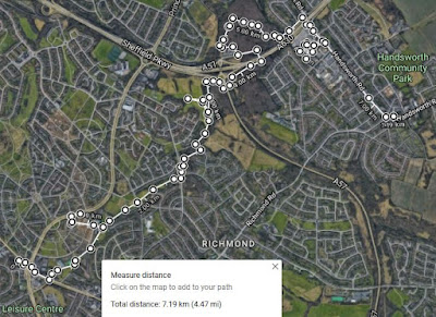
Week 46 of the COVID-19 Pandemic coincided with the last week of January 2021 and, having been out only once for a good walk during the previous three months, from Normanton Hill to Treeton, I looked forward to my next day out – to further explore the course of the Carr Brook, which I had encountered the year before at Carbrook Ravine Nature Reserve and Bowden Housteads Wood.
Taking the No. 73 bus to Manor Top, I started my walk at the aptly named Pit Lane, which once led down to the former Nunnery Woodthorpe Pit, one of two collieries that were in close proximity. Following the path alongside the fire station and then down past Prince Primary School, I was surprised to discover that it suddenly opened into a green corridor.
 |
| A Google Map view of Manor Top |
When undertaking some preliminary research on various maps, to discover the location of the head of the Carr Brook - a tributary of the River Don - all I could see on Google Map was a large building site, where a large area was covered in coal waste that looked like it was being landscaped.
 |
| The headwater of the Carr Brook |
Although marked on the 1855 Ordnance Survey map just to the north of Nunnery Woodthorpe Pit, I didn’t expect to find any sign of the Carr Brook for another kilometre, where the stream first appears on Google Map and the modern Ordnance Survey map; however, I discovered a small frozen pond, which empties with a flow of water that barely makes an impression on the land.
 |
| The start of the Carr Brook |
Before setting off to follow it downstream, I had a quick look at the various blocks of sandstone that have been placed here as part of the landscaping scheme. Very often, these contain interesting sedimentary structures or variations in the lithology but, on this occasion, I only noted a few poorly preserved fossils of Carboniferous trees.
 |
| Fossils of Carboniferous trees |
Within a hundred metres from the source, the flow of the brook has increased sufficiently to have incised a sinuous course, with gently sloping banks, and then carries on in a shallow channel that occasionally forms ponds.
 |
| A view up the Carr Brook |
Passing the remains of old reservoirs, which I presume are related to the Woodthorpe Colliery, which opened in 1854 and closed in 1930, I then followed the brook for a short distance, along a stretch where it hardly marks the surface of the land over which it is flowing.
 |
| The course of the Carr Brook |
After the coal mines closed, the area was redeveloped as a large council housing estate and the Carr Brook disappears into a culvert beneath Woodthorpe Recreation Ground, where the most attractive features are the large lumps of rock that deter cars from entering it.
 |
| Boulders in Woodthorpe Recreation Ground |
When Carr Brook emerges again in Woodthorpe Ravine, it is surrounded by trees and shrubs and, although I couldn’t get close enough to see its banks, I did notice that the stream bed here is stained orange – a characteristic that is often seen in old coal mining districts, where there is a discharge of pollutants from abandoned mines.
 |
| An iron stained stretch of the Carr Brook |


No comments:
Post a Comment