Friday, 2 October 2020

Greenway West - Part 1


A sandy lens and beds of red marl

At the beginning of August 2019, during a trip to Barlborough, a very helpful volunteer at Barlborough Heritage Centre mentioned to me that the Clowne Branch Line Greenway was due to open soon along an old railway line that runs through nearby Clowne - and that an excellent section of geology can be found there.

An extract from Down to Earth Extra

When I saw a short article about this in the November 2019 edition of Down to Earth Extra, I decided to undertake some further research and - following a proposal at the January indoor meeting of the Sheffield U3A Geology Group - it was agreed that we would explore the area around Clowne for our April 2020 field trip.

A map of Hollinhill and Markland Grips Nature Reserve

Having been sent various information and maps by Derbyshire County Council and Derbyshire Wildlife Trust over the winter and made contact with local residents in Clowne and nearby Bolsover, who could advise me on the best routes, I made arrangements to go with Paul May to Clowne on the Saturday following our trip to Charnwood Forest.

Arriving at the North Road Car Park in Clowne for a 10:30 am start, we were met by various people who knew the area well and had helped the Group with the planning of our walk - and who had also added to our understanding of its history.

Greenway West

With our various introductions made, we then set off on the first leg of the walk, to explore the section known locally as Greenway West, which is cut into the Magnesian Limestone escarpment to expose a 600 metre long section of the Cadeby Formation.

An extract from the  geological memoir

In the Geology of the Country Around Sheffield, the memoir which accompanies the British Geological Survey 1;50,000 series map, there is a generalised description of the dolomitic limestones that are exposed here.

A general view

It soon became apparent that the section is dominated by relatively thin beds, which are often rubbly or flaggy in nature and contain thin beds of marl, which can usually be identified by the fact that they have differentially weathered to form distinct linear features that often undercut the limestone above.

A sandy lens in flaggy beds

There is only a very gentle dip of the strata to the east and the thicknesses of the beds can be seen to change laterally, with the development of much more massive beds and the occasional appearance of lenses of sand and beds of red marl.

Examining a sand lens

Wednesday, 30 September 2020

Charnwood Forest - Part 4


A general view from the Altar Stones

The final stop on my trip to Charnwood Forest, with Paul May of the Sheffield U3A Geology Group, was at the Altar Stones Nature Reserve, which is situated a few hundred metres north of the Hole Hill Quarry Nature Reserve car park.

A view from the path leading to the layby

The reserve occupies less than 4 hectares of a ridge of high ground, sometimes obscured by thick clumps of gorse, which the geological map shows to be formed by a small elliptical inlier of rocks of the Precambrian Maplewell Group surrounded by Triassic mudstones.

An outcrop of the Bradgate Formation

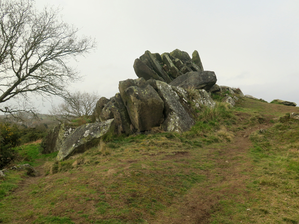
Along the top of the ridge, which provides good views of the surrounding countryside, numerous outcrops of jagged rocks dip steeply to the south-west and, becoming progressively younger to the north-east, comprise volcaniclastic sediments of the Bradgate Formation, the Sliding Slump Breccia, the Beacon Hill Formation and the Park Breccia.

Outcrops of the Bradgate Formation

The Bradgate Formation, which we had already seen on the top of Billa Barra Hill, was easily recognisable from its well bedded, fine grained and dense nature and its tendency to form solid angular landforms, but the surface of the rock is covered in lichens and its colour is not obvious.

A sample from the Bradgate Formation

Examining a couple of specimens with fresh surfaces, which I had found lying on the ground, there is distinct green colouration due to the abundance of the mineral chlorite, which is very common in metamorphosed volcaniclastic sediments, and graded bedding can be clearly seen.

Another sample from the Bradfield Formation

Both of the specimens display weakly developed cleavage and one of them contains veins of banded quartz and dark green hornblende, with some pink colouration, which I assume is related to the intrusion of markfieldite at the nearby Hill Hole Quarry.

An outcrop of volcaniclastic breccia

We had no time to systematically examine the various outcrops and I just wandered around to take a few general photographs; however, although I couldn’t assign them to a particular rock formation, many of the outcrops are knobbly and not obviously controlled by well defined bedding planes or the regional pattern of jointing.

A detail of breccia

A close inspection reveals that these are composed of a jumbled mass of irregularly sized and shaped clasts, which are obviously one of the breccias. These were formed by underwater landslides, generated by earthquakes, and consist of rafts of partially lithified sediment.

A general view

Other outcrops are very ragged in nature and consist of needle like blocks pointing to the skyline, which contrast with the forms of those described above, but I didn’t examine any of them closely using my hand lens.

A general view

Having last visited Charnwood Forest as a geology undergraduate, when we explored the area around Beacon Hill, I was pleased to see some wild Precambrian rocks again and, if the weather was dry, Altar Stones Nature Reserve would be a great place to have lunch.

A general view

At the end of the day, we both thought that the geological content of the walk had been a little bit disappointing, partly due to the lack of access to the markfieldite quarries in the morning after a lot of effort made, and that we would have to reorganise our itinerary accordingly.

A general view


Tuesday, 29 September 2020

Charnwood Forest - Part 3


Hill Hole Quarry

Leaving the car park at Billa Barra Hill Nature Reserve, having explored Billa Barra Hill and New Cliffe Hill Quarry during the reccy for the forthcoming field trip to Charnwood Forest with the Sheffield U3A Geology Group, we then set off on a short drive to the village of Markfield.

A notice board at the car park

Parking at the Hole Hill Nature Reserve car park on Hill Lane, we walked down the path alongside some fine allotments until we came across a path up to the edge of Hill Hole Quarry, which is the type locality for the Precambrian granophyric diorite known as markfieldite.

A notice board at the viewing point

To our great surprise and amusement, the viewing point was occupied by a few locals who were spending their Saturday afternoon drinking a few beers and using the nature reserve as a golf driving range.

Hill Hole Quarry

After chatting with them for a while, and seeing enough of the quarry faces from afar to note the points of interest, we walked back down to the village where I quickly took a few photographs of the church of St. Michael and All Angels.

The church of St. Michael and All Angels

Dating back to the C12, the oldest visible part is the C14 tower and the church was restored in 1856, with a new north aisle added and many windows replaced at the same time. Unsurprisingly, it is built out of irregular blocks of markfieldite, with Carboniferous sandstone quoins and dressings, and the diorite is also used for large buttresses to the north churchyard wall.

Buttresses in the churchyard

Looking up at the various roofs to the north elevation, I could see that at least two different types of roofing slate have been used at various times. I didn’t get any close up photos of the details but I though that some of the roofing slate might be Swithland slate, which was once quarried at nearby Groby and at Swithland and Woodhouse Eaves a few kilometres to the north.

The Cambrian Swithland Formation comprises purple to grey meta-mudstones and greywackes with thin conglomeratic sandstones and it was used from Roman times as a roofing material and at the height of the industry, supplied slate for the roof of St. Pancras railway station in London.

The north elevation of the church

During the formation of the Charnwood Anticline, a weak cleavage was imposed on the rocks of Charnwood Forest but Swithland slate does not split well land the slates have rough surfaces and a range of thicknesses and sizes, with the largest being used for the courses above the eaves.

A Swithland slate roof

Although quarrying in Swithland continued to the late C19, the development of the canals and railways spurred the expansion of the Welsh slate industry, whose cheap, uniformly sized slates soon superseded Swithland slate as the preferred roofing material in this region.

The lychgate roof

Good examples of immediately recognisable Swithland slate can be seen in the lychgate to the church and also to the brick house that is set immediately next to it but, with time starting to move on, we didn’t further explore the village to see if we could find further examples of its use.

The war memorial

Before setting back to the car, we briefly stopped at the markfieldite war memorial, where the coping stones are made of a green banded stone that reminded me of the tuffs of the Borrowdale Volcanic Group in the Lake District; however, as I soon discovered at Altar Stones Nature Reserve, this was another example of the Bradgate Formation.

A detail of the war memorial


Saturday, 26 September 2020

Charnwood Forest - Part 2


A general view of New Cliffe Hill Quarry

Continuing our recce for the forthcoming Sheffield U3A Geology Group field trip to Charnwood Forest, Paul and I went on a short unplanned detour following the track of an old railway line that runs alongside Billa Barra Lane, before finally discovering the very muddy path that led up to the southern edge of New Cliffe Hill Quarry.

The path to New Cliffe Hill Quarry

This large quarry was opened in the 1980’s to exploit the South Charnwood diorite, once known as markfieldite, which forms one of the many intrusions into the volcaniclastic sediments of the Charnian Supergroup that are found in the region.

An information board at Cliffe Hill

Arriving at a purpose made viewing point, where there is a rather dilapidated information board, we took advantage of the seating to have a cup of coffee and a bite to eat while we reviewed the information provided by Dr. Annette McGrath’s geology guide, which was published in 2004.

A general view of New Cliffe Hill Quarry

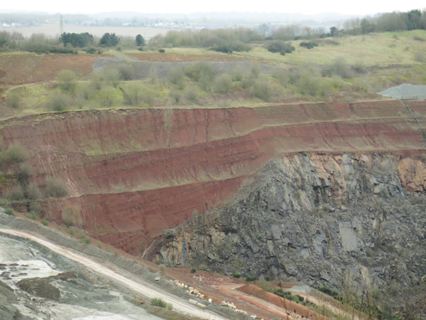
The unconformity between the red mudstones of the Triassic Edwalton Member and dark Precambrian diorite is clearly visible in the mid distance and the sediment filled depression at the western end has been interpreted as a wadi.

A detail of the wadi

We planned to then follow the marked path around the perimeter of the quarry to obtain views of the north quarry face; however, the paths here proved impassable in places and instead we decided to head down the path towards Stanton under Bardon, where a local resident showed us the way to the village.

A detail of the Old School House

Stopping only for me to take a few photographs of the Old School House, which is built in markfieldite, we then walked up Main Street to try and find a way to the Old Cliffe Hill Quarry. Although we encountered an old interpretation board, which demonstrates that someone was once interested in highlighting the local geology, there was no obvious access to this quarry.

An information board

At the car, having done a lot of walking without seeing that much geology, we both decided that we might have to reorganise the itinerary and route on the day - to take into account places that would be suitable for a group of up to 25 people to sit and have their packed lunch - and then set off to Markfield for the second leg of the walk.

A piece of markfieldite in my rock collection


Friday, 25 September 2020

Charnwood Forest - Part 1


The Bradgate Formation at Billa Barra Hill

In the first week in March 2020, having already visited Edensor and Conisbrough, I quite unexpectedly finished it with a trip to Charnwood Forest with Paul May of the Sheffield U3A Geology Group, to undertake a recce for our next day out.

On the Friday evening, he had phoned me to ask if I wanted to accompany him on the recce for the field trip that had been scheduled for 19th March - to explore the Precambrian rocks  around Billa Barra Hill and Markfield.

Billa Barra Nature Reserve

Arriving at 11.15 at the car park for Billa Barra Hill Nature Reserve, our plan was to follow the guide produced by Dr. Annette McGrath - A geological walk around Cliffe Hill Quarry – and, after briefly stopping to examine the dry stone wall at the Charnwood Noon Column, we headed off to explore Billa Barra Hill.

The Charnwood Noon Column

It comprises a small knoll of volcaniclastic siltstone of the Bradgate Formation, part of the Charnian Supergroup laid down during the Ediacaran Period, in a local environment dominated by explosive volcanic eruptions of gaseous and silica rich magma, with frequent pyroclastic flows. The island of Montserrat in the Caribbean is considered to be a good modern analogy of its geological setting.

Joints on a bedding plane

Hidden amongst the trees on top of the hill, there are various small jagged outcrops of tilted rock with a well defined rhomboidal pattern of jointing and weak cleavage that generally pervades the body of the rock.

Weakly developed cleavage

The outcrops are all very pale pink/grey in colour and, on weathered surfaces, extremely fine laminations can be seen, with graded bedding and differential weathering highlighting its sedimentary nature. No other larger sedimentary structures were observed here and, like other rocks in Charnwood Forest that are described elsewhere, these are thought to have been deposited as a distal turbidite fan.

A sample from Billa Barra Hill

Breaking open a piece of similarly weathered rock that I picked up from the ground, the fresh surface is seen to be pale grey/green, with pinkish and darker bands, which intensify in colour when wet. The surface of the stone has weathered to a form a dark brown skin, which appears to be a concentration of iron oxides/hydroxides, and there is no reaction with hydrochloric acid.

A fresh surface

An inspection with a hand lens reveals that the rock is dense and siliceous and without obvious grains seen on a fresh surface, except a scattering of tiny dark green/black grains of an undetermined mineral, and there is a general green/ grey or pink colouration to the banding.

Slickensides at Billa Barra Hill

A quarry is cut into the south-west side of the hill at a lower level, but is now water filled and the rock faces are inaccessible. Although largely covered in moss, after an area had been roughly cleaned, the old quarry floor exposes well defined slickensides.

An examination of slickensides

Bearing in mind the age and mobility of the group as a whole, we agreed that the slope down to the old quarry and back to the path was quite safe and manageable and, having finished this part of the walk, we went in search of New Cliffe Hill Quarry, where the South Charnwood diorite is exposed.

A notice