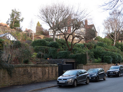
Arriving at the end of Storth Lane, during my preliminary exploration of Ranmoor for a forthcoming talk to the Ranmoor Society, on the subject of the geology and local architecture, I had seen a variety of different sandstones in the houses and streets.
With the benefit of hindsight, having undertaken numerous investigations of the geology and building stones of Sheffield since this day out, I have also learned that the Chatsworth Grit also contains flaggy beds – as seen in the Grade II Listed boundary wall to the similarly listed terrace of ten houses that constitute Nos. 446 to 464 Fulwood Road.
Continuing with my walk along Fulwood Road towards Sheffield, I passed several large detached houses that were built in the second half of the C19 and are set in large gardens with stone boundary walls, which the Ranmoor Conservation Area Statement of Special Interest considered to be one of Ranmoor’s most important features.
Although I could only get glimpses of the houses, the entrance gate piers form quite a feature, with their varying and sometimes elaborate design, which serve to announce the residents' social standing in this highly desirable suburb.
Typically, these are made from large blocks of coarse grained Chatsworth Grit, which is generally light brown in colour, whereas the basic walling is built using grey/orange varieties that are less massive and often contain well defined planar beds.
Between the Bull’s Head public house and the Ranmoor Inn, a triangle of land between Fulwood Road and Ranmoor Road was largely developed in the second half of the C19 – as seen on the 1855, 1894 and 1906 Ordnance Survey maps – with Nos. 378-382 Fulwood Road possessing some interested details carved in the gritty sandstone used here.
I had spent less than two hours wandering around Ranmoor and I carried on with my walk down Riverdale Road, where large inter-war houses have been laid out on a steep sided slope, where stone has been used extensively for the landscaping of the terraced gardens.
Turning into Graham Road, the Grade II Listed Riverdale House and its former lodge and gate piers, both dated 1873 and forming part of the Storth Crescent Land Society development, were on my list of buildings to photograph for the British Listed Buildings website.
Riverdale House was originally built for Charles Henry Firth, brother to Mark Firth of Oakbrook, with another famous owner being J.G. Graves, one of the great benefactors to the City of Sheffield, which includes Graves Park and the Graves Art Gallery.
I could only see the house from a distance but, with the building having bean cleaned, I can see that the rock-faced walling is pale coloured and without prominent iron staining and looks like the Crawshaw Sandstone used for the Sheffield Board Schools, with massive Derbyshire gritstone probably used for the dressings.
I took a few photos of the lodge from beyond its gate and of the boundary walling on Graham Road, which is made out of another quite coarse gritty sandstone that I didn’t examine closely, but which I think might be Loxley Edge Rock from the quarries at Greystones rather than Chatsworth Grit.
Having had a good afternoon exploring Ranmoor, I headed down Riverdale Road to Endcliffe Park, where I had a wander to the north of the Porter Brook, which I had not visited, before having another look at the small exposures of Greenmoor Rock on the hillside above the playground.


No comments:
Post a Comment