On the anniversary of the COVID-19 Pandemic Lockdown in the UK, on 15th March 2021, there was still no sign of being able to continue with my investigation of mediaeval churches or go out with the Sheffield U3A Geology Group; however following on from my brief visit to Shirtcliff Wood, a late afternoon break in the weather enabled me to investigate some more local geology.
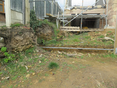
When coming back from St. Helen’s church in Treeton, I had noticed that the uppermost beds of the Treeton Rock were exposed in a building site on Church Lane. I therefore decided to go and have another look at an exposure of this sandstone, which I had discovered several years earlier, when exploring a disused railway line that once led to the Tinsley marshalling yard.
Now only referred to as an unnamed Pennine Middle Coal Measures Formation sandstone on the British Geological Survey map, the Treeton Rock forms a distinctive escarpment that runs from Swallownest to Treeton, before being breached by the River Rother at Catcliffe.
Although only a small outcrop, generally no more than a metre thick, except for the temporary exposure that I had seen in the new Jones Homes development during a recent walk around Treeton, it is the only exposure of Treeton Rock that I know and it has some interesting features.
Unlike the cross-bedded sandstone that I had seen in a few historic buildings and various boundary walls in the centre of Treeton, the sandstone here is generally very flaggy and micaceous, with fine cross-laminations and ripples being common.
Weathering of the sandstone has certainly increased the general friability of the outcrop, especially the thin flaggy beds, but I was a little surprised to discover that I couldn’t easily obtain a small sample of the more massive sandstone with my Estwing hammer.
The printed BGS map shows three measurements of the dip of the strata around Treeton, from 5 to 10 degrees, and the apparent dip in the cutting to the disused line appears to be consistent with these measurements. My compass-clinometer was stolen many years ago, but several bedding planes are exposed where a measurement of the dip and strike could easily be made.
Having made my observations and also collected a specimen of markfeldite, which is used ubiquitously in the UK for railway track beds, I made my way back home via Church Lane. Here, I obtained another sample from the above mentioned building site and took a few photographs of a retaining wall, where Treeton Rock is mixed with Rotherham Red sandstone.
Arriving home, after spending not much more than an hour in the sunshine, I then took a few minutes to clean the specimens that I had collected – together with a piece of Crawshaw Sandstone - ready for labelling and cataloguing.


No comments:
Post a Comment