 |
| The Grade II Listed Gate House on The Green |
Leaving Greenlands Park at the main entrance on Quarry Lane, having obtained a couple of small samples of stone from the old quarry face, I arrived at the northern boundary of the North Anston Conservation Area, which contains a few listed buildings that I wanted to photograph for the British Listed Buildings website.
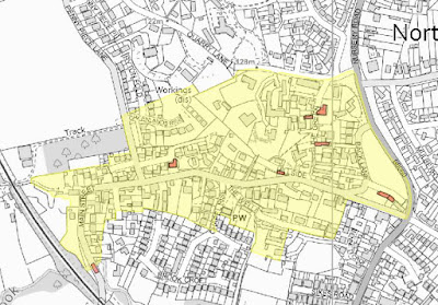 |
| North Anston Conservation Area |
Walking down The Green, many of the houses have high garden walls, which block views and I could only see parts of the building where they face directly onto the road or get glimpses of whole elevations through open gates.
 |
| A view down The Green |
All of the houses are built in the yellowish local dolomitic limestone from the Cadeby Formation, which is well squared and coursed, with a mixture of red clay pantiles, grey concrete pantiles and Welsh slate used for the roofing materials.
 |
| The east elevation of No.18 The Green |
Except for the east elevation of No. 18 The Green, whose oldest parts date to the C17 and have some fine mullioned windows typical of the period, I didn’t get the opportunity to see any interesting architectural features and carried on down to a large green, which has stone cottages on three of its sides.
 |
| Houses surrounding The Green |
Continuing down the path to the south-west corner of The Green, I reached the edge of the Magnesian Limestone escarpment, with the land falling sharply to the south and from here there are views over the rooftops to South Anston, where the escarpment continues to Kiveton Park and beyond to Derbyshire and Nottinghamshire.
 |
| A panoramic view towards South Anston |
Descending the path to Hillside, despite the steep slope here, a number of houses have been squeezed in either side of the road and, on a LIDAR map, several distinct scars can be seen in the land, which suggest that quarrying here may have predated the building of the houses.
 |
| Views of Hillside |
On Main Street, the slope of the land is again emphasised by a high retaining wall, which runs along the north side of the road for over 100 metres, above which more stone houses have been built and with a drop to its south side.
 |
| The retaining wall on Main Street |
Walking further down Main Street, there is a mixture of older and modern housing, with some agricultural buildings, which are built in the local vernacular style of limestone with red pantiles. Although adding to the general character of the Conservation Area, with the exception of the Grade II Listed Lodge Farmhouse, none of the buildings have particular architectural merit.
 |
| A view along Main Street |
Retracing my steps along Main Street, I then carried on until I reached The Wells which, as the name suggests, is the site of a spring that seeps out of the hillside and was once the water supply for the inhabitants that lived in the oldest part of the village.
 |
| The spring on The Wells |
I followed the channelled stream to the point on The Wells where it disappears beneath the houses and turned south to follow the path towards South Anston where, after about 100 metres, the stream reappears. Following it down to Anston Brook, I then made my way to the Leeds Arms and, while waiting for the X5 bus, enjoyed a pint of Abbot Ale in the sunshine.
 |
| The channelled stream on The Wells |
No comments:
Post a Comment