 |
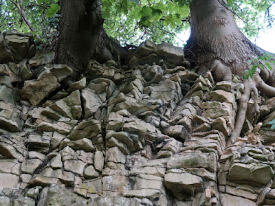
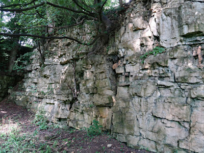
| A view of the Carr Wood quarry in Hooton Levitt |
Leaving Carr, to continue my walk from Throapham to Maltby, my first stop was to look at a garden boundary wall at the beginning of Tunwell Road, where the blocks of yellowish coloured limestone scattered amongst the greyish limestone contain some interesting textures.
A few blocks contain quite large crystal lined vughs, whereas others vary from fine grained and compact to very porous and open textured with shell fragments – both within the same block. Also, another contained angular to sub-rounded fragments of limestone, which record a period when the sea level had fallen and the partially cemented rock was subjected to sub-aerial erosion.
For several hundred metres, I followed the path across low lying and occasionally waterlogged ground, which is underlain by mudstones of the Pennine Upper Coal Measures Formation, with the land gently rising to form the Magnesian Limestone escarpment to the east.
Crossing the Thurcroft Fault, I carried on up the public footpath to the edge of the escarpment, where I came across an old quarry at the edge of Carr Wood, which I visited very briefly 25 years previously, when undertaking surveys for the South Yorkshire RIGS (Regionally Important Geological Sites) Group.
A section of up to 4 metres of the Wetherby Member of the Cadeby Formation is clearly exposed in an L-shaped quarry face over approximately 100 metres. I didn’t actually recall visiting this particular site and I have only one colour transparency slide to record my visit but, now looking through the eyes of a field trip leader for the Sheffield U3A Geology Group, I think that this is an excellent site for educational purposes.
Having surveyed very many exposures of the Cadeby Formation, from Knaresborough to Mansfield, I continue to be fascinated by the variation that can be seen in a rock formation that I thought was quite boring, when I first encountered it 30 years ago.
Both laterally and vertically, it can change from a uniformly bedded limestone – which is well suited to use as good quality walling stone – into a very irregularly bedded limestone that is often very rubbly or brecciated and only suitable for burning in lime kilns.
The sample that I took with my Estwing hammer is very finely granular, with no sign of an oolitic texture or shells, but an examination with a hand lens does reveal disseminated black specks of manganese oxide that I have seen in several places in South Yorkshire.
Continuing my walk past the Manor House into Hooton Levitt, I took a quick diversion down Carr Lane, which runs down the escarpment. Although I had hoped to find further exposures of the Cadeby Formation here, most of it was vegetated and I only managed to see one small outcrop.
Returning to Joan Lane, I carried on through the village until I reached Home Farm, where I stopped to take a photograph of an early C18 farm building for the British Listed Buildings website, before finding the path to take me down to St. Bartholomew’s church in Maltby.


No comments:
Post a Comment