 |
| The entrance to Greno Woods |
After finishing my brief look at the masonry of Hoober Stand and the Abdy Rock in the Hoober Plantation quarry, my friend Andy and I drove to the needle’s Eye and then down into Wentworth Village, where we had a quick look at the monuments in Old Holy Trinity Church.
Whilst I always like to photograph these, to capture them in different light, I can’t add any more information about them and so I will carry on by describing my next day out, a few days later, when I walked from Grenoside to Chapeltown in Sheffield.
The main purpose of my trip was to try and find the Local Geological Site at Charlton Brook in High Green, Sheffield, which the Sheffield Area Geology Trust (SAGT) website cites the principal interest as the strata above the Whinmoor Coal – a sequence of rocks that I had walked across earlier in the year, at Kimberworth in Rotherham.
Arriving in Grenoside on the No. 86 bus from Sheffield, I took a few quick snaps of various historic buildings that are not listed but, being built with the locally quarried Grenoside Sandstone, add character to the Conservation Area and very often deserve local listing.
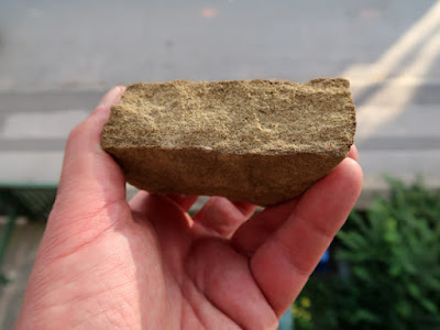
Continuing through Greno Woods, I encountered a small shallow quarry, which was presumably used to obtain the underlying Grenoside Sandstone for field boundary walls and, although there were no rock exposures, I obtained a sample from the vegetated rock waste.
The sample that I obtained has a bed thickness of 30 mm and is fine/medium grained, but with no obvious mica, which the geological memoir states is considered to be a characteristic feature of the Grenoside Sandstone. Its colour is light brown and this results from iron bearing minerals and their degradation to iron oxides/hydroxides, which can be seen with a hand lens.
Continuing my walk through the woods to Penistone Road and crossing over to Bracken Hill, I headed down to Burncross and briefly stopped at the entrance to Barnes Hall Farm, where I was able to photograph the west and north barns for the British Listed Buildings website.
I was also interested in the dry stone walling used in the boundary wall here, as I am pretty sure that it is an example of the use of the Penistone Flags, which I had only seen in a couple of very small outcrops, when undertaking surveys for the South Yorkshire RIGS (Regionally Important Geological Sites) Group back in 1996.
This formation comprises shales that contain very many beds of flaggy sandstone, which are extremely variable in thickness and lateral extent and, because it has been large built over, has not been easy to map. Walking down Hollow Gate to the Bridge Inn, I had hoped to see some exposures in the steep bank on the east side of the road, but I could see nothing from the path.
 |
| A view down Hollow Gate |


No comments:
Post a Comment