 |
| A sample of coal smut from the stream in Ockley Bottom |
Originally known as Droppingwell Wood and being much more extensive before Droppingwell Road was created, the Fuelling a Revolution leaflet states that much of Ockley Bottom overlies spoil from colliery workings.
 |
| An extract from the Fuelling a Revolution leaflet |
The area around Grange Park has had a long history of mining, for coal and ironstone – dating at least back to 1161 when the monks from Kirkstead Abbey began mining the latter. Furthermore, a very large number of bell pits have been recorded, three deep mines once operated in the area and opencast mining was undertaken after WWII.
 |
| Former collieries in the vicinity of Ockley Bottom |
Although I was aware of its mining history, I was mainly interested in the sandstone quarries on this occasion and, having had a good look at the Thundercliffe Grange quarries, I didn’t investigate any of the small exposures that I saw from the path that runs along the bottom of Barber Wood.
 |
| A small outcrop of Whinmoor Rock |
The escarpment that I had been following turns sharply to the north and fringes a wooded valley and, even though I didn’t notice at the time, the path crosses over the line of the railway that led to Grange A Colliery, which was set near to the top of Droppingwell Road.
 |
| The stream running through Ockley Bottom |
The stream that occupies the valley is culverted in its lower stretch and, after it emerges upstream, for some distance there are no signs of any stream banks where the Pennine Lower Coal Measures Formation strata might be exposed and, keeping to the path, the most interesting feature that I noticed was one of a series of cast iron sculptures by Marcela Livingston.
 |
| A sculpture by Marcela Livingston |
When crossing the bridge over a part of the stream where the banks of its relatively deep channel here had been reinforced with stone walls, I noticed that some of the masonry had collapsed to expose the stream bank.
 |
| A masonry lined section of the stream |
Continuing on the path towards Droppingwell Road, I was very interested to see an exposure of various sedimentary rocks, which were unlike those that I had recently seen at Bowden Housteads Wood, Shirtcliff Wood and Jervis Lum.
 |
| A stream bank exposure in Ockley Bottom |
Instead of flaggy sandstone, siltstone and mudstone, which had often weathered to yellow clay, there is a section of what looks like the coarse brown/grey ash that I recall being taken away from the burnt out open coal fire when I was young.
 |
| A detail of the stream bank exposure |
From this, in the upper part of the section, there protrudes a black layer with pronounced bedding planes and a similar bed occurs at a lower level a couple of metres downstream, which has a slight ochreous tinge in a couple of places.
 |
| Another detail of the stream bank exposure |
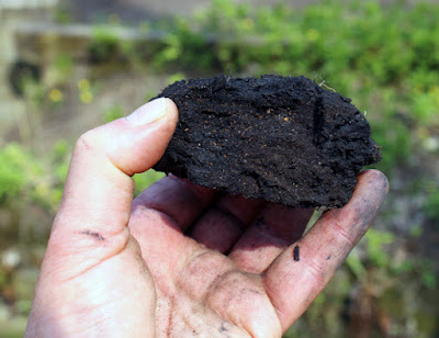
Retracing my steps, I was determined to obtain a sample with my Estwing hammer and, even though access to this stream bank outcrop was not easy, I managed to get down to a place where I could hack off a small sample of what would be called coal smut – a black, earthy and worthless outcrop of a coal seam.
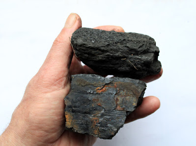 |
| Samples of coal smut (top) and clean bright coal (bottom) |
On the British Geological Survey Sheet 100 map, the Mickley Thin (Whinmoor Coal) is shown to outcrop below the sandstone escarpment (formerly known as the Whinmoor Rock) that I had been following from Thundercliffe Grange and, although it is not a clean bright coal here – as described in the accompanying memoir – it is probably this seam that is exposed in the stream bank.
 |
| A geological map showing the Mickley Thin Coal (MN) |
No comments:
Post a Comment