Entering the hamlet of Whitley on the public footpath from Cinder Hill Lane during my walk from Grenoside to Whitley, having passed various paddocks, the first property that I got a very clear view of was a converted agricultural building.
To the north of this, fronting Whitley Lane, is the mid C18 Grade II Listed Whitley Farmhouse, but I could only get a glimpse of the frontage to Whitley Lane, with its wooden oriel window, and the range of farm buildings to the rear of it – including a doorway that is dated to 1896.
On the opposite side of the road, the late C17 Sylvesters Farmhouse is set back in a large front garden behind a high garden wall, where the view is partially obscured by shrubs and trees. Both farmhouses are built with a yellowish sandstone that is typical of the Grenoside Sandstone, with Whitley Farmhouse having a stone slate roof, but the original roof at Sylvesters Farmhouse has been replaced with Welsh slate.
I headed east along Whitley Lane and stopped briefly at the brow of a gentle hill to photograph a terrace of cottages and another farm building, which are marked on the 1855 Ordnance Survey map, where the waggon entrance has been partially infilled to incorporate a door that has itself been subsequently blocked up.
Continuing down Whitley Lane, a gap in the roadside trees enabled me to get another distant view of the ridge of Pennine Lower Coal Measures Formation sandstone upon which the A629 road and Keppel’s Column is set.
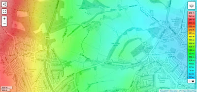
Although it is not possible to determine the detailed landforms on the England topographic map, which I very often use in conjunction with a geological map, the contours on the 1:25,000 Ordnance Survey map shows that Whitley Lane from here onwards follows the southern side of quite a pronounced valley.
Walking down Whitley Lane, where there is no footpath, I noticed exposures on the steep bank, which I tried to get to but it was too slippery to obtain a sample of the Penistone Flags that is exposed here, although I was able to take a few photos that clearly show cross-laminations in the very silty sandstone.
Looking down into the stream that flows down the valley, I decided against trying to find a way down to the stream bank to look for further rock exposures and continued down to the junction with Elliott Lane and then along the drive to the Grade II* Listed Whitley Hall Hotel, where I went to the reception to obtain permission to take a few photos of the exterior.
With a wedding taking place, I didn’t venture any further than the north elevation and therefore didn’t get much of an appreciation of this building, which is first recorded in a deed of 1406 as Launder House, but whose existing structure dates to 1596, with C17 and C18 with C19 and C20 additions and alterations.
Having spent just a few minutes at Whitley Hall Hotel, I retraced my steps along Elliott Lane to Hoyle House, to find one of the public footpaths that might lead me to the site of the old Hunshelf Quarry, before I continued to Ecclesfield.


No comments:
Post a Comment