 |
| Bolsover Castle has commanding views over the Doe Lea Valley below |
After visiting St. Giles’ church in Great Longstone, I wanted to see some different geology and so I turned my attention to north-east Derbyshire, starting with a trip to Bolsover, where I advised English Heritage on suitable building stones to be used for major restoration work to the Little Castle back in 1993.
 |
| An online Ordnance Survey map of Bolsover |
With Bolsover Castle being set on the Magnesian Limestone escarpment above the Doe Lea Valley, I undertook some research of the local geology – including a visit to Shuttlewood and Hardwick Hall - and in the hamlet of Palterton, I encountered a distinctly pink, thinly bedded calcareous mudstone outcrop on Main Street.
 |
| Main Street in Palterton on Google Street View |
Once known as the Lower Permian Marl but now classified as the lowest beds of the Cadeby Formation, which I have since extensively surveyed as the principal surveyor of the South Yorkshire RIGS (Regionally Important Geological Sites) Group and an independent consultant geologist, I was very keen to know more about these.
 |
| A geological map of the area around Bolsover |
Further north in Rotherham, at Laughton-en-le-Morthen and Harthill - although I haven’t seen exposures of them yet – these beds occupy the position between the dolomitic limestone and the Yellow Sands Formation; however, a few kilometres further south at Bolsover, the Yellow Sands Formation has completely disappeared.
 |
| A view of the Little Castle from Hill Top |
Arriving on the Stagecoach No. 53 bus from Sheffield at Hill Top, to the north of the town centre, there is a good view of the Little Castle, which forms the north-west corner of the castle and overlooks the steep sided Hockley Valley.
 |
| Foundations of calcareous mudstone from the Cadeby Formation |
Making my way to St. Mary’s church via Castle Street and High Street, I then came across an outcrop of flaggy calcareous mudstone at the top of Castle Lane, which falls steeply down to the valley of the River Doe Lea, which lies to the west. The small weathered outcrop here forms the foundations of the garden wall to the end terrace house on the corner of High Street/Castle Lane, with much of it now being obscured by landscaping and planting.
 |
| Weathered calcareous mudstone |
To the rear of this house, I briefly explored the open land to the rear of High Street and, although I saw no more rock outcrops, I encountered one of the four Conduit Houses that run along the escarpment and which supplied water to Bolsover Castle.
 |
| A partially vegetated outcrop of calcareous mudstone on Station Road |
After looking around the church, where I was told that I could find further rock outcrops on Station Road, I walked back through the Bolsover's central Conservation Area to make further investigations. Although largely overgrown with vegetation, up to 8 metres of yellow flaggy limestone are exposed on the south side of the valley, with similar crags apparently outcropping on the north side.
 |
| Crags of calcareous mudstone behind houses on Station Road |
Now conserved as a RIGS (Regionally Important Geological Site), I took a few photographs of the outcrop and then made my way down the escarpment along Station Road, where I caught the Stagecoach No. 1 bus to Chesterfield.
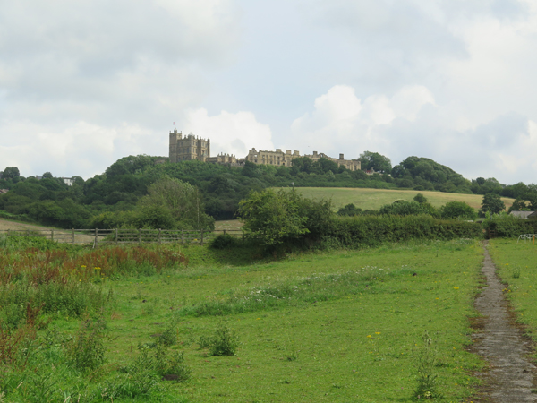 |
| A view of the limestone escarpment and Bolsover Castle |
No comments:
Post a Comment