 |
| An ochreous spring in Ecclesall Woods |
With my attempt to obtain a specimen of the Rough Rock being unsuccessful, I continued my walk with the intention of trying to find an exposure of the strata associated with the Ganister Coal at Ran Wood. The upper part of the course of the Limb Brook follows the line of a fault that separates the Rough Rock and younger Pennine Lower Coal Measures Formation (PLCMF) strata but, after entering Ecclesall Woods, the brook turns sharply to the south

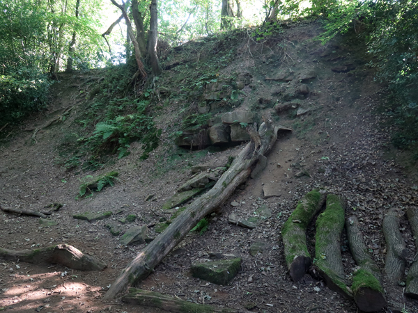
Continuing along the path around the perimeter of the woods, I soon encountered one of several sections of sunken trackways that can be found in Ecclesall Woods, which is presumed by the Friends of Ecclesall Woods to be C19, or later, as it runs across a goit that took water down to the now ruined Ryecroft Mill.
 |
| A sunken trackway |
It is likely that they were used by packhorses or mules to carry their loads, quite possibly taking coal from Dore mine down to Abbeydale Industrial Hamlet, although an opencast quarry in the Bird Sanctuary produced poor quality coal and there are at least two old ganister quarries in Wood 3.
 |
| A tributary of the Limb Brook in Ran Wood |
Having only a grid reference, provided by the Sheffield Area Geology Trust (SAGT), to help me locate the Ran Wood Local Geological Site, I followed the tributary of the Limb Brook for a short distance. Only finding detached blocks of sandstone in various sizes and deciding to come back and take a better look another day, I returned to the path and carried on until I reached a C18 Grade II Listed footbridge, which crosses the tributary.
 |
| The Grade II Listed footbridge |
Without having a detailed Ordnance Survey map or my Garmin GPS with me, I can only estimate the location of the various points of interest encountered, but I next came to an ochreous spring, which I had discovered during my previous visit to the woods in early 2017.
 |
| The ochreous spring |
Such ochreous deposits are usually associated with the bacterial weathering of the mineral iron pyrite, which is typically associated with coal seams and often mark the location of adits to shallow mines. Looking at the online version of the 1:50,000 British Geological Survey map, a very thin outcrop of the Loxley Edge Rock is overlain by the Forty-Yards/Hard Bed Band Coal (40Y) but I have not found any records of coal mining here.

At the same location, in a small escarpment that runs along the edge of the wood, there is a small outcrop of massive sandstone, which forms an overhang above thin flaggy beds of siltstone. I can't precisely determine the position of these oucrops but, looking at the geological map, it think that it is a fine grained variety of the Loxley Edge Rock.
 |
| Massive sandstone overlying siltstone |
I collected a couple of small samples, one of which is a pale grey/brown, thinly bedded, very fine grained sandstone/siltstone and the other is a slightly coarser, micaceous sandstone and contains oxidised iron bearing minerals, which in places give an orange tinge to the generally drab light brown colour of the stone.
 |
| Specimens from Ecclesall Woods (21 mm diameter coin) |
A little further along the path, I encountered further small outcrops of massive sandstone, which I didn’t examine closely. Looking at old Ordnance Survey maps, there are no quarries marked in this section of Ecclesall Woods and the first ganister quarries only appear on the 1924 edition map, but these are located either side of Abbey Lane approximately 1 km to the north.
 |
| An outcrop of Pennine Lower Coal Measures Formation sandstone |
No comments:
Post a Comment