 |
| A detail of the Sprotbrough Member to the west of Scarcliffe |
Once I had left Palterton and reached the highest point of the Magnesian Limestone plateau, which has an elevation of about 180 metres, I crossed the Mansfield Road and, discovering that the stretch of Main Street leading to Scarcliffe does not have any footpaths, I proceeded along this hedge lined lane with great caution.
Approaching Scarcliffe, sporadic exposures of a soft sandy rock appeared in the verges, with its reddish brown weathering products being washed down and deposited on the roadside. It was not safe to stop and investigate, but I am assuming that the lowest calcareous mudstones of the Cadeby Formation are exposed here.
This exposure continued for several metres, but it was soon succeeded by an exposure of thinly bedded cream coloured dolomitic limestone. In South Yorkshire, the lower part of the Cadeby Formation - the Wetherby Member - is generally massive, with oolitic and shelly beds and it often contains bryozoan reefs but, further south in north--east Derbyshire, the reefs disappear and the beds become progressively thinner.
There is a distinct rise in the land just before entering the village, which coincides with quite a long exposure of the same coloured dolomitic limestone in the road cutting. Examining the sedimentary structures, in addition to flat bedding, there is shallow trough cross-bedding, which is similar to that seen in the eastern end of the Clowne Greenway.
The British Geological Survey memoir for the Chesterfield district states that the bulk of the Cadeby Formation and almost the whole of the outcrop of limestone in the region is formed by the upper division, the Sprotbrough Member.
Arriving at the Rotherham/Mansfield Road, I checked out the various locations of the bus stops for my return journey and then continued down Main Street, where there is noticeable slope down towards St. Leonard’s church, which is set at the east end of the village.
The road here again does not have footpaths and, continuing down the hill, I encountered another small exposure of massive limestone of the Sprotbrough Member poking out of the grass verge, but the pattern of bedding could not be clearly seen.
 |
| Gently dipping thinly bedded limestone |
Further along, a more extensive outcrop of thinly bedded limestone can be seen, with the beds dipping gently to the east. At the corner of Main Street in Palterton, the dip is measured at 6 degrees and at the beginning of the Bolsover Tunnel, it is measured at 2 degrees and over the 2 km distance between these points, the elevation drops from 179 metres to 146 metres.
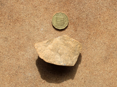
Nowhere does the limestone form sections greater than 1 metre in height, with it often only occurring as a few thin beds that form the foundations of a boundary wall; however, despite yellow/pink/orange varieties of limestone being seen in various buildings and walls, there is no sign of pink/red colouration and the sample that I obtained is yellow in colour and granular.


No comments:
Post a Comment