 |
| Micklebring Quarry |
A few days after my trip to Wingerworth in Derbyshire, where I had a good look at the exterior, interior and churchyard of All Saints church and photographed various historic buildings, I headed off to Leeds with the Sheffield U3A Geology Group.
 |
| The geology of east Leeds |
On this occasion, Bill Fraser of the Leeds Geological Association – who had taken us around Roundhay Park in Leeds back in 2021 – had agreed to lead us around four sites to the east of Leeds, where the Carboniferous Pennine Lower Coal Measures Formation (PLCMF) and the Permian Cadeby Formation are exposed.
 |
| The road cutting at William Parkin Way |
Meeting at The Springs shopping centre car park, next to junction 46 of the M1 motorway, our first stop was at William Parkin Way – a road cutting that was excavated in 2018 and which once created an excellent section through sandstones, siltstones and mudstones of the PLCMF, but which is gradually being overgrown.
 |
| Examining rock specimens |
Although the vegetation has started to take hold of what would have been quite a spectacular rock exposure, once we all got our eye in, the subtle variations in colour and texture that distinguish them could be quite clearly seen.
 |
| Samples of very fine grained grey sandstone |
I collected a couple of samples of very fine grained pale grey sandstone, which has some iron staining in the form of Liesegang rings and, on the thinly bedded specimen, there is carbonaceous material that indicates a coal forming environment.
 |
| An old quarry in the Cadeby Formation |
On the vast majority of field trips, we devise a circular walk that provides the group with some good exercise, as well seeing some interesting geology, but this time the sites were at some distance apart and we returned to our cars and drove to Garforth Garden Centre and walked down to an old quarry in the Permian Cadeby Formation.
 |
| A 'hills and holes' landscape |
Returning to the public footpath, we stopped to look at a ‘hills and holes’ landscape, produced by the waste from the mining of the Yellow Sands Formation, which occurs immediately below the Cadeby Formation, for use as moulding sand in iron foundries.
 |
| The escarpment at Roach Hills |
We were then taken on a quick diversion to the limestone escarpment at Roach Hills, to look at the change in the landscape that occurs at the Carboniferous-Permian unconformity – with good views of the topography and the outliers of the Cadeby Formation in the area around Kippax.
 |
| A view from the limestone escarpment |
As at Roundhay Park, Bill came well prepared with photographs of some quite large fossil Schizodus clams, which can be found after the fields have been ploughed. I was particularly interested in these, as my experience of Permian fossil bivalves and brachiopods was of very small species, whose growth had been very restricted by the hypersaline conditions in the Zechstein Sea where they lived.
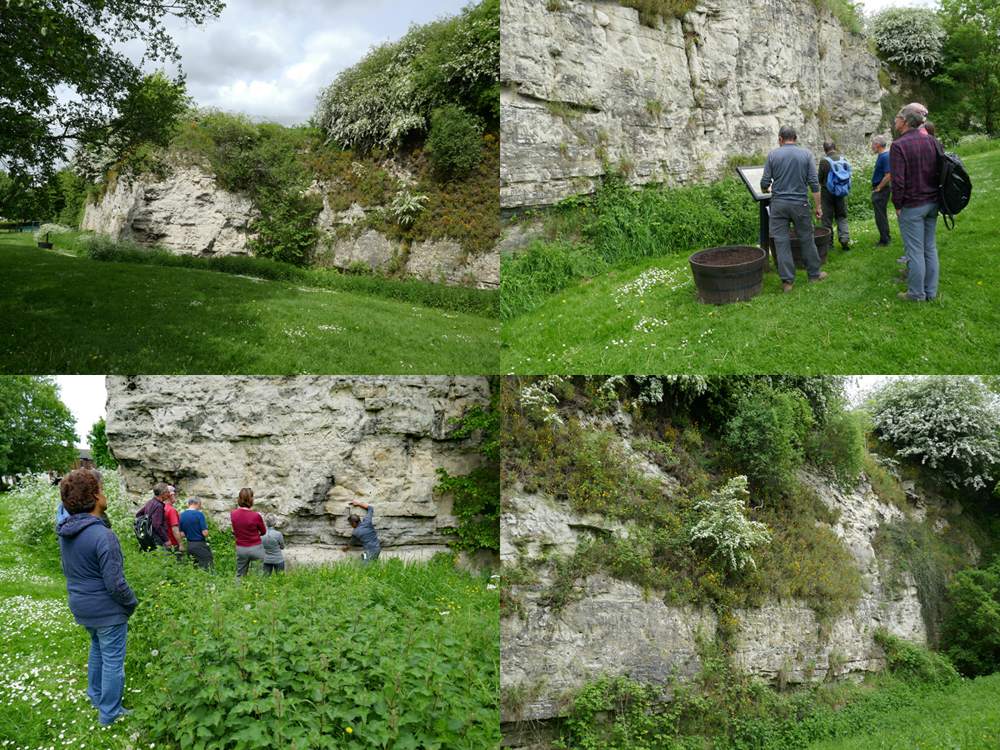 |
| Views of the Micklefield Quarry |
After lunch, we then took another short drive to the Micklefield Quarry SSSI, where there is an excellent section of the dolomitic limestone of the Cadeby Formation – both the lower Wetherby Member and the upper Sprotbrough Member.
 |
| Bill showing the position of the Hampole Beds |
The most interesting feature here is the Hampole Beds, which separate the two members and represent a period when sea levels had fallen and, on the edge of the shallow platform formed in the Zechstein Sea, large shallow lakes and lagoons were formed. In these relatively still waters, very fine grained muddy sediments that include green clay were deposited.
 |
| A detail of the Hampole Beds |
Our final destination of the day was the linear village of Aberford, which I briefly visited back in 2019 during a trip to see All Saints church in Barwick-in-Elmet. Having parked the cars, we firstly had a look at the various textures found in a boundary wall, which is built in dolomitic limestone from the Cadeby Formation.
 |
| Examining dolomitic limestone in a boundary wall |
We finished an excellent day by taking a quick look at the stromatolite algal mats that can be seen in the roadside verge on Cattle Lane. These flat domed structures, which I had previously seen at the South Elmsall Quarry, are formed by the fine calcite mud adhering to the algae and with this growing by new layers repeatedly being added by the same process.
 |
| Stromatolite algal mats |
No comments:
Post a Comment