Tuesday, 5 January 2021

From Kiveton Park Station to Todwick


The church of St. Peter & St. Paul in Todwick

Arriving at Kiveton Park railway station after a short walk along the Chesterfield Canal from Kiveton Community Woodland, I had an hour before the next X54 bus arrived in Todwick, which gave me plenty of time to walk there.
 
Back in 1997, when surveying various sites for the South Yorkshire RIGS (Regionally Important Geological Sites) Group, I visited a few old quarries in the immediate vicinity – some of which can been from the top deck of a bus – but on this occasion I couldn’t see any of them.
 
A view of Harthill from Red Hill

Walking up Red Hill, whose name reflects the reddened dolomitic limestone that is found at the base of the Cadeby Formation here, the views to the south are mostly obscured by plantations that mark the site of old quarries but, at one place, there are clear views towards Harthill.
 
1. Viewpoint  2. All Hallows Church  3. Quarry  4. Winney Hill

In the foreground, the Cadeby Formation slopes down to the line of the Kiveton Park fault and beyond this in the mid-distance, the Mexborough Rock - with its very distinctive reddened soil - forms an undulating landscape that results from minor folding of this rock formation here; however, on the geological map, not a single measurement of the dip of the strata is marked and this highlights the value of making observations out in the field.
 
1. Viewpoint  2. All Hallows Church  3. Quarry  4. Winney Hill

The geology in this part of South Yorkshire does not generally produce spectacular landforms that are easily identifiable and I have found that good high resolution photographs and Google Maps are invaluable for finding landmarks that enable me to better understand the landscape. In Harthill, I can pinpoint Winney Hill, All Hallows church and the plantation that hides the quarry that probably supplied the stone from which the latter was built.
 
A headstock at Kiveton Park

Quickly moving on to Kiveton Lane, where the old headstock records the former colliery here, I headed up the hill towards Todwick and onto the Mexborough Rock and continued until I reached Todwick Court, a small housing development that includes several barn conversions. 
 
A gate pier at the entrance to Kiveton Hall

At the entrance, the gate piers are Grade II Listed but there is no access to any of the houses or to Kiveton Hall; however, from the footpath, the buildings that I could see are built in the traditional vernacular style of dolomitic limestone, with red pantile roofs.
 
Ribbon pointing on random rubble walling

Just beyond this is a collection of mainly modern farm buildings with steel frame construction, among which there are a couple of unusual older limestone buildings, where the masonry comprises large irregular and uncoursed blocks with very bold ribbon pointing in sand and cement.
 
The tower of the church of St. Peter & St. Paul

Carrying on to Todwick, I had another quick look at the mediaeval church of St. Peter and St. Paul, which I have briefly described previously, and took a few more photographs to supplement those in my archive before continuing down to The Pastures, where I would catch my bus back to Treeton.
 
Todwick war memorial

While waiting, I had a look at the war memorial here, which was unveiled on 29th March 2014 and comprises a simple inscribed ‘black granite’ obelisk with a Carboniferous sandstone wall behind. I didn’t have the time to examine it closely, but it provided a good way to end another walk that provided some well needed exercise and satisfied my curiosity as a geologist.

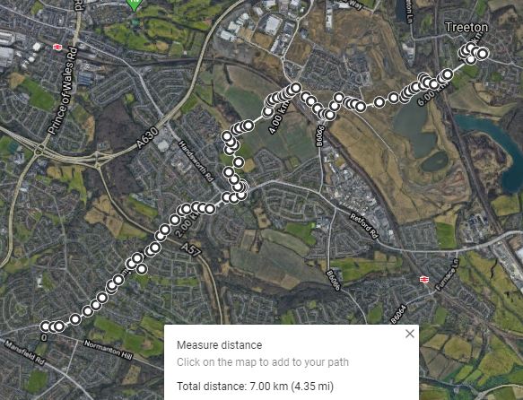
My route from Harthill to Todwick

Monday, 4 January 2021

The Chesterfield Canal at Kiveton Park


The canal bridge at Kiveton Park railway station

My walk from Harthill to Kiveton Park took much less time than I thought and, with no pubs open to tempt me, I decided to make the most of the sunny day by walking along the Chesterfield Canal towards Kiveton Park railway station and then making my way back towards Todwick.
 
The Cuckoo Way

Leaving Kiveton Community Woodlands at the entrance on Hard Lane, I crossed the road to join the Cuckoo Way, a long distance footpath that follows the Chesterfield Canal from Chesterfield to West Stockwith on the River Trent – a distance of 74 km.
 
A view across the Kiveton Fault

For the first 500 metres, the path runs alongside an area of wetland that adjoins Broad Bridge Dike and which coincides with the line of the Kiveton Fault, an extension of the Spa Fault that I had previously investigated during previous walks to Spa Farm and Guilthwaite.
 
The land rising to the north here forms part of the Kiveton anticline and the easternmost houses and woodland beyond are set on the Permian Cadeby Formation, which here dips to the south and south-east. Also, east of Hard Lane, between Broad Bridge Dike and the railway line, there also features in the land that look to me like a ridge and furrow field system.
 
A ridge and furrow field system

Arriving at the east entrance of the Norwood Tunnel, which at 2663 metres was the longest in the world when it opened in 1775, I couldn’t get a photograph of it without danger of falling into the canal and had to be content with a view east along the canal. It has suffered extensively from subsidence due to the coal mining here and after decades of repair, the tunnel was never reopened after a major collapse in 1907.
 
A view from the eastern portal of the Norwood Tunnel
 
Passing a few walkers and cyclists on the way, I carried on along the towpath for a few hundred metres, where much of the surroundings were overgrown with vegetation and it was mainly a few gabions and the enormous carp in the canal that particularly caught my eye.
 
Gabions along the towpath

I had never explored the Chesterfield Canal or any other canals before and I was therefore interested to encounter the rather grand feeder just before Kiveton Park railway station, which is linked to Harthill Reservoir by the Broad Bridge Dike, together with a winding hole for turning.
 
The feeder and winding hole

As with the bridge at Kiveton Park railway station, where I left the canal, it is built from dolomitic limestone which was no doubt supplied by one of the many quarries that once operated in the immediate area.

The canal bridge at Kiveton Park railway station

Sunday, 3 January 2021

From Harthill to Kiveton Park


A sculpture of a pit pony

On the last day of May 2020, during week 11 of the COVID-19 Pandemic restrictions, having explored the geology and historic buildings in the area immediately surrounding Treeton - finishing with a walk to Guilthwaite and back - I decided to travel further afield on the X54 bus.
 
I had used this route very many times before to explore the mediaeval churches in Harthill, Todwick and Aston among others, but with only an irregular service on a Sunday, I needed to plan my trip well and therefore decided to investigate the area around Kiveton Community Woodland.
 
A detail of efflorescence on Rotherham Red sandstone walling

Alighting from the bus in the centre of Harthill, I was interested to see that much of the Rotherham Red sandstone walling here was exhibiting severe efflorescence, like I had seen a few weeks previously at St. Helen’s church in Treeton – something I had not seen before during numerous previous visits to this village.
 
Excavated subsoil
 
After photographing All Hallows church, I made my way down Union Street, where excavations in a front garden had exposed weathered Mexborough Rock, which underlies Harthill and has been quarried in several locations around the village.
 
Salvaged finials

A little further down the road, in another front garden, I was very surprised to see a couple of old, highly weathered dolomitic limestone finials that I presume were salvaged from the church across the road, when its mediaeval tower was restored.
 
A bridge over Broad Bridge Dyke

Taking the path at the edge of the village, I followed it past undulating agricultural land where the reddened soil is derived from the Mexborough Rock lying beneath, until I came to Broad Bridge Dike, which was barely flowing at the time
 
The escarpment of Mexborough Rock at Harthill

This small stream runs down from Harthill Reservoir, which was built as a feeder for the Chesterfield Canal, and on the geological map it is seen to occupy an extensive area of alluvium that records the position of its former courses.
 
A view towards Kiveton Park

Finally arriving at Kiveton Community Woodland, which has been reclaimed from the former Kiveton Park Colliery tip, I made my way up to the viewing point from which high ground formed by the Mexborough can be seen in the distance. Looking around me, compared to the Waverley Estate, I thought that this was a much better example of land restoration.
 
A memorial to coal miners at Kiveton Park Colliery

Walking down towards the lakes, many people had come out on this sunny day and, passing a memorial to the miners who had died at the colliery, I continued as far as the former Kiveton Park Colliery Offices on Colliery Road.
 
A boulder of dolomitic limestone

I then stopped briefly to look at a large isolated boulder of dolomitic limestone, which forms part of the landscaping. From a distance, I thought perhaps that the unusual surface on the bedding plane might be the remains of burrows; however, looking closely, it has a very strange angular texture to it, whose origin I have still been unable to determine.

An unusual surface texture in dolomitic limestone

Saturday, 2 January 2021

A Walk to Guilthwaite and Back


A milestone at Guilthwaite Grange

Now entering the 10th week of the COVID-19 Pandemic restrictions in the UK, in addition to doing my essential weekly shopping, I continued to explore the geology and historic buildings around Treeton and my next trip was to the hamlet of Guilthwaite – set at a distance of 2 km from my house as the crow flies.
 
The geology between Treeton and Guilthwaite

Now that we were in the last phase of spring, with the swallows and swifts having arrived a couple of weeks earlier, I decided that it was a good time to spend some more time in my small postage stamp sized garden and, with a geological excuse to further investigate the Spa Fault, I headed off to Guilthwaite Nurseries on a sunny afternoon.
 
A ridge of Mexborough at Moorgate in Rotherham

Following the road east out of Treeton, as I had already done a couple of times when exploring Treeton Wood and Hail Mary Hill Wood, I stopped a few times to photograph views of the Mexborough Rock, where the reddened soil could still be clearly seen in places.
 
A landscape dominated by the Mexborough Rock

The presence or absence of this reddened soil was once used by geologists to determine the position of the Spa Fault in the region and, when the wheat around here is reaped, the clouds of dust thrown up by combine harvesters are quite obviously red in colour.
 
A view of Burnt Wood from the A618

Arriving at Ulley crossroads, I then headed north along the A618 past Ulley Reservoir and stopping occasionally to photograph Burnt Wood, which partially occupies the top of Spa Hill and the escarpment of Mexborough Rock and straddles the Spa Fault.
 
Vernacular architecture at Guilthwaite Hall Farm

Ulley Brook occupies the low lying between the A618 and Burnt Wood but I didn’t stop again until I came to a group of miscellaneous Rotherham Red sandstone buildings that includes Guilthwaite Hall Farm.
 
A stone carving at Guilthwaite House

Carrying up to Guilthwaite Grange and the mainly brick built Guilthwaite House, where the most interesting feature in stone was what looks like a carved goat’s head set into a Rotherham Red sandstone extension at the latter, I finally arrived at Guilthwaite Nurseries, where I bought blackcurrant and gooseberry bushes and a few herbs.
 
A distant view of scarp and vale topography on the skyline

Stopping to look at the views of the scarp and vale topography in the distance to the north-west, I then made my way back along a path down towards Long Lane, from which there are good views of the northern section of the Mexborough Rock escarpment and the Spa Fault near Spa Farm.
 
A panorama showing Burnt Wood and Spa Hill Farm

Crossing Long Lane, I then made my way along the path on the embankment next to the River Rother and, with the weather being much better than during my previous visit, I had much better view of the spur of Mexborough Rock at Bole Hill Plantation, with the Pennine Middle Coal Measures Formation strata beneath it marked by a distinct change in slope that runs down to the alluvial plain.

Rotherham Red sandstone at Old Flatts Farm

The last part of my walk back to Treeton passed an area of marshy ground near to Old Flatts Farm, which like other cottages on Flatts Lane are built in Rotherham Red sandstone from Bole Hill Plantation, but I didn’t stop here, other than to take a photo of a magnificent monkey puzzle tree in the garden of one of the terraced houses.
 
Terraced houses on Flatts Lane

After a walk of more than 8 km, I had managed to get some good exercise but, by now, I had fully explored the area around Treeton and for my next walk, I would have to find somewhere new.
 
A circular walk to Guilthwaite


Friday, 1 January 2021

The Waverley Estate


Weathered shale

The last leg of my walk from Normanton Hill to Treeton, having walked down the hill from Handsworth Community Park started at the southern entrance to the Waverley Estate, where the ramped walls on either side of the road – built in rusted steel, laminated sandstone and slate – are very impressive.

A ramped wall at the entrance to the Waverley Estate

More than ten years ago, before the house building was started, I had a good wander around the restored site and the most interesting thing I noticed, from a geologist’s point of view, was that innumerable pieces of weathered sandstone, siltstone and shale could be seen everywhere.
 
Weathered fine grained sandstone

In addition to the coal seams that were exploited at the Orgreave opencast mine, all of these rocks would have been clearly distinguished in the working face of the mine, in addition to seatearth/ganister, as part of a repetitive sequence of rocks known as a cyclothem.
 
Weathered siltstone

From my experience of surveying geological sites in South Yorkshire and the Peak District National Park, I know that opportunities to study the Coal Measures rocks are now very few and far between; however, looking closely at the weathered and often frost shattered rocks that are still lying around, a simple lesson in geology could easily be undertaken here.
 
A view of the escarpment of Treeton Rock

I stopped a couple of times to take a few photographs of the escarpment of Treeton Rock, which I have previously mentioned in my brief descriptions of Treeton Dyke and Hail Mary Hill Wood but, except for the red shale used on the paths – which also forms part of the Treeton Colliery tip – there is not much else to see.
 
An exposure of the Haughton Marine Band

Having quickly walked through the Waverley Estate, just before I crossed the bridge over the River Rother, I stopped at the weir that forms part of the river diversion undertaken here in 2000, as part of the reclamation of the former Orgreave colliery and coking works.
 
A view along the exposure
 
From the viewing point here, a stretch of dark shale with bands of ironstone can be seen along the east bank of the river and I went to investigate further. With the river level low enough to provide access to this exposure, I scrambled down the bank to take a few photographs.
 
A detail of the Haughton Marine Band

Looking at the geological map of the area, this outcrop seems to coincide with the marked Haughton Marine Band, which is generally described in the accompanying geological memoir as containing the brachiopods Lingula mytilloides and Orbiculoidea cf. Nitida and scales of an extinct genus of coelacanth named Rhabdoderma sp.
 
The outcrop of the Haughton Marine Band

Palaeontology is not my field of interest and I didn’t collect any specimens or look for fossils but, for geologists who are researching the Coal Measures or conserving geological sites, such as the Sheffield Area Geology Trust, I think that this is a particularly interesting outcrop. 
 
A house being built on Church Lane

I ended the day by walking up the escarpment to Church Lane, where I briefly stopped to photograph a house that is slowly being built here. It is notable only for the fact that it is built of what looks to me like Birchover gritstone from Derbyshire, despite being within Treeton's Conservation Area, where the vast majority of its historic buildings are constructed in Rotherham Red sandstone.
 
A detail of defective mortar at St. Helen's church

Rotherham Red sandstone gives most of the historic architecture in Rotherham and surrounding villages its distinctive character but Ulley Quarry, its last remaining source, is no longer producing this for the foreseeable future and this will present some difficulties for restorers.
 
A general view of the eaves at St. Helen's church

Finishing my walk at the Grade I Listed St. Helen’s church, where I have got to know the neglected fabric well over the last five years, the sight of a plant growing from the eaves – one of very many that I have encountered and treated with herbicide in this time – did make me think yet again that the last church architect was not doing a good job here.
 
My walk from Normanton Hill to Treeton