 |
| Weathered shale |
The last leg of my walk from Normanton Hill to Treeton, having walked down the hill from Handsworth Community Park started at the southern entrance to the Waverley Estate, where the ramped walls on either side of the road – built in rusted steel, laminated sandstone and slate – are very impressive.
 |
| A ramped wall at the entrance to the Waverley Estate |
More than ten years ago, before the house building was started, I had a good wander around the restored site and the most interesting thing I noticed, from a geologist’s point of view, was that innumerable pieces of weathered sandstone, siltstone and shale could be seen everywhere.
 |
| Weathered fine grained sandstone |
In addition to the coal seams that were exploited at the Orgreave opencast mine, all of these rocks would have been clearly distinguished in the working face of the mine, in addition to seatearth/ganister, as part of a repetitive sequence of rocks known as a cyclothem.
 |
| Weathered siltstone |
From my experience of surveying geological sites in South Yorkshire and the Peak District National Park, I know that opportunities to study the Coal Measures rocks are now very few and far between; however, looking closely at the weathered and often frost shattered rocks that are still lying around, a simple lesson in geology could easily be undertaken here.
 |
| A view of the escarpment of Treeton Rock |
I stopped a couple of times to take a few photographs of the escarpment of Treeton Rock, which I have previously mentioned in my brief descriptions of Treeton Dyke and Hail Mary Hill Wood but, except for the red shale used on the paths – which also forms part of the Treeton Colliery tip – there is not much else to see.
 |
| An exposure of the Haughton Marine Band |
Having quickly walked through the Waverley Estate, just before I crossed the bridge over the River Rother, I stopped at the weir that forms part of the river diversion undertaken here in 2000, as part of the reclamation of the former Orgreave colliery and coking works.
 |
| A view along the exposure |
From the viewing point here, a stretch of dark shale with bands of ironstone can be seen along the east bank of the river and I went to investigate further. With the river level low enough to provide access to this exposure, I scrambled down the bank to take a few photographs.
 |
| A detail of the Haughton Marine Band |
Looking at the geological map of the area, this outcrop seems to coincide with the marked Haughton Marine Band, which is generally described in the accompanying geological memoir as containing the brachiopods Lingula mytilloides and Orbiculoidea cf. Nitida and scales of an extinct genus of coelacanth named Rhabdoderma sp.
 |
| The outcrop of the Haughton Marine Band |
Palaeontology is not my field of interest and I didn’t collect any specimens or look for fossils but, for geologists who are researching the Coal Measures or conserving geological sites, such as the Sheffield Area Geology Trust, I think that this is a particularly interesting outcrop.
 |
| A house being built on Church Lane |
I ended the day by walking up the escarpment to Church Lane, where I briefly stopped to photograph a house that is slowly being built here. It is notable only for the fact that it is built of what looks to me like Birchover gritstone from Derbyshire, despite being within Treeton's Conservation Area, where the vast majority of its historic buildings are constructed in Rotherham Red sandstone.
 |
| A detail of defective mortar at St. Helen's church |
Rotherham Red sandstone gives most of the historic architecture in Rotherham and surrounding villages its distinctive character but Ulley Quarry, its last remaining source, is no longer producing this for the foreseeable future and this will present some difficulties for restorers.
 |
| A general view of the eaves at St. Helen's church |
Finishing my walk at the Grade I Listed St. Helen’s church, where I have got to know the neglected fabric well over the last five years, the sight of a plant growing from the eaves – one of very many that I have encountered and treated with herbicide in this time – did make me think yet again that the last church architect was not doing a good job here.
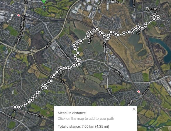 |
| My walk from Normanton Hill to Treeton |
No comments:
Post a Comment