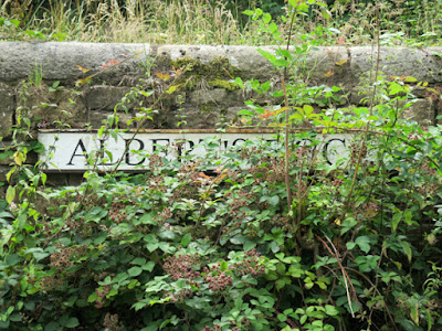
 |
Albert's Dock
|
 |
An exposure of the Cadeby Formation
|
So far, not having deviated from the towpath, I hadn’t seen much direct evidence of the hard rock geology here, although the land beyond the canal bank just to the west of Pudding Dike Bridge did look like it had been disturbed.
 |
A detail of a limestone outcrop
|
A couple of hundred metres beyond Thorpe Bridge, however, there is a vertical rock face immediately adjacent to the south bank of the canal, where massive, vuggy limestone from the Cadeby Formation is exposed.
 |
An exposure of limestone in an old quarry
|
Being so close to the water’s edge, I assume that this must be a cutting to accommodate the line of the canal, which here no longer follows the line of the Spa Fault. Together with the railway line here, it runs through a valley cut by a tributary of the River Ryton, which runs from Pebley reservoir south through Harthill down to Kiveton Park, before turning sharply to the east.
 |
An overgrown quarry
|
Just a little further on, another old quarry with lime kilns is marked on the 1924 Ordnance Survey map, and this coincides with more irregular rocky exposures and a tract of obviously disturbed ground that extends for a short distance to the west.
 |
The remains of a wall from the old malt house
|
Approaching Dog Kennels Bridge, at the end of a very interesting walk, there is the remains of a limestone wall, which has been dismantled to the levels of the window sills, and its position coincides with a large building that first appears on the 1894 map and is marked on the 1950 map as a large malt house.
 |
An information board
|
 |
A terrace of houses at Albert's Dock
|
On the south bank, there is a terrace of six houses at right angles to the canal, with various outbuildings, built in the local limestone, but I haven’t seen any record of these being associated with this aspect of the canal’s history.
 |
A wall built in limestone and siltstone
|
The north bank is flanked by various remnants of structures that once stood here, built in brick and stone – including grey siltstone from the Pennine Middle Coal Measures Formation - and which I assume were associated with the stone yard that was once found here; however, the historian for the Chesterfield Canal, Christine Richardson, would no doubt be able to throw more light on these.
 |
A section of walling on the north bank
|
The final stretch of the towpath is flanked by a large retaining wall, built with pitch-faced stone. The lower part dates from the canal’s construction in 1777, with the upper part added around 1841, when it was raised to about 5 metres, to support the adjoining railway embankment.
 |
A view along the retaining wall
|
During a recent phase of repairs to the wall, part of the wall was found to be the blocked-up entrance to a tunnel that connected to the nearby Turner’s Quarry - a supplier of Anston stone - where rough blocks of stone were precisely cut into smaller blocks before being loaded - which is also recorded by the Kiveton Park and Wales History Society.
 |
Dog Kennels Bridge
|


No comments:
Post a Comment