Friday, 5 May 2023

Carr Bank Lane and Fulwood Road

 
A detail of the east door to The Florentine

Starting at the Towers, during my brief investigation of the area between Sandygate Road and Stumperlowe, I had encountered very many examples of the Chatsworth Grit used for general walling, gatepiers, roads and pavements and Rough Rock for stone roofing tiles, at least, with another sandstone that could be the Crawshaw Sandstone from the Ranmoor quarries. 
 
A boundary wall on Stumperlowe Lane
 
At the end of Stumperlowe Lane, at the junction with Fulwood Road, the boundary wall here is made of flaggy sandstone, with a high proportion of blocks that have dark rusty brown staining on the joint planes – a feature that I had begun to associate with the Rough Rock. 
 
Gates and railings at Nether Green Junior School

I quickly walked down Fulwood road until I reached the Nether Green Junior School, formerly the Ranmoor Council School, where I took a few photos of the Grade II Listed gates, railings and boundary wall, which I had forgotten to take on my previous visit. 
 
A view of Nether Green Junior School from Carr Bank Lane

When walking down towards the school, I was interested in the wooded area known as Carr Bank Wood, which occupies a quite a deep and steep sided valley to the south of Fulwood Road. I retraced my steps and had a quick walk along Carr Bank Lane, from which I got a good view of the relatively clean sandstone exposed on the south elevation of the school.
 
A geological map of the area around Ranmoor and Fulwood
 
The BGS GeoIndex online map shows a small outcrop of Crawshaw Sandstone, which forms an escarpment along which Carr Bank Lane runs. Although there are no clear exposures of the sandstone, a few small blocks can be found lying around the upper part of the bank and the solid rock is not too far from the surface. 
 
A view along Carr Bank Lane

In one place, the roots of a large tree growing on the upper bank have grown around large lumps of sandstone, which look very dark in colour, but I did not have my Estwing hammer with me to try and obtain a sample from these. 
 
Tree roots on Carr Bank Lane

From the loose blocks that I could find, however, I did manage to break off a couple of pieces into a size that I could take home. One is a mud coloured silty sandstone, which is highly laminated, micaceous and has carbonaceous inclusions, with the other being a distinctly reddened fine grained sandstone, with some cross-bedding. 
 
Samples of sandstone from Carr Bank Lane

Returning to Fulwood Road, I took a quick diversion up Graham Road, where there is a further example of garden landscaping using stone cleared from the fields, yellow gritstone gatepiers and massive capping stones used for the overbridge carrying Stumperlowe Crescent Road. 
 
Stonework on Graham Road and Stumperlowe Crescent Road

Walking down to Ranmoor, there are yet more examples of Chatsworth Grit in a variety of gatepiers – some of which are inscribed – boundary walls that have the same coarse texture and grey colour as seen along Sandygate Road and more garden landscaping. 
 
Stonework on Fulwood Road
 
Passing through Ranmoor, I had another quick look of St. John’s church, which didn’t provide me with any more clues to the provenance of the sandstone walling, before continuing down Fulwood Road – passing another uniformly buff coloured wall that looks like it is built with planar bedded Crawshaw Sandstone. 
 
Crawshaw sandstone walling on Fulwood Road

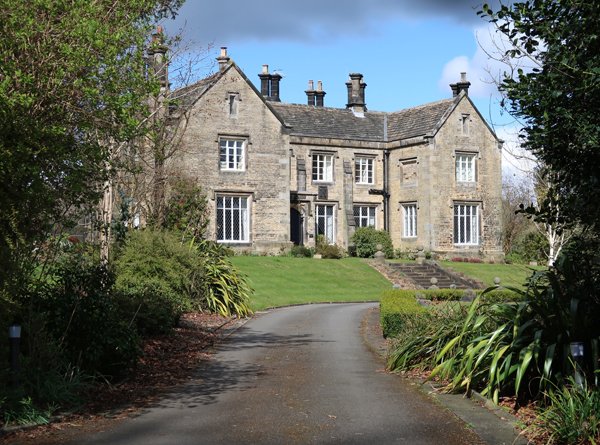
Having already walked 8 km over a period of hours, I ended my day at The Florentine hotel, which was originally built in 1865 as Moordale for the Sheffield industrialist James Nicholson, who operated the Mowbray Steel Works at Kelham Island and is commemorated with a fine monument at Sheffield General Cemetery. 
 
A view of The Florentine from Fulwood Road

I had a quick look at its east and north elevations, where there are some spectacular dragons at eaves level, but I didn’t study the stonework in any detail; however, the walling stone looks like it again could be Crawshaw Sandstone, with Derbyshire gritstone used for the very elaborate door surround on its east end. 
 
A dragon at The Florentine

On this occasion, I didn’t take advantage of the refreshments on offer at The Florentine and only took a few photos of the various details of the surround to the east door, which I would use in my forthcoming illustrated talk to the Ranmoor Society. 
 
A detail of the door surround at The Florentine
 

Carsick Hill and Stumperlowe

 
Stone tile roofs at Grange Farmhouse

Having a good look at various examples of the use of the Chatsworth Grit, at the lodge to the Towers and along Sandygate Lane and Redmires Road, I set off to explore the residential suburbs of Carsick Hill and Stumperlowe – another part of Sheffield that I had never visited before. 
 
A structure along the route of the Redmires conduit

Crossing the road from the Barncliff Stoop, I headed along Hallam Grange Road, which is dominated by inter-war houses, before finding a public footpath that runs along the route of the Redmires conduit, which was built to carry clean water to Barker's Pool following the devastating cholera epidemic of 1832. 
 
A large Arts and Crafts style house

Arriving at Tom Lane, I was immediately struck by a very large Arts and Crafts style detached house, which has been built on one of the plots of land that was offered for sale by the Carsick Hill Society, after it was formed in 1876. Seven Land Societies were formed around Ranmoor but, although this part of Sheffield is very desirable, the plots didn't sell until the C20 because the area wasn't yet well served by public transport.
 
No. 109 Tom Lane

The Grade II Listed early C19 house at No. 109 Tom Lane is very probably built with Chatsworth Grit, as are many of the various boundary walls that I saw when having a quick wander around the area; however, the underlying bedrock is the Rough Rock here, which forms an escarpment below which outcrop softer Pennine Lower Coal Measures Formation (PLCMF) rocks.
 
A view from Tom Lane towards Greystones

Turning down Belgrave Drive, the Edwardian Westgarth is built out of quite thinly bedded masonry, with a high proportion of dark rusty brown blocks, which I had seen many examples of during my investigation of Fulwood the previous summer and I thought was the Rough Rock. 
 
Westgarth

I could only see the house at a distance, from the entrance, but it certainly looks quite different to the Chatsworth Grit that I had so far encountered on my walk, which is again used for the large round gatepiers. Continuing along Belgrave Drive, the public footpath runs along a snicket, where the boundary walls are built out of a mixture of massive and flaggy sandstone. 
 
The boundary wall along the snicket at Belgrave Drive

Looking over the boundary wall, I got glimpses of the north elevation of Grange Farmhouse, which Historic England describes as “early C17 and early C18, remodelled c1929, with addition to left c1965, in sympathetic style”. From the few quick snaps that I took from over the high boundary wall, I can’t see enough to tentatively determine its provenance, but the dark rusty brown colouration again suggests that this may again be Rough Rock and not Chatsworth Grit. 
 
Views of Grange Farmhouse

The Rough Rock was best known around Sheffield for its stone roof tiles, which were quarried in a few places on the west side of Sheffield, but the quarries did also produce building stone. Walking round to its entrance on Stumperlowe Hall Road, I was interested to see that the roof to the south elevation uses these extensively, with some fine details around the gables. 
 
Various stone tile roofs at Grange Farmhouse

Adjacent to Grange Farmhouse is the early C17 The Barn, a complex of buildings that was converted and altered in the late C20 and is built with the same materials. I took a few photographs of the various elevations that I could see from the driveway and when continuing with my walk down Stumperlowe Hall Road.
 
The Barn
 
This is a very affluent part of Sheffield and, when taking a few record photographs of the Grade II Listed Stumperlowe Cottage and Barn, one of the residents who had been walking along the road was curious to know what I was doing. I explained that this was part of my preparation for an illustrated talk to the Ranmoor Society, on the subject of the local geology and architecture, which I would be giving later in the year. 
 
Stumperlowe Cottage and Barn
 
Continuing along Stumperlowe Hall Road, I encountered a block of unlisted buildings that I assume to be mainly agricultural, which has been built in various phases and styles and has some interesting window details at its southern end.
 
Various old buildings on Stumperlowe Hall Road
 
Next to these are the late C17 Stumperlowe Grange and Stumperlowe House, which was originally one house. I could only see the roadside elevation of this imposing building, but it is built with PLCMF sandstone, with quoins that look like the medium/coarse grained Kinderscout Grit or Ashover Grit from Derbyshire.
 
Stumperlowe Grange and Stumperlowe House
 
I didn’t stop to examine the stones closely but, looking at a photograph of the walling, it is medium grained and planar bedded and is quite similar to the sandstone that I had seen for the lodge at Claremont Hospital, while walking along Sandygate Lane earlier in the day. The old Ranmoor quarries, producing Crawshaw Sandstone, were not far away and may have been its source.
 
Walling stone at Stumperlowe House
 
The last building on my list to photograph for the British Listed Buildings website was Stumperlowe Hall, whose original owners - the Mitchell family – had owned land in the area since the late C14. Henry Isaac Dixon (1820-1912), a co-owner of the Britannia metal manufacturing company James Dixon & Sons of Cornish Place, acquired the C17 hall in 1854 and replaced it with this substantial Tudor Revival style house. 
 
Stumperlowe Hall
 
The hall is set back from the road in a large garden, which has a back gate and main entrance gate, from which I could get glimpses of the house. When enlarging my photos, I can see some dark rusty brown blocks, which can be seen in both the Rough Rock and the Chatsworth Grit, but I think the latter has been used here.
 
Stumperlowe Hall
 

Tuesday, 2 May 2023

Sandygate Road and Redmires Road

 
A detail of the Barncliff Stoop

Leaving the lodge to the Towers, I crossed to the other side of Sandygate Road and immediately came across further examples of the Chatsworth Grit in the kerbstones, large paving setts and a boundary wall, which is weathered to a uniformly grey colour, with some iron staining. 
 
Chatsworth Grit on Sandygate Road

I didn’t stop to closely examine any of them, but I didn’t notice any obvious pebbly beds like I had seen at the entrance to the Towers. Most of the Chatsworth Grit that I had seen to date was a very massive sandstone, but a lot of the coarse grained walling stone here is planar bedded, with larger blocks used for the copings. 
 
The entrance to Sandygate Lodge

Passing the entrance to Sandygate Lodge, I was interested to see that large blocks of sandstone have been used for landscaping in the front garden. During a previous walk around Ranmoor and along Fulwood Road, I had seen many large houses with landscaping like this, with the scattered large stones being cleared from the land as they were being built.
 
A possible old quarry to the east of Sandygate Lane

Crossing over the road again, I was intrigued by a private garden and pond that is set in what seems to be a landscaped old quarry. On the 1894 Ordnance Survey map, a quarry like excavation is clearly marked to the east of what is now Sandygate Lane, but it is not named as a quarry. 
 
The site of a possible old quarry

Stopping very briefly at the private Claremont Hospital, I was interested to see that the main house, lodge and various outbuildings are built with a Coal Measures sandstone and not Chatsworth Grit, but I only took a few quick record photos. 
 
The former lodge at the Claremont Hospital

Looking at the detail of the walling to the lodge, the sandstone is medium grained, has planar bedding and iron staining is sometimes developed as Liesegang rings. A moderately sized quarry in the Crawshaw Sandstone operated at nearby Ranmoor, which supplied the stone to build the older parts of the village and it is possible that it is the source for the stone here. 
 
A detail of the walling to the former lodge

Having had a good wander around many of the western suburbs of Sheffield, which grew rapidly in the second half of the C19, I have seen very many different sandstones used in  houses of all sizes,  along with their boundary walls, gateposts and the pavements and roads that surround them – but there is so little evidence remaining of the quarries themselves.
 
The Chatsworth Grit on Sandygate Road

My next stop was the Grade II Listed Holly Mount, which I photographed at a distance and could not really see the stone very well. Continuing my walk along the north side of Sandygate Lane, I encountered various ornate caps to gatepiers and walls and further sections of walling, which contain blocks of pebbly Chatsworth Grit and the typically grey sandstone has marked iron staining in places. 
 
Outcrops of Chatsworth Grit on Sandygate Road

Beyond Sandygate Park, the roadway opens up with a wide grassy verge that separates the road from the footpath, which much to my surprise contains several small outcrops of Chatsworth Grit that poke out from an area of slightly raised ground. 
 
Details of pebbly Chatsworth Grit used in boundary walls
 
The Chatsworth Grit used for the boundary walls continued to throw up surprises, with further examples of pebbly beds, where milky quartz is clearly visible. Although I have a few samples of Chatsworth Grit in my rock collection, none of them are pebbly in nature and so I couldn’t resist taking home a small piece that I found on the footpath, which must have become dislodged from the adjoining wall. 
 
A specimen of pebbly Chatsworth Grit (21 mm diameter coin)
 
Passing the clubhouse at the Hallamshire Golf Club, on Redmires Road, which is a continuation of Sandygate Road, I went to investigate the public footpath that crosses the golf course to the Rivelin Valley and was interested to find that it passes a former small quarry that has been excavated into the edge of the Chatsworth Grit. 
 
Views of the old quarry
 
Although I had my Estwing hammer with me, there was nowhere where I could easily obtain a sample and some of the remaining faces are obscured by trees and quite inaccessible, so I just took a few record photos and carried on along Redmires Road. 
 
The 1855 Ordnance Survey map shows that there was previously another larger quarry a short distance further down the road, which was known as the Barncliffe Quarry but is marked as disused on the 1947 edition. This is wholly within the grounds of the golf club, but there are tantalising glimpses of thick clumps of gorse just beyond the boundary wall, which are probably hiding some old quarry ledges and faces. 
 
Gorse at the edge of Hallamshire Golf Club

I finished this leg of my walk by taking a few photographs of the Barncliff Stoop, an old waymarker that is considered by Historic England to be probably C14 and erected to mark the line of an "ancient packhorse highway" - the Long Causeway - but the square capstone has a barely legible date that looks to be from the C18. 
 
The Barncliff Stoop
 

Chatsworth Grit at the Towers

 
Pebbles in the Chatsworth Grit

For my next day out in April 2022, after my further investigation of Loxley Edge and Wadsley Common, the spring weather encouraged me to extend the length of my walks and, in preparation for my forthcoming illustrated talk to the Ranmoor Society, I decided to undertake some further investigations of the area.
 
Listed buildings around Sandygate and Ranmoor

As usual, I planned my walk to include buildings on the British Listed Buildings website that did yet have a photograph, which I assumed would provide very many examples of the use of locally quarried building stones for the buildings, boundary walls, roads and pavements. 
 
The lodge to the Towers

Taking the No. 51 bus from Arundel Gate in Sheffield and alighting at the Sandygate Road/Coldwell Lane stop, the first building on my list was the lodge to the Towers (1896), built in the Scottish Baronial style to the design of Flockton and Gibbs – an architectural practice whose work I was now quite familiar with, from my investigations of the historic architecture of Sheffield. 
 
The lodge and entrance to the Towers

When taking a couple of photos from the opposite side of the road, I could quite clearly see the uncoursed rubble masonry, which is quite an unusual style that I can only recall seeing before at St. Mark’s church hall in Grenoside and Whiston Methodist Church. 
 
Boundary walling at the entrance to the Towers

Crossing the road to take a closer look, it was immediately obvious that the lodge and the boundary walls are built in coarse grained Chatsworth Grit, which outcrops along the nearby Rivelin Valley. Old Ordnance Survey maps and the new Building Stones Database for England record several quarries in the area, but most of them are no longer visible. 
 
The geology around the Towers

I was very surprised to see that several blocks used for the rubble walls are actually face bedded, with fingernail sized pebbles being exposed in exactly the same way that I had seen many times on natural bedding planes, when surveying the RIGS (Regionally Important Geological Sites) in the Peak District National Park and since walking along the gritstone edges in Derbyshire.
 
Pebbles in the Chatsworth Grit

Although the quoins to the entrance to The Towers have been obviously squared and tooled, the pebbly blocks show no sign of tool marks whatsoever. On a previous trip to Roundhay Park with the Sheffield U3A Geology Group, I learned that beds such as these were formed by the larger stones being rolled around in underwater sand dunes in the channels of a large river delta - approximately 315 million years ago. 
 
The Towers

The Towers itself is set on private land, which is only visible from the road that leads up to the houses that have since been built alongside it. I just took a few quick snaps of the parts of the building that I could see, which I presume is also built out of the Chatsworth Grit and then continued my investigation of Sandygate Road and Redmires Road. 
 
The Towers